Desolation Maps

Desolation Wilderness Maps
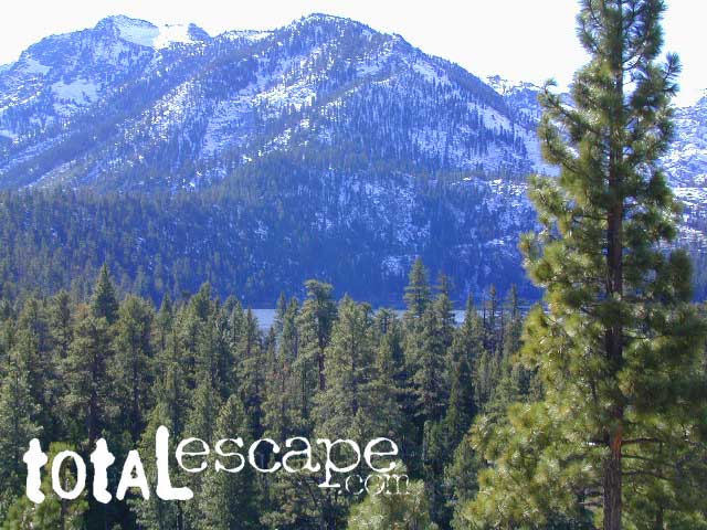
Westside of Lake Tahoe

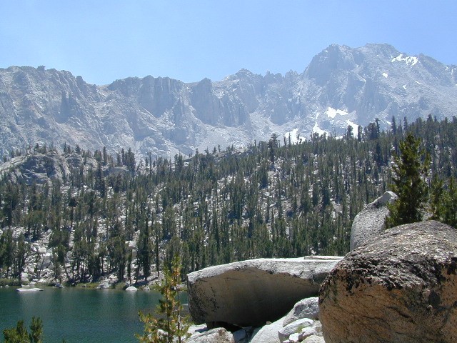
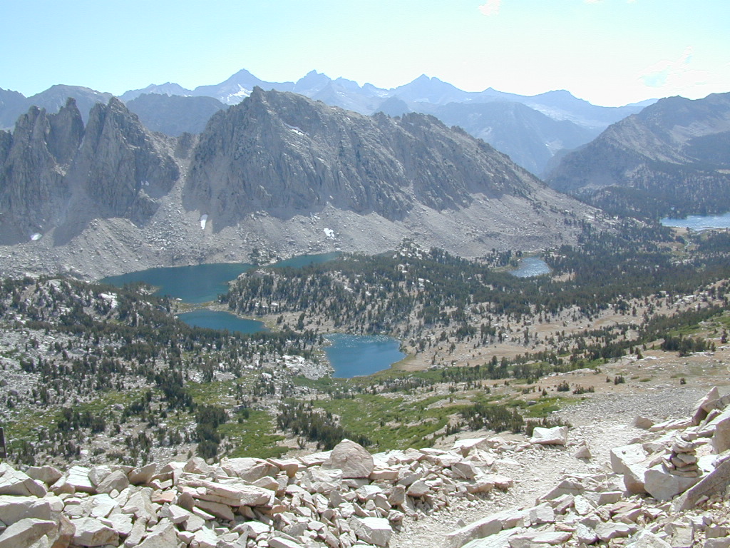
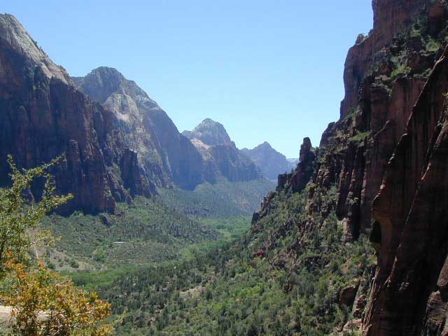
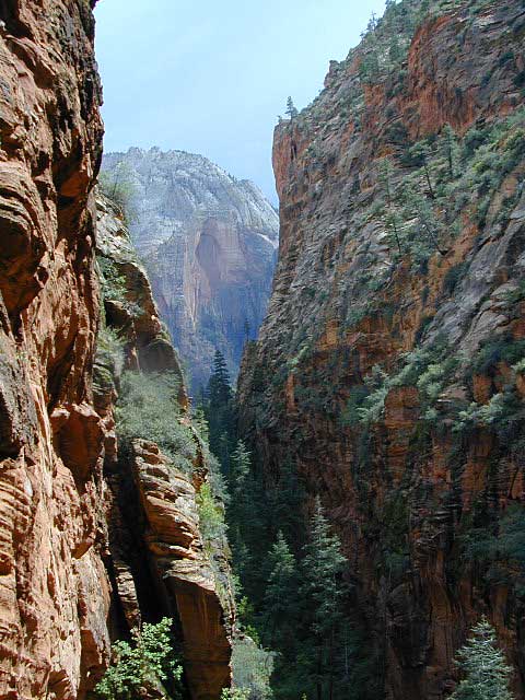
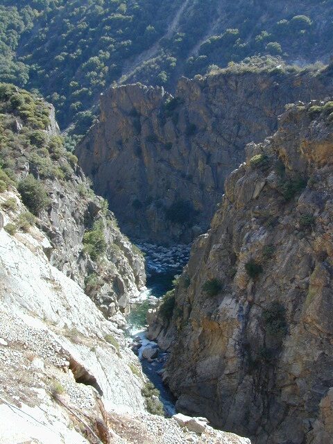
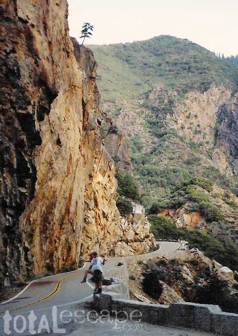
High Sierra Granite, Lakes Sierra Nevada California

Several maps and books cover this Sierra Wilderness Area located right next to Lake Tahoe, the premier alpine lake destinations on the West Coast. Granite Chief Wilderness and Desolation Wilderness featured on the same map from NatGeo.

Desolation Maps

Desolation Maps

Desolation Wilderness USDA Map

Desolation Map / Desolation Wilderness / Hikes Tahoe

Backpacking & Hiking Trail Map for Desolation Wilderness (Part of El Dorado NF) Waterproof Plastic Paper. Perfect for a day hike reference or extended backpacking adventures. Map Scale = 2″ to mile; ISBN# 9781593514402

Desolation Maps

Tom Harrison & Wilderness Press
publish Desolation Maps too

Desolation Maps

Desolation Wilderness Trail Map
Tom Harrison MapsDesolation Maps

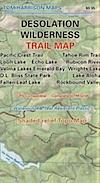
Desolation Wilderness Map Trail Map, Tahoe Lake Camping. Lake Tahoe, CA; Tahoe Westside, Loon Lake camping, Lake Aloha, Emerald Bay, Fallen Leaf Lake, DL Bliss State Park, Echo Lake, Velma Lake, Wrights Lake, Rubicon River, Rubicon 4×4 Trail, Rockbound Valley, Tahoe Rim Trail hiking PCT Pacific Crest Trail; Sierra Nevada High Country Tahoe hiking; Durable, waterproof plastic map; Folded. Map Scale: 42.24K; ISBN# 9781877689611

Desolation Maps

see also –
Lake Tahoe Basin Maps
Tahoe Rim Trail Map
Tahoe Basin Topo Atlas

Desolation Maps

Desolation Books –

Trail Tools Desolation Maps (1996) by Dennis O’Neill

Zion National Park Map

Zion National Park Map

Waterfalls appear after a big sudden thunderstorm.

National Geographic Trails Illustrated Map #214
Zion Canyon, Virgin River, Zion NP

Zion National Park, UT – Zion Narrows, Kolob Canyons, La Verkin Creek Trail, Hop Valley Trail, Wildcat Canyon, West Rim Trail, Floor of the Valley Road, East Rim Trail, Telephone Canyon, and the Virgin River.

Waterproof Map Paper. Printed in 2019, ISBN 9781566952972


hikers map

Zion National Park Map

Zion Canyon is a mini Yosemite Valley, in red rock, in the high desert.

A terra cotta colored wonderland.

Zion National Park is one of the most visited of all the Utah National Parks Loop, due primarily to its proximity to Las Vegas, NV and Interstate 15.

Zion National Park Map

Zion Canyon, from hiking trail to Angel’s Landing

ZION NP OVERVIEW: To prevent traffic jams and preserve the wildness, the NPS offers a common parking lot (on Hwy 9 @ Springdale, UT) with tram/shuttle service to and from the valley. Plan to be away from your car most of the day when visiting the main canyon. Unless of course, you have reservations at the main lodge. Numerous hiking trails, the Virgin River, Zion Lodge and a restaurants.

Utah Highway 9 leads east through tunnels and more amazing rock scenery, with abundant pullouts for RVs and visitors. Nice uncrowded hikes can be found on the east side of the National Park at many of these random parking lots along the highway.

A small portion of Zion National Park parallels Interstate 15. This Kolob Area is far less crowded than the rest of the park, but no camping is allowed.

Abundant boondock camps can be found all over the Zion area, even along the freeway.

Awesome camps that we discovered in the late 1990’s are now well known and crowded, all year long.

Free river beach campsites W of Rockville, high country of the Smithsonian Butte trail, above Grafton ghost town. These areas are NO LONGER a secret, and are very crowded. BLM camping at Leeds exit is on a first come basis and limited, so you better arrive before dark for the best spots.

EXPERTS TIP – Buy a real map and learn to find campsites, that no one else knows about. Mark a GPS waypoints for future reference. Have the whole place to yourself for once!

Benchmark Atlas: Utah

Zion National Park Map

Hiking Zion National Park – Refrigerator Canyon. Refreshingly cool breezes pass through this canyon, so even hot summer days are okay. A great place to escape the mid-day heat.

avenzabar

apps/maps:
download digital topos & maps

driftwood

more maps on Utah


Zion National Park Map

Atop Angel’s Landing, Zion National Park, Utah

see also –

Bryce Canyon National Park Map
Capital Reef National Park Map 
Utah Maps
Utah Books

Sequoia Kings Canyon Maps

Sequoia Maps
Kings Cyn Map

Roaring River Falls
One of the most visited areas of the Sierra Nevada Mountains – Kings Canyon & Sequoia NP sit next door to each other, just south of Yosemite National Park.

Kings Canyon National Park has a deep granite gorge with lower elevations, along the Kings River (the longest river in the Sierra). Plus Kings also has an expansive back-country – accessible only by foot, to High Sierra peaks and many alpine lakes.

On the south side, Sequoia National Park has a higher terrain with a highway skirting the ancient groves, on the west side of the Sierra range.

Several Maps for this Sierra National Parks region:NPS

Sequoia Kings Canyon Maps

Sequoia Kings Map

Sequoia Kings Canyon
NatGeo Map #205


Trails Illustrated Map from National Geographic. NatGeo map #205. Sequoia National Park Map w/ Kings Canyon National Park. Mount Whitney, Giant Sequoia National Monument, John Muir Wilderness, Pacific Crest Trail. Topographic Hiking Maps, Sequoia Backpacking, Sequoia Camping, Sierra Lakes. Back Roads, Kings River Camping & Hiking Map.

Very detailed & colorful. Waterproof Plastic Map; Tear Resistant. GPS data. Scale 1:80,000 Contour Interval = 100 feet. Updated 2013. ISBN# 9781566952989

Sequoia Kings Canyon Maps

Kings Canyon Highway 180

  • backpack
  • camp
  • canyons
  • climb
  • creeks
  • fish
  • hike
  • horseback
  • lakes
  • mountain peaks
  • picnic
  • rivers
  • waterfalls

hiker

pinetree

Sequoia National Park &
Kings Canyon NP

Generals Highway Map

Sequoia Kings Canyon Maps

Sequoia Kings Canyon Maps

CALIFORNIA HWY 198: The Generals Highway is the main paved road that runs the ridge, north to south inside Sequoia National Park.  Since they have named the giant redwood trees after famous military generals, the road name mirrors that theme.

Now-a-days, our ancient and massive trees are fighting for their lives in a new type of war. Wildfires, drought and bark beetle infestations are taking their toll and killing these beauties. They have stood the test of time for thousands of years and withstood fires in the past, but recent blazes are hotter and more destructive than previous.

Kings Canyon Highway 180: A long, scenic, dead end road which descends dramatically into the river canyon. Elevation spans from 6600′ at Grant Grove to 4000′ at Cedar Grove at the end of the paved route.

biggest115

Kearsarge Pass Trail Map

Kearsarge Pass to Rae Lakes Loop
High Sierra, Eastern Sierra

Kearsarge Pass Map
Rae Lakes Loop Hike
Tom Harrison Maps

Kearsarge Pass Trail Map, Rae Lakes Loop, Onion Valley Hikes, Hiking John Muir Backpacking Maps Rae Lakes Loop. Onion Valley Campground; Eastern Sierra Trails, Kings Canyon High Country; Eastern Sierra, High Sierra Maps; Areas include: Rae Lakes Loop, Paradise Valley, Vidette Meadow, Charlotte Lake, Onion Valley, Bubbs Creek.

Durable, waterproof plastic map; Folded. Map Scale: 42K; ISBN# 9781877689840

avenza mapsdownload digital version of this map –
Kearsarge Pass Map

hikers map

National Forest Maps
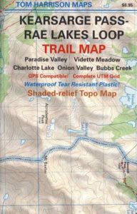
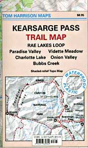
Onion Valley Campground NFS
@ 9200′ elevation

Kearsarge Pass @ 11,835′ elevation

  • alpine lakes
  • backpacking
  • camping
  • climbing
  • fishing lakes
  • hiking
  • horse packing
  • granite peaks & pinnacles
  • waterfalls
  • wilderness
  • wildflowers

horse trail maps

see also –

Kings Canyon Highcountry Map
Sequoia Kings NP Map by NatGeo
Sequoia Kings NP Map by Tom Harrison
Inyo National Forest Map
Inyo Topo Atlas
John Muir Wilderness Maps

wow scenery

High Sierra Lakes Loop Hikes

nearby towns:
Big Pine, CA
Independence, CA
Lone Pine, CA

Kearsarge Pass Map

OLD EDITION

Kearsarge Pass Map

Hike Kearsarge Pass

Kearsarge Pass Map

RAE LAKES LOOP – OLD MAP

Kearsarge Pass Map

Kings Canyon High Country