Ventana Wilderness Map

Ventana Wilderness Hiking Maps

Ventana Wilderness Map

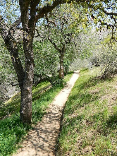
Buckeye Trail in Silver Peak Wilderness

Several map makers offer topographic hiking maps for the Ventana Wilderness Map, located on the super scenic Big Sur coast in California. Silver Peak Wilderness is to the south of Ventana, and usually included on the same map. Perfect for day hikes, overnight backpacking trips or just getting an impressive view of the Pacific Ocean.

Ventana Wilderness

Silver Peak Wilderness

Ventana Wilderness Map USDA
found at USGS

Ventana Trail Map / Coastal Trails / Big Sur Trail MapVentana Wilderness Map

Silver Peak Wilderness located inside the northern section of Los Padres National Forest (Monterey County California)

If you plan on backpacking the Big Sur Coast, this is the California topo map you will need. This map covers both the southern section – Silver Peak Wilderness & the northern most Ventana hiking areas. This map covers everything south and east of Andrew Molera State Park over to Sierra de Salinas near Hwy 101, and southward to Ragged Point & Windy Point in the southern Big Sur coastline. Camp in coastal redwood groves, hike the trails with outstanding views over the Pacific Ocean, and play in the numerous fern lined creeks.

Map printed with vegetable oil based ink, on waterproof polypropylene plastic. Might be available from Los Padres USFS Ranger Stations. USDA printing 2007; Scale 1: 63 – ISBN# 9781593514655

Ventana Wilderness Map

Ventana Wilderness Map

big sur back roads

nearby towns:

Ventana Wilderness Map

ocean glare afternoons

day hikes big sur

see also –

Big Sur Books
Big Sur Maps
Los Padres National Forest Maps
Los Padres Forest Atlas

Lake Tahoe Basin Map

Two different recreation maps for the Lake Tahoe Basin are created by the USDA & NatGeo. Several smaller brands for regional topographic trail maps. The US Forest Service has the Tahoe National Forest Map that encompasses a much larger area. Numerous books exist for backpacking and hiking around Tahoe.

Lake Tahoe Basin Map

NatGeo Map #803 Tahoe Basin

tahoebasin803

Lake Tahoe Trails Illustrated Map from National Geographic

Recreation Map for Lake Tahoe Basin, Topographic Lake Map, Backroads Hiking Maps, Tahoe Backpacking, Tahoe Camping, All Campgrounds, Trailheads, Creeks and Lakes. Sierra Nevada Back Roads, Truckee River Camping and Hiking Map. Very detailed and especially colorful, topo map. In this case, a 2 -sided map, waterproof plastic map; tear resistant. GPS data. Map scale 1:63,360 / Contour Interval = 50 feet. ISBN# 9781566953344

Lake Tahoe Basin Map

Lake Tahoe Basin MapMany believe that Lake Tahoe was formed by the collapse of an ancient volcanic crater, but the natural lake and mountain basin was actually formed by the rise and fall of the landscape due to faulting.

The Tahoe Basin which spans approximately 22 miles long (and 12 wide), is located on top of the Sierra Nevada mountain range. Separating California from Nevada state, a year-round, mountain resort destination. In particular, this is considered the north part of the majestic Eastern Sierra range. Furthermore, Lake Tahoe is often referred to as “Jewel of the Sierra”.camp map

Largest freshwater, alpine lake in North America.
Second deepest lake in the U.S.
Second highest lake in the U.S.

LAKE TAHOE – 6625′ elevation above sea level

Equally as relevant, our wide range of Tahoe maps listed below are current, full color publications – covering wildlife to wildflowers, forest back roads to 4WD routes, horseback trailheads to hiking trails, mountain peaks to meadows, creeks to waterfalls, trail camps to campgrounds, and of course cross country skiing to backcountry ski tours.

NatGeo Tahoe Map Pack

NatGeo Wilderness Maps

Adventure Maps Tahoe

Tahoe Heritage Foundation Map

Fine Edge Tahoe Maps

Tahoe Backcountry Ski Maps


Lake Tahoe Basin Map

Lake Tahoe Basin Management Unit, USDA Map


tahoebasin

Lake Tahoe Map USDA
Lake Tahoe Basin Management Unit

NFS Lake Tahoe Basin Map USDA

Lake Tahoe Basin & Vicinity

USGS Map California: Lake Tahoe Basin Map; Sierra Nevada Mountains, Lake Tahoe, Desolation Wilderness, Granite Chief, Fallen Leaf Lake. Tahoe Recreation, Camping Map. USDA NFS Recreation Area. Certainly all forest lands, trails and roads surrounding Lake Tahoe; 10 miles all the way around lake. Printed on waterproof plastic. Pictured published 2010. ISBN# 9781593514808.

LAKE TAHOE
OUTDOOR RECREATION

  • backpackinghikers map
  • boating
  • camping
  • casinos
  • cycling
  • fishing
  • hikinghorse trail maps
  • horseback
  • kayaking
  • mountain biking
  • mountaineering
  • off-roading
  • sailing4x4 maps
  • snow skiing
  • snowboarding
  • swimming
  • water skiing
  • xc skiing

see also –
Tahoe Rim Trail
Tahoe National Forest Map
Lake Tahoe Maps
Tahoe 4×4 Map Guide

Lake Tahoe Basin Map

Tahoe National Forest

nearby towns:

In the distance, Desolation Wilderness can be seen on the opposite side of the lake, typically covered in snow more than half the year.

snowridge

Desolation Wilderness on the Westside of Lake Tahoe

South Warner Wilderness Map

South Warner Map USDA

South Warner MountainsWarner Wilderness / South Warner Mountainshikers map
South Warner Wilderness

Modoc National Forest

South Warner Wilderness Map, Scale = 1″ to mile;  Perfect for a day hike reference, horseback or extended backpacking adventures.

campPLASTIC MAP; waterproof & tear resistant. Ranger Map – NFS issued map. GPS: Longitude & Latitude; Rivers, Creeks, Peaks, Elevations, 4WD & every dirt BackRoad, Hot Springs, Equestrian Areas, all Campgrounds, Hiking Trails & BackPacking Trailheads. ISBN# 9781593514747

Blue Lake in Modoc 

Mill Creek Falls

see also –
Fishing Maps for Californiafishing map
Modoc Books
Modoc National Forest Map
Modoc Topo Atlas

towns nearby:

please note: ISBN MISPRINT (2010) the USDA has accidentally printed the new plastic Six Rivers National Forest with the exact same ISBN# as this South Warner map. The official number belongs to this Wilderness map on this page, and the Six Rivers reprint may not be for another decade. Yee haaw. Your tax dollars, hard at work.

Yosemite High Country Map

Yosemite High Country Map
by Tom Harrison Maps

Yosemite High Country Map. Topographic; Backpacking Yosemite Backcountry, Topo Maps of Yosemite National Park Highcountry, Camping Yosemite Park Hiking Trails.

2022: OUTTA PRINT & UNAVAILABLE

HIGH SIERRA LOOP
TOPO MAP YOSEMITE

Durable, waterproof plastic map; Folded. Map Scale: 63K; ISBN# 9781877689581

Explore the Yosemite high elevation back country with this detailed topographic map, which gives contour lines, trails and information for campers, hikers, and outdoor enthusiasts. GPS compatible w/ complete UTM grid. Beautifully designed over the USGS topographic quads, enhanced with shaded relief.

Includes these areas: Merced Lake, Wawona, Ten Lakes, Tuolumne Meadows, Tioga Pass, Vogelsang, Bridalveil Creek

Yosemite Maps

OLD EDITION

Yosemite Mapdownload digital version of this map –
Yosemite High Country Map

Yosemite backcountry Map

Granite slopes trail hike to Merced Lake

Highest peak in Yosemite National Park with the best granite scenery and alpine lakes, forests, wildlife and of course, epic views around every bend. Horseback or hiking trails are the only way to enjoy this amazing place. But please remember that it is often buried in deep snow more than half the year, so you only get a few months (summer) to enjoy this landscape and hike the best trails in the Sierra.

hikers map

Yosemite Topo Map

CLICK TO ENLARGE

Yosemite High Country Map

ALPINE LAKES, Yosemite National Park