California Fishing Maps
 Best Fishing Holes & Fishing Vacation Destinations
Alphabetical list of popular fishing destinations within California. Mountains to coastline, there are many maps to choose from.
Blue links lead to maps, while green links lead to prime fishing spots. Map list below does not include Coastal Pier fishing.

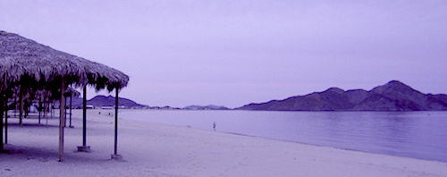
Baja California Maps
Surf, Camp, Fish, Kayak, Dive
Pacific Ocean & Sea of Cortez
Baja California Mexico

Lake Berryessa California
Wine Country Reservoir

Big Bear Trail Map
San Berdoo Mountains Map
San Bernardino National Forest Map USDA
Big Bear Lake, Lake Arrowhead & Idyllwild
Southern California Mountains
Bishop Pass Map
North Lake, Sabrina, South Lake
Bishop Creek, Eastern Sierra
Bishop, CA
Bucks Lake Wilderness Map
Bucks Lake Wilderness
Bucks Lake Campgrounds
North Sierra Nevada Mountains
Quincy, CA
California Delta Maps


Carson Pass, Sierra Highway 88
Carson Iceberg Wilderness Map
Central Sierra Nevada Lakes & Rivers

Casitas Lake, Ventura County

Carson Pass, Sierra Highway 88
Carson Iceberg Wilderness Map
Central Sierra Nevada Lakes & Rivers
Silver Lake @ Carson Pass
Central Valley Reservoirs
Clear Lake, Wine Country California

Crystal Basin Sierra Nevada
Crystal Basin / Silver Fork Map
Central Sierra Nevada Mountains
Eldorado National Forest
Silver Lake @ Carson Pass
El Dorado National Forest Map
Mokelumne River, American River
Dinkey Lakes Wilderness Map
Tom Harrison Map
Sierra Hikes, Dinkey Creek
Dinkey Lakes Wilderness
Golden Trout Wilderness Map
Golden Trout Wilderness
Upper Kern River, Southern Sierra
Green Creek Road
Toiyabe Forest Maps USDA
creek fishing, trailhead campgrounds
Bridgeport, CA Eastern Sierra
Hat Creek California
Headwaters to the Pit River


Hoover Wilderness Map
Hoover Wilderness
Bridgeport, CA Eastern Sierra
Hot Creek @ Mammoth Lakes, Eastern Sierra

Inyo National Forest Map
Inyo Forest Topo Atlas
Mount Whitney, Owens River, High Sierra Lakes
Bishop, Crowley, Mammoth Lakes & June Lake
Eastern Sierra Nevada Mountains

Kearsarge Pass Trail Map
Rae Lakes Loop, High Sierra
Onion Valley Campground
Eastern Sierra Nevada Mountains
Kings Canyon High Country Map
Kings Cyn National Park
Trails, hike-in only alpine lakes
Klamath National Forest Map
Klamath Mountains Topo Atlas
Klamath River, NorCal
Salmon River, Hoopa Valley Tribe
Hwy 96, Happy Camp, CA
Lakes Basin Recreation Area
Lakes Basin Map USDA
over a dozen small lakes, w/ trails, fishing
Gold Lake California
Sierra Buttes, North of Gold Country
Lake Mead, Nevada


Lake Tahoe Basin Map NatGeo
Lake Tahoe Basin Atlas USDA
Lake Tahoe Rim Trail Topo Map
Lassen Forest Map
Lassen National Forest &
Lassen Volcanic National Park
Hat Creek, Feather River, Lassen Lakes
Mammoth Lakes Map NatGeo
Mammoth Lakes CA
Mono Divide, High Sierra
June Lake, Eastern Sierra Nevada
Merced River Recreation Map NatGeo
Merced River & Tuolumne River
Yosemite Camping & Fishing
Gold Country, Western Sierra Rivers
Millerton Reservoir, West Sierra
Fresno, CA

Mineral King Trail Map
Southern Sequoia National Park
day hike to wilderness lakes in Golden Trout
Mineral King Canyon, Three Rivers, CA
Modoc National Forest Map
Modoc National Forest
South Warner Wilderness
Pit River, Blue Lake
Owens River, Eastern Sierra

Plumas National Forest Map
Lake Almanor, Lake Oroville
Feather River
Wild and Scenic Feather River Map (middle fork)
Sacramento River, North State

Sequoia National Forest Map
Sequoia Topo Atlas USDA
Sequoia National Forest
Giant Sequoia, Western Divide
Kern River, Lake Isabella
Kern Plateau, Kennedy Meadows
Southern Sierra Nevada
Shasta National Forest Map
Shasta Trinity National Forest
Sacramento River, Lake Shasta
NorCal fishing, Mount Shasta
Castle Crags Map
Trinity Alps Wilderness
Trinity Alps Wilderness Map
Trinity River, Weaverville CA

Sierra National Forest Map
Sierra National Forest
San Joaquin River, Dinkey Creek
Kings River, Pine Flat Reservoir
Lake Edison, Florence
Shaver Lake, Huntington Lake
BlackRock, Courtright, Wishon
Stanislaus National Forest Map
Stanislaus Topo Atlas
Stanislaus National Forest
Sonora Pass, Dardalelle
Stanislaus River, Gold Country
Sierra Buttes in Lakes Basin Recreation Area
Tahoe National Forest Map
Donner Pass, Yuba River
Gold Country Sierra Nevada
Tahoe Sierra Buttes Map NatGeo
Sierra Buttes, Donner Pass
Lakes Basin Recreation Area
Tahoe Yuba Map NatGeo
American River, Yuba River
Gold Country California
Toiyabe National Forest Maps
Eastern Sierra Nevada Mountains
Toiyabe Carson Map
Carson River, Markleeville CA
Eastern Sierra, South of Lake Tahoe
Toiyabe Bridgeport Map
Walker River, Twin Lakes CA
Eastern Sierra, Yosemite East
Hoover Wilderness
Yosemite Valley Map
Yosemite Wilderness Hiking Maps by NatGeo
Hetch Hetchy Reservoir Map
Merced River & Tuolumne River Map
Yosemite National Park
Central Sierra Nevada Mountains

Wishon Lake (Reservoir)
more ways to find fishing –
California Lake List
California Rivers
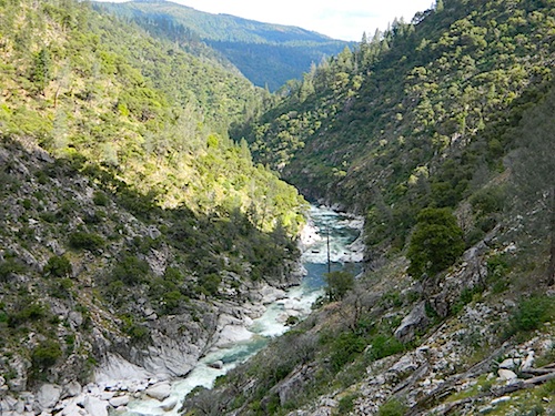
Middle Fork of the Feather River (before the 2020 Bear Fire)
