Ansel Adams Wilderness Map

Ansel Adams Map USDA
USDA Ansel Adams

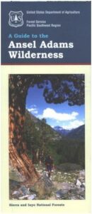
Ansel Adams Wilderness, part of Inyo NF and Sierra NF

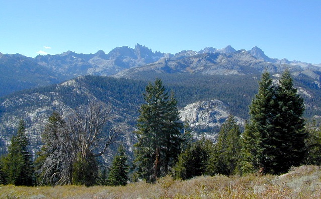
This High Sierra terrain spans some of the most majestic areas of the Sierra Nevada – the youngest mountain range in the U.S. This wilderness is bordered by National Parks, National Forests, and other Wilderness Areas – all the way around it. Kaiser Wilderness and Lake Edison inside Sierra NF on the west, Yosemite National Park on the north, Inyo NF on the east side, and John Muir Wilderness on the south end. Wow!

This 230,300 acre, high elevation wilderness was formerly the Minarets Wilderness, renamed in 1984 to honor the pioneering landscape photographer, Ansel Adams. Known for spectacular alpine scenery, elevations range from 7,000 to 14,000 feet. Rugged granite peaks and passes, with alpine lakes, includes high country east of the Sierra crest. Pacific Crest Trail and John Muir Trail cross this High Sierra Wilderness region.

This USDA map is also available at Ranger Stations.

Perfect for packing and hiking references, fishing lakes, creeks, high altitude camp sites, horse packing routes, or extended backpacking adventures. Map Scale = 1″ to mile; Printed on waterproof plastic paper. Updated in 2011. ISBN# 9781593515188

minarets

see also –

Ansel Adams Trail Map

Ansel Adams Wilderness Trail Map
by Tom Harrison Topo Maps

Eastern Sierra Trail Map

OLDER EDITION

NatGeo Ansel Adams
Map #309
Yosemite SE

NatGeo Map

Ansel Adams Trailhead locations include –

Eastern Sierra: Lee Vining, June Lake, Mammoth Lakes, CA

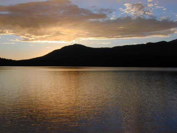
Western Sierra: Edison Lake (pictured below), Huntington Lake, Shaver Lake, Clover Meadow, Mammoth Pool Reservoir, NorthFork via Bass Lake and Yosemite National Park.

Edison Lake

Cuyamaca Rancho State Park Map

Cuyamaca Rancho State Park
San Diego Mountains

cuyamaca map
Rancho Cuyamaca State Park Map
Tom Harrison

  • Cuyama Peak
  • Cuyama Lake nearby

Hiking San Diego Mts.
Campground Camping

hikers map
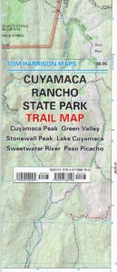
Rancho Cuyamaca State Park inside Cleveland National Forest; Hiking Map San Diego Mountains, Laguna Mountains Camping, Julian Campgrounds, Cuyamaca Peak, Stonewall Peak, Paso Picacho, Lake Cuyamaca, Green Valley Falls, Sweetwater River. Cuyamaca Maps Backpacking San Diego Maps; Durable, waterproof plastic map; Folded. Map Scale: 32K; ISBN# 9781877689796

cuyamaca map

  • campCuyamaca Map
  • climb
  • hike
  • horseback
  • mountain bike
  • picnic
  • waterfalls
Cuyamaca Map

Cuyamaca Peak, East San Diego County

San Diego Hiking Maps

Day use areas and overnight camping in the San Diego mountains. Located along Highway 79, in between Julian and Interstate 8, Rancho Cuyamaca State Park is a popular spot for family camping, day hikes and picnics. Oak foothills, pine forests, meadows, boulder peaks, waterfalls, campgrounds, trailheads and picnicking areas.Cuyamaca Map

  • Cuyamaca Peak
  • Green Valley
  • Lake Cuyamaca
  • Paso Picacho
  • Stonewall Peak
  • Sweetwater River
Cuyamaca Map

older edition

Lake Cuyamaca is a recreation area offering boating, fishing, and camping at the reservoir. Campground, store, cafe, and tackle shop are available at the lake. The small reservoir is stocked with trout annually, and is the only San Diego lake that is able to stock trout all year long.

Conical Middle Peak is above the lake on the east, and North Peak is on the north side. Hiking trails reach the summit of Cuyamaca Peak, located to the southwest of Cuyamaca Reservoir and inside Cuyamaca Rancho State Park.

The dam at Cuyamaca lake is the second oldest in California still in use, completed in 1888. It was built to supply drinking water to the city of San Diego. It was originally piped down to San Diego in wooden flumes. It continues to be part of the municipal water supply system for San Diego County.

cuyamaca maps

see also –

Cleveland National Forest Map
Cleveland Forest Atlas

Mount Laguna Trail Map
San Diego Backcountry Map
San Diego County Trail Map
Pine Creek – Hauser Wilderness MapĀ 
Anza Borrego Desert Map

Klamath National Forest Map

Northern California’s Klamath region is a wild and rugged country, for city folks thinking about visiting, especially during the wet winters. Call ahead to local ranger stations to find out if the roads are indeed open and if 4×4 is required. Always check the weather forecast and do not expect cell phone coverage in this remote, steep, narrow, river canyon landscape. Rock slides and landslides are quite common, therefore you should be well prepared to spend the night in your vehicle. Pack warm clothes, blankets, flashlights, food and drinking water whenever you travel in this neck of the woods.

2024: THIS MAP CURRENTLY UNAVAILABLE

klamath river map

Klamath River Map

klamath maps
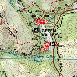
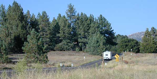
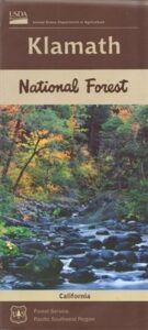
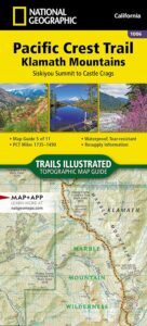
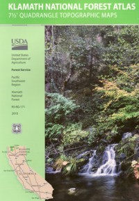
Northern California forest situated around the Klamath River

Klamath River Map / Klamath National Forest

Klamath Forest

klamath river mapKlamath National Forest Map USDA
USGS map California: Klamath Map. Klamath River Camping, Hiking and Fishing. NorCal Mountains, Rivers, Creeks

Klamath Ranger Map – NFS issued map. GPS: Longitude & Latitude; Rivers, Creeks, Peaks, Elevations, 4WD & every dirt BackRoad, Hot Springs, Equestrian Areas, all Campgrounds, Hiking Trails & BackPacking Trailheads. Areas include: Northern California, Trinity County, Siskiyou County, Humbolt County, Yreka, Fort Jones, Happy Camp, Klamath River, Scott River, Salmon River, Marble Mountain Wilderness, Salmon Mountains , Macdoel, Goosenest, Oak Knoll, Ukonom, Orleans, fishing map klamath
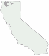
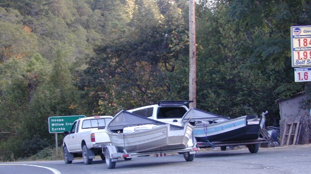
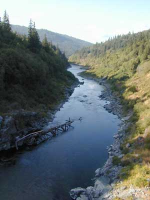
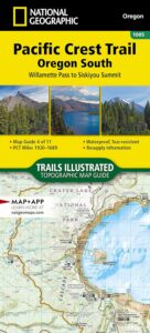
Butte Valley Wildlife Area, Somes Bar, Siskiyou Mountains, Oregon border.

Map Size: 35″x 45″ overall / 4″x9″ folded; ISBN# 9781628114249

Klamath River Map

OLDER VERSION

Klamath Topo Map

Klamath Highway 96 – when gasoline was less than $2 per gallon!

Road Impassible?

Road conditions on Klamath Forest roads can change at a moment’s notice. In Northern California wet climate, sudden storms can cause land slides, deep mud, erosion and flash floods. Areas that were easily accessible in other seasons can become treacherous in winter. Forest roads may be closed and gated in winter months. A high-clearance vehicle is best when traveling within the Klamath National Forest, and in wetter months 4-wheel drive may be required on the back roads This region in particular has an increased risk of avalanche, even along paved Highway 96.

REAL OLD EDITION

klamath river map

PCT Klamath Maps

PCT Map Klamath NF

PCT Oregon South

Klamath Maps

Downtown Weed, California


Klamath Forest Atlas

Klamath Topo Atlas USDA

Klamath National Forest

nearby towns:klamath trail map

Klamath National Forest Maps

Downtown Yreka, California

NFS or USFS

Klamath USFS ranger stations:

Klamath National Forest Headquarters
1711 South Main Street
(Highway 3: Fort Jones Road)
Yreka, California 96097
530-842-6131

Macdoel Ranger Station USFS
Goosenest Ranger District
Butte Valley National Grassland
37805 Highway 97, Macdoel, CA 96058
530-398-4391

Happy Camp Ranger Station USFS
Oak Knoll Ranger District
63822 Highway 96, Happy Camp, CA 96039
530-493-2243

Fort Jones Ranger Station
Salmon River USFS
Scott River Ranger District
11263 Highway 3, Ft Jones, CA 96032
530-468-5351

ranger stations

Golden Trout Wilderness Map

Golden Trout
Wilderness Area Maps

Mtn Home

Golden Trout as seen from Mountain Home SF (2010)

Golden Trout / South Sierra Map
Golden Trout Wilderness USDA
Kern River Gorge
South fork of Kern River
Upper Kern River
Backcountry Sequoia
California

    • backpack trails
    • hiking trails
    • fishing lakes/streams
    • horse packing
    • hot springs
    • kern river
    • horse trails

Tom Harrison
Golden Trout Trail Map

Tom Harrison Map Kern

hiker

Golden Trout Wilderness
and South Sierra Wilderness

NFS

goldentrout
Golden Trout Wilderness Map
US Forest Service USGS

Official Trail Map for the U.S. National Forest Service. Map scale 1:63,360. Contour lines at 80 foot intervals show elevation. Detailed road network shown. Encompassing 475 square miles in the Sequoia and Inyo National Forests. Map Scale = 1″ to mile; Usually only found at Ranger Stations. MAY BE DISCONTINUED. Printed on paper in 1995.

Golden Trout Wilderness Trail Map, Sequoia National Forest, South Sierra Backpacking Maps, Forks of the Kern River Map, Jerky Meadow Trailhead, Big Whitney Meadow, Kern Peak, Coyote Peaks, Grey Meadow, Little Kern River, Kern Canyon, Jordan Hot Springs, Casa Vieja Meadow, Monache Meadows. Topo Sequoia Camping Kern River.

horseback

see also –
Golden Trout Wilderness Trail Map
Dome Land Wilderness Map
South Sierra Wilderness Map
Kern River Maps

goldencold

Creek dipping at Camp 4, Sequoia NF

JERKY MEADOW trailhead Forks of the Kern, located at the end of Sequoia forest road #22S82 also has numerous primitive camp sites located near the Kern Gorge. A moderate day hike will lead to waterfalls, swimming holes and granite bowls like these. Steep trails lead further down to the river 1000′ below. Forks of the Kern, Upper Kern River, Kern Hot Springs, Golden Trout Kern, Golden Trout Wilderness Area, South Sierra, Kern River Fishing, Camping, Backpacking Jerky Trailhead. Kennedy Meadows, California.

recent wildfires in this area:

Windy Fire 2021
Castle Fire / SQF Complex 2020forestKern River Map