California Redwood Maps
Sequoia Groves in the Sierra Nevada, Coastal Redwoods in Northern California & Central Coast of Big Sur
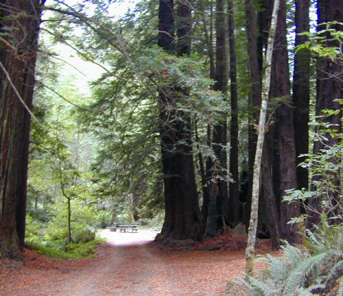
California Redwood Maps: From the North Coast Redwoods, the Central Coast Redwoods over to Southern Sierra Sequoia Groves, California is blessed to have so many old growth trees. Backpack, Camp, Hike, Picnic among these Ancient Giants.

2021 UPDATE: Sad to report that Big Basin State Park, Big Sur Coastal Redwoods, Western Divide Giant Sequoia and Mountain Home State Forest have been affected by the recent 2020 wildfires – plus a giant landslide on Pacific Coast Highway 1. Furthermore, Yosemite’s Mariposa Grove had several Sequoia trees fall over from super strong winds in early 2021. These forested areas and many roads are closed to the public until further notice.
Nope, sorry! This is not normal, as these ancient trees have stood the test of time and have been growing in place, for hundreds, if not thousands of years. These recent wicked wind events and the resulting larger wildfires are damaging these precious natural preserves. Don’t be surprised if the authorities close off some of these area to overnight camping.

Big Sur Map by NatGeo (Central Coast California)
Limekiln, Julia Pfeiffer, Ventana Wilderness
Santa Cruz Mountains Map (Central Coast California)
Big Basin, Portola, Nisene Marks, Henry Cowell State Parks
Redwood Map (North Coast California)
Redwood National Park and Redwood State Parks
Lost Coast Map by Wilderness Press (North Coast California)
Redwood Groves, Usal Beach
Shaver Lake Map by NatGeo (Central Sierra Nevada)
McKinley Grove, Sierra National Forest
Sequoia NP Map by National Geographic
(Central Sierra Nevada Mountains)
Sequoia National Park & Kings Canyon National Park
Sequoia NP Recreation Map by Tom Harrison
(Central Sierra Nevada Mountains)
Sequoia National Park & Kings Canyon National Park
Sequoia National Forest Map USDA
(Southern Sierra Nevada Mountains)
Giant Sequoia National Monument, Mountain Home, Kern River, Lake Isabella
Sequoia National Forest Topo Atlas USDA
(Southern & Central Sierra Nevada)
Collection of all Quadrangle Maps for Sequoia National Forest & Giant Sequoias
Yosemite National Park NatGeo Map #306
(Central Sierra Nevada Mountains)
Mariposa Grove of Sequoias, near Yosemite Valley


see all California redwood groves and parks –
Ancient, Big, Old, Tall Trees
 2020: Never have we seen such Destruction
Camping and hiking among the Giant Sequoias and Coastal Redwoods has never been so limited as right now. Make sure the park or forest you want to visit is indeed open, before you make your travel plans.
So much destruction during the 2020 wildfire year, has burned several Sequoia groves inside the Southern Sierra regions, as well as the Redwood parks around the Santa Cruz Mountains.
In addition, the Big Sur coast and the Russian River redwoods have trees that are also damaged and dangerous to be around. Furthermore, Yosemite National Park’s Mariposa Grove was badly damaged by severe winds in January 2021, in which 15 Sequoia trees were uprooted and fell down. While the clean up process may takes years, these affected areas are not fit for public use right now.

