Death Valley Books

Death Valley Road Trip, Camping Death Valley National Park, Mojave Desert California

Death Valley Books

Dante’s View, DVNP

Hiking Book DVNP

Moon Death Valley Book

DVNP Photographers Book

Off Road Death Valley

wildflowers death valley

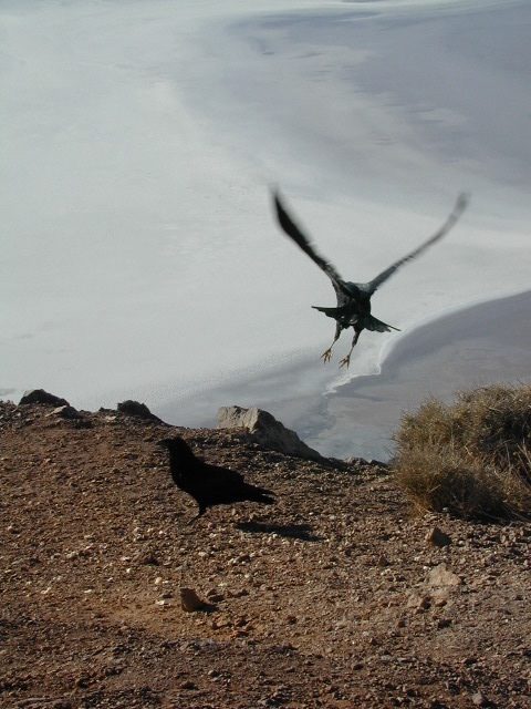
Death Valley is a desert valley in Eastern California, in the northern Mojave Desert, bordering the Great Basin Desert. It is one of the hottest places on Earth.

Bad Water

The Badwater Basin is the point of lowest elevation in North America, at 282 feet below sea level. It is located 85 miles east-southeast of Mount Whitney, the highest point in the contiguous United States, with an elevation of 14,505 feet.

Tallest Peak

The highest point in Death Valley National Park is Telescope Peak, in the Panamint Range, which has an elevation of 11,043 feet. This is one of the few spots that you can see the lowest point and the highest peak in the lower 48 states.

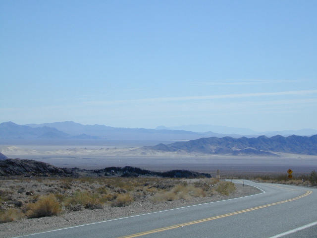
Lying mostly in Inyo County, California, near the border of California and Nevada, in the Great Basin, east of the Sierra Nevada mountains, Death Valley constitutes much of Death Valley National Park and is the principal feature of the Mojave and Colorado Deserts Biosphere Reserve. It runs from north to south between the Amargosa Range on the east and the Panamint Range on the west; the Grapevine Mountains and the Owlshead Mountains form its northern and southern boundaries, respectively. It has an area of about 3,000 sq miles.

Desert Climate

Death Valley has a subtropical, hot desert climate, with long, extremely hot summers; short, mild winters; and little rainfall.

The valley is extremely dry, because it lies in the rain shadow of four major mountain ranges (including the Sierra Nevada and Panamint Range). Moisture moving inland from the Pacific Ocean must pass eastward over the mountains to reach Death Valley; as air masses are forced upward by each range, they cool and moisture condenses, to fall as rain or snow on the western slopes. When the air masses reach Death Valley, most of the moisture has already been lost and there is little left to fall as precipitation.

Explore Death Valley

Geology of Death Valley

ghost towns death valley

History of Death Valley

Road Guide DVNP

see also

Death Valley Topo Map
Benchmark California Atlas
Inyo National Forest Map
Inyo Forest Topo Atlas
Jawbone Canyon Map

US 395 map

Amargosa Opera House @ Death Valley Junction

Death Valley Books

Stanislaus National Forest Map

hiking trail mapExplore more of the Central Sierra Nevada Mountains with the Stanislaus National Forest Map, which covers forests on both sides of Highway 108, Sonora Pass. Gold Country foothills give way to wilderness peaks and secluded streams. California gets some serious snow up in this high country, so most areas are only accessible half the year. Plan accordingly.

stanislaus USDA

Sonora Pass Map

Stanislaus Forest Camping / Sonora Pass / Stanislaus River
Stanislaus Sonora Maps

CA 108 Stanislaus. Stanislaus Map. Calaveras, Northwest Yosemite, Spicer Reservoir, Union, Utica Lakes, Dodge Ridge, Bear Valley Ski, Lake Alpine, Hetch Hetchy

Stanislaus National Forest Map

WATERPROOF PLASTIC MAP; water & tear resistant. Ranger Map – NFS issued map. GPS: Longitude & Latitude; Rivers, Lakes, Reservoirs, Creeks, Mountain Peaks, Elevations, 4WD routes and every dirt Back Road. Furthermore this map features Equestrian Areas, all Campgrounds, Picnic Grounds, Sierra Viewpoints, in addition to Hiking Trails & BackPacking Trailheads.

fishing map

Areas include: Gold Country California, Stanislaus County, Northwest Yosemite, Columbia, Sonora, Groveland, Twain Harte, Calaveras Big Trees, Hathaway Pines, Carson Iceberg Wilderness, Mokelumne Wilderness, Emigrant Wilderness, Cherry Lake, Pinecrest Lake, Spicer Reservoir, Donnell Lake, Tuolumne River, Merced River, Dodge Ridge, Bear Valley Ski, Lake Alpine, Hetch Hetchy, Union Lake, Utica Reservoir, Salt Springs Reservoir, Beardsley Lake, State Game Refuge, Mi-Wuk Village.

USDA Map Stanislaus

OLDER VERSION

see also

Carson Iceberg Wilderness Map
Emigrant Wilderness Map
Fishing Maps for California
Merced and Tuolumne Rivers Map
Stanislaus Forest Topo Atlas

Sonora Pass Camping Maps

stanislauspak

Stanislaus National Forest Map and Sonora Pass: Backpacking, Camping, Fishing, Hiking, Kayaking, Off Roading, Stargazing and Rock Climbing

Gold Country California

Stanislaus National Forest
Stanislaus River

nearby towns:stanislaus horseback trail map

California Benchmark Atlas

Benchmark California Map

California Benchmark Atlas

The best selling state atlas for the golden state – The California Road and Recreation Atlas

Benchmark California Atlas
California Driving Map. Topographic features, back roads map.

Best Overall Map: California Road & Recreation Atlas. This map books is the ideal state-wide map for any outdoor enthusiast. Excellent for exploring all of the golden state from the deserts of Southern California to the rivers of Northern California.

The Benchmark CA Atlas highlights include – all lakes, trailheads, Wilderness Areas, Campgrounds, National Forests, State Parks, National Parks, outdoor recreation destinations, plus extensive back roads (dirt & paved). This full color beauty is one of the most successful California map products of our time!

Recent editions have improvements: ground-cover detail at a very high-resolution.(forested, cultivated, marshland, desert, or scrub land). Extensively revised the 14-page Metro Map section; Complete Recreation Guide, page-to-page overlap and legendary accuracy. Printed on paper. 11th edition (2021) ISBN# 9781734315035

avenzabar

download this atlas w/ Avenza Maps

driftwood

California Benchmark Atlas


However, featured above is the current edition being sold but DanaMite actually prefers the look of the less-digitized version – the popular 2nd edition (printed in 2000), shown below. Easier to read maps, less text, less information overall, less busy looking.

California Benchmark Atlas

California Benchmark Atlas

Well Used, Well Loved. 2000, Second Edition

US 395 map

Benchmark US Hwy 395 Map

camp maps

Baja California Atlas
by Benchmark Maps

baja benchmark atlas

see also –
Benchmark Atlases for other states

Timber Trail Route

Timber Trail Route, Los Padres NF


Mount Shasta Castle Crags Map

Mount Shasta Wilderness Map
w/ Castle Crags Wilderness

(alternate maps listed below)

Shasta Castle Crags Map USDAShasta Castle Crags Map

OUTTA STOCK / OUTTA PRINT
Might be found @ ranger station

Map of Shasta / Castle Crags Map / Shasta County Map

Mount Shasta Wilderness and Castle Crags Wilderness, are Part of Shasta Trinity National Forest. Waterproof Plastic Paper. 2″ to mile; Usually only found at Ranger Stations. Perfect for a day hike reference or extended backpacking adventures. Printed on plastic in 2001.

Castle Crags Wilderness State Park, located along Interstate 5 NorCal, above Lake Shasta and south of Dunsmuir, CA

Mount Shasta Wilderness, western slopes of Mt Shasta, next to Mount Shasta City, CA

Shasta Castle Crags Map

Mount Shasta Wilderness Map by Wilderness Press

Shasta Wilderness Map

Mount Shasta Wilderness Trail Map by Tom Harrison

Classic Rock Climbs #18
Castle Crags California Book by Laird Davis

Mount Shasta is a potentially active volcano at the southern end of the Cascade Range in Siskiyou County, California. At an elevation of 14,179 feet, it is the second-highest peak in the Cascades and the fifth-highest in the state. Mount Shasta has an estimated volume of 85 cubic miles, which makes it the most voluminous stratovolcano in the Cascade Volcanic Arc. The mountain and surrounding area are part of the Shasta–Trinity National Forest.

camp mapThe summer climbing season runs from late April until October, although many attempts are made in the winter. Mount Shasta is also a popular destination for backcountry skiing. Many of the climbing routes can be descended by experienced skiers, and there are numerous lower-angled areas around the base of the mountain.

The most popular route on Mount Shasta is Avalanche Gulch route, which begins at the Bunny Flat Trailhead and gains about 7,300′ of elevation in a round trip of approximately 11.5 miles. The crux of this route is considered to be to climb from Lake Helen, at approximately 10,443′ to the top of Red Banks. The Red Banks are the most technical portion of the climb, as they are usually full of snow and ice, are very steep, and top out at around 13,000′ before the route heads to Misery Hill.

snowThe Casaval Ridge route is a steeper, more technical route on the mountain’s southwest ridge best climbed when there’s a lot of snow pack. This route tops out to the left (north) of the Red Banks, directly west of Misery Hill. So the final sections involve a trudge up Misery Hill to the summit plateau, similar to the Avalanche Gulch route.

Climbing Mount Shasta can be done in one day; however, it is often completed in two days. Climbers can ascend from Avalanche Gulch and camp at either Horse Camp @ 7,900′ elevation, or at Helen Lake @ 10,400′. Camping at a higher altitude also helps with acclimatization and often reduces risk of altitude sickness.

hikers mapNo quota system currently exists for climbing Mount Shasta, and reservations are not required. However, climbers must obtain a summit pass and a wilderness permit to climb the mountain. Permits and passes are available at the ranger station in Mount Shasta and the ranger station in McCloud, or climbers can obtain self-issue permits and passes at any of the trailheads 24 hours a day.

see also – 

Shasta Trinity National Forest Map
Shasta Trinity Forest Atlas
Shasta Books