Oregon Dunes Map

Oregon Dunes Map

2022 – IN STOCK

oregon dunes map
Oregon Dunes Map

2022 currently this map is unavailable on Amazon; might still be found at local ranger stations

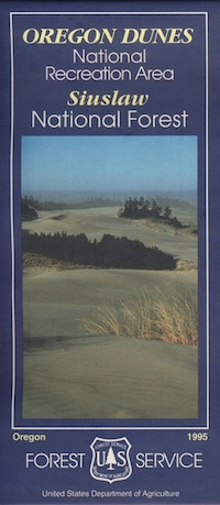
Sand Dunes NRA, Siuslaw National Forest, Oregon

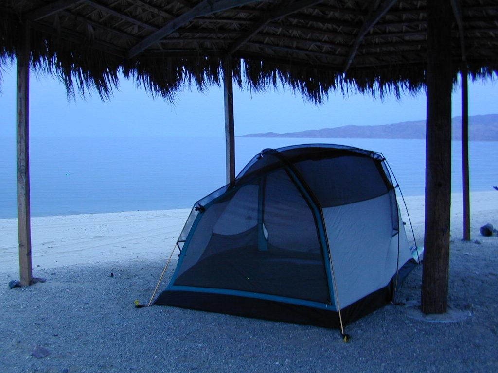
Oregon Sand Dunes – Camping on the Oregon coast.
Florence OR, Oregon Dunes Campgrounds

4x4 mapsOregon Dunes National Recreation Area Map, Siuslaw National Forest Oregon, Oregon Dunes NRA, OR Beaches, Oregon coast map. Oregon Dunes Camping, off-road, OHV, ATV. Lagoon Campground, Driftwood II Campground, Goose Pasture, Siltcoos Beach. Westlake, Florence OR, Reedsport, Coos Bay Oregon Maps. Printed in paper in 1995

Oregon Dunes Map

see also – 

Rogue River National Forest Map
Rogue River Float Guide
Six River National Forest Map
Siskiyou Map
Smith River Map
Coastal Maps for California 

Desolation Maps

Desolation Wilderness Maps
Westside of Lake Tahoe

High Sierra Granite, Lakes Sierra Nevada California

Several maps and books cover this Sierra Wilderness Area located right next to Lake Tahoe, the premier alpine lake destinations on the West Coast. Granite Chief Wilderness and Desolation Wilderness featured on the same map from NatGeo.

Desolation Maps

Desolation Maps

Desolation Wilderness USDA Map

Desolation Map / Desolation Wilderness / Hikes Tahoe

Backpacking & Hiking Trail Map for Desolation Wilderness (Part of El Dorado NF) Waterproof Plastic Paper. Perfect for a day hike reference or extended backpacking adventures. Map Scale = 2″ to mile; ISBN# 9781593514402

Desolation Maps

Tom Harrison & Wilderness Press
publish Desolation Maps too

Desolation Maps

Desolation Wilderness Trail Map
Tom Harrison MapsDesolation Maps

Desolation Wilderness Map Trail Map, Tahoe Lake Camping. Lake Tahoe, CA; Tahoe Westside, Loon Lake camping, Lake Aloha, Emerald Bay, Fallen Leaf Lake, DL Bliss State Park, Echo Lake, Velma Lake, Wrights Lake, Rubicon River, Rubicon 4×4 Trail, Rockbound Valley, Tahoe Rim Trail hiking PCT Pacific Crest Trail; Sierra Nevada High Country Tahoe hiking; Durable, waterproof plastic map; Folded. Map Scale: 42.24K; ISBN# 9781877689611

Desolation Maps

see also –
Lake Tahoe Basin Maps
Tahoe Rim Trail Map
Tahoe Basin Topo Atlas

Desolation Maps

Desolation Books –

Trail Tools Desolation Maps (1996) by Dennis O’Neill

Baja California Books

Benchmark Baja California
Road & Recreation Atlas

Baja Map Mexico

Release date MAY 2021 – announcing a brand new atlas for Baja California, created by Benchmark Maps. 

see more Baja California Maps

Baja California Books

Baja California Mexico

Baja California Mexico Books


Baja California Books

Baja California Books

Baja California Books

Lower California

as opposed to Alta California (US state of California)

Baja California encompasses a territory within the Californias region of North America, which exhibits diverse geography for a relatively small area. The Peninsular ranges of the California cordillera run down the geographic center of the state. The most notable ranges of these mountains are the Sierra de Juárez and the Sierra de San Pedro Mártir. These ranges are the location of forests reminiscent of Southern California’s San Gabriel Mountains. Picacho del Diablo is the highest peak on the peninsula.

Valleys between the mountain ranges are located within a farm growing climate zone, that is particularly suitable for agriculture. Such valleys include the Valle de Guadalupe and the Valle de Ojos Negros, areas that produce citrus fruits and grapes. The mineral-rich mountain range extends southwards to the Gulf of California, where the western slope becomes wider, forming the Llanos del Berrendo on the border with Baja California Sur. The mountain ranges located in the center and southern part of the state include the Sierra de La Asamblea, Sierra de Calamajué, Sierra de San Luis and the Sierra de San Borja.

Baja Climate

Temperate winds from the Pacific Ocean and the cold California Current make the climate along the northwestern coast pleasant year-round. Rains from the north barely reach the peninsula, thus leaving southern areas drier. South of the El Rosario River, the terrain changes from a Mediterranean landscape to a desert one. This desert exhibits diverse succulent species that flourish in part due to the coastal fog.

There are numerous islands on the Pacific shore. Guadalupe Island is located in the extreme west of the state’s boundaries and is the site of large colonies of sea lions. Cedros Island exists in the southwest of the state’s maritime region. The Todos Santos islands are located off the coast of Ensenada; Coronado Islands are located off of Tijuana.

Baja California Books

Gonzaga Bay, Baja California Mexico