Klamath Forest Topo Atlas

Klamath National Forest Atlas

Camping Klamath / Kayaking Klamath / Klamath River Fishing

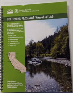
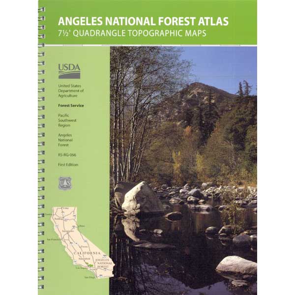
Klamath National Forest AtlasThe KLAMATH FOREST atlas, is a spiral bound book – a collection of all the quads (7½ minute topographical maps) of all of the Klamath National Forest back country. This book map has detailed topo lines, mountain peaks, streams, lakes, hiking trails, trailheads and all back roads.

Perfect for all kinds of recreational needs. Published in 2010 with the USDA (United States Department of Agriculture)Klamath National Forest Atlas

Klamath National Forest

Klamath River

Klamath National Forest Atlas

Klamath National Forest Atlas

Klamath Camping, Klamath River Fishing, Klamath California, Klamath Redwoods, NorCal Camping, Siskiyou County, Siskiyou Camping, Lakes, Rivers, All Dirt Roads, Off Road Routes, Northern California Hunting, Kayaking Creeks, Rafting Klamath, CA SR 96, California Highway 96, Yreka Mountains, Beaver Creek, Eagles Nest, Scott River Road, Scott Bar, Horse Creek, Grider Creek, Walker Creek, Seiad Valley, Seiad Creek, China Grade, Happy Camp, Elk Creek, Goosenest, Oak Knoll, Salmon River, Ukonom, Juanita Lake, Martins Dairy, Orr Lake, Shafter Campground, Curly Jack, Norcross, O’Neill Creek, Sarah Totten, Sulphur Springs Campground, West Branch, Fort Goff, Mount Asland, Tree of Heaven Campground, Big Flat, Hotelling Campground, Idlewild Campground, Matthews Creek, Mulebridge, Red Bank, Shadow Creek, Bridge Flat, Carter Meadows, Hidden Horse, Indian Scotty, Kangaroo Lake, Trail Creek, Beans Camp, Dillon Creek, Frog Pond, Nordheimer, Crystal Springs, Oak Bottom, Ti-Bar Flat TiBar, TBar, Ti Bar river access, Lovers’ Camp NorCal, Big Foot Country

Klamath National Forest Atlas

Klamath National Forest Atlas

KlamathAtlas

Klamath Topo Atlas USDA


Klamath National Forest Atlas

see also – trail map

nearby towns –

CA96

CA Hwy 96, known for rock slides & closures

Callahan, CA
Etna, CA
Fort Jones, CA
Happy Camp, CA
Klamath River
Orleans, CA
Seiad Valley
Somes Bar
Yreka, CA

NFS or USFS

Klamath USFS ranger stations:

Klamath National Forest Headquarters
1711 South Main Street
(Highway 3: Fort Jones Road)
Yreka, California 96097
530-842-6131

Macdoel Ranger Station USFS
Goosenest Ranger District
Butte Valley National Grassland
37805 Highway 97, Macdoel, CA 96058
530-398-4391

Happy Camp Ranger Station USFS
Oak Knoll Ranger District
63822 Highway 96, Happy Camp, CA 96039
530-493-2243

Fort Jones Ranger Station
Salmon River USFS
Scott River Ranger District
11263 Highway 3, Ft Jones, CA 96032
530-468-5351

ranger stations

California Benchmark Atlas

Benchmark California Map

California Benchmark Atlas

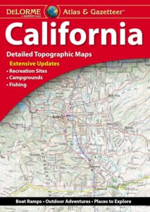
The best selling state atlas for the golden state – The California Road and Recreation Atlas

Benchmark California Atlas
California Driving Map. Topographic features, back roads map.

Best Overall Map: California Road & Recreation Atlas. This map books is the ideal state-wide map for any outdoor enthusiast. Excellent for exploring all of the golden state from the deserts of Southern California to the rivers of Northern California.

The Benchmark CA Atlas highlights include – all lakes, trailheads, Wilderness Areas, Campgrounds, National Forests, State Parks, National Parks, outdoor recreation destinations, plus extensive back roads (dirt & paved). This full color beauty is one of the most successful California map products of our time!

Recent editions have improvements: ground-cover detail at a very high-resolution.(forested, cultivated, marshland, desert, or scrub land). Extensively revised the 14-page Metro Map section; Complete Recreation Guide, page-to-page overlap and legendary accuracy. Printed on paper. 11th edition (2021) ISBN# 9781734315035

avenzabar

download this atlas w/ Avenza Maps

driftwood

California Benchmark Atlas


However, featured above is the current edition being sold but DanaMite actually prefers the look of the less-digitized version – the popular 2nd edition (printed in 2000), shown below. Easier to read maps, less text, less information overall, less busy looking.

California Benchmark Atlas

California Benchmark Atlas

Well Used, Well Loved. 2000, Second Edition

camp maps

2021 NEW Baja Atlas
by Benchmark

see also –
Benchmark Atlases for other states

Timber Trail Route

Timber Trail Route, Los Padres NF


Shasta Trinity Forest Atlas

USDA Shasta-Trinity National Forest Topo Atlas

Shasta Trinity Forest AtlasThe SHASTA-TRINITY FOREST atlas, is a spiral bound book – a collection of all the quads. (7½ minute topographical maps, of all of the Shasta and Trinity back country) This book map has detailed topo, contour  lines, mountain peaks, streams, lakes, hiking trails and all back roads. Perfect for all kinds of recreational needs.

Since this area of Northern California covers two National Forests- both Shasta National Forest and Trinity National Forest, the atlas book is thicker than the average atlas. Topographic maps for miles and miles of forest in between Mount Shasta and Redding, and from Weaverville on the west, to Burney on the east side.

Shasta Trinity Forest AtlasPublished in 2018.

7½ Minute Quadrangle Topographic Maps
119 Map Sheets covering the entire Shasta-Trinity National Forest
Map Scale: 1″ = 1 mile (1:63,360)
Topo Lines – Contour Interval 100 Feet
Folded Dimensions: (L” × W” × D”) 11 × 8.5 × 0.25
Unfolded Dimensions: (L” × W”) 17 × 11National Forest Maps
Spiralbound

Shasta-Trinity National Forest

trinity lush

areas covered include:

Lake Shasta
Mount Shasta
McCloud River
Trinity River
Trinity Alps
Trinity Lake (Clair Engle)
Lewiston Lake
Weaverville Basin
Whiskeytown Reservoir

whiskeytown lake

Whiskeytown Lake

Iron Canyon Reservoir
Castle Crags State Park
Yolla Bolly Peaks

Shasta Trinity Forest Atlas

Shasta Trinity Forest Atlas

Shasta Trinity Forest Atlas

turtle and goose

turtle and goose

Parade Weaverville

Summer Parade in Weaverville, California

see also –

Shasta-Trinity National Forest Map
Mount Shasta Wilderness Trail Map
Castle Crags Wilderness Map
Trinity Alps Wilderness Map 
Shasta Books

Benchmark Baja Atlas

Benchmark Baja Atlas

New MAP ATLAS for Baja!!!

Benchmark Baja California
Road & Recreation Atlas

Baja Map Mexico

Benchmark Baja Atlas -Announcing a brand new atlas for Baja California, created by Benchmark Maps. 

The first edition Baja California Road & Recreation Atlas showcases the diverse recreation opportunities found along the full length of the Baja California Peninsula. Regional maps provide a wider view of the region and Recreation Guides list an array of attractions for trip planning.

Published May 2021. ISBN: 9781734315059

Benchmark Baja Atlas

Covers both states:
Baja California Norte & Baja California Sur

Large scale maps (1:300,000) with detailed road classifications and points-of-interest

  • Kilometer markers on major highways
  • National Parks and Wildlife Areas
  • Recreation categories include
  • Parks, Monuments, Natural Wonders
  • Boating and Fishing Access, Beaches
  • Historic Missions & Ruins
  • Campgrounds and RV Parks

Regional maps at medium scale (1:1,000,000) illustrate broader views and longer routes.

Focused maps for La Paz, Los Cabos, and wineries of Valle de Guadalupe

Benchmark Baja Atlas

xterraroad

Baja California Mexico

Lower California

as opposed to Alta California (US state of California)

Baja California encompasses a territory within the Californias region of North America, which exhibits diverse geography for a relatively small area. The Peninsular ranges of the California cordillera run down the geographic center of the state. The most notable ranges of these mountains are the Sierra de Juárez and the Sierra de San Pedro Mártir. These ranges are the location of forests reminiscent of Southern California’s San Gabriel Mountains. Picacho del Diablo is the highest peak on the peninsula.

Valleys between the mountain ranges are located within a farm growing climate zone, that is particularly suitable for agriculture. Such valleys include the Valle de Guadalupe and the Valle de Ojos Negros, areas that produce citrus fruits and grapes. The mineral-rich mountain range extends southwards to the Gulf of California, where the western slope becomes wider, forming the Llanos del Berrendo on the border with Baja California Sur. The mountain ranges located in the center and southern part of the state include the Sierra de La Asamblea, Sierra de Calamajué, Sierra de San Luis and the Sierra de San Borja.

Baja Climate

Temperate winds from the Pacific Ocean and the cold California Current make the climate along the northwestern coast pleasant year-round. Rains from the north barely reach the peninsula, thus leaving southern areas drier. South of the El Rosario River, the terrain changes from a Mediterranean landscape to a desert one. This desert exhibits diverse succulent species that flourish in part due to the coastal fog.

There are numerous islands on the Pacific shore. Guadalupe Island is located in the extreme west of the state’s boundaries and is the site of large colonies of sea lions. Cedros Island exists in the southwest of the state’s maritime region. The Todos Santos islands are located off the coast of Ensenada; Coronado Islands are located off of Tijuana.

Petroglyphs in Baja

Rock Art Petroglyphs @ Catavina

see also –

NatGeo Baja Maps
Baja California Books

camp map