Cheeseboro Canyon Map

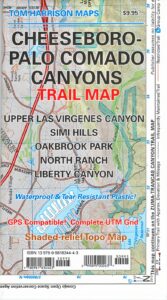
Cheeseboro Palo Comado Canyons Trail Map
by Tom Harrison

Simi Valley, LA hikes. Cheeseboro Canyon Map, Palo Comado Canyon

Simi Hiking Trails

Tom Harrison Cheeseboro Canyon Map. Hiking trails Los Angeles North, Upper Las Virgenes Canyon, Oakbrook Park, North Ranch, Liberty Canyon Hiking trailheads, mountain biking trails, outdoor recreation. Tom Harrison brand map, topographic, waterproof map. Released and printed in 2012. Scale 1:31,680 40 & 50 foot contour lines. ISBN# 9780981834443

Cheeseboro Canyon Map

nearby towns:

see also –Cheeseboro Canyon Map

Malibu Creek State Park Map
Point Mugu State Park Map

Columbia River Map

Columbia River Gorge

On the border between Oregon and Washington state, this huge river gorge is a recreation paradise. Fishing, camping, kayaking, wind surfing, hiking and much more.

Columbia River Gorge National Scenic Area

USDA Columbia River
Columbia River Map NFS

Columbia River Camping, Oregon Hikes, Columbia River Gorge Campgrounds

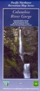
Recreation Map Oregon Washington. Topographic Map. Pacific Northwest Recreation, Outside in Oregon, Columbia River National Scenic Area, Maps, Mount Hood National Forest, Gifford Pinchot National Forest

On the borders of southern Washington state and the north boundary of Oregon lies the Columbia River Gorge, which cuts through the Cascade Mountain Range, and is the deepest, spectacular river canyon on the entire west coast. 80 miles long and 4,000′ deep. Bird watching, boating, camping, fishing, hiking, mountain biking, picnicking, rock climbing, windsurfing, wildflowers. Waterfalls in Oregon. Multnomah Falls is the second highest in the United States.

Map Scale: 1 inch = 1 mile; BLM & USDA. Printed in 2007 on waterproof plastic. This map can also be found at USFS Ranger Stations.

Columbia River Map

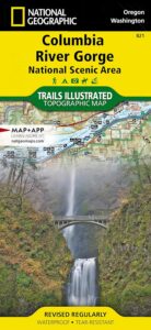
National Geographic has a full color map for this region

Columbia River Gorge NSA
Map #821

Columbia River Map

Mt Hood OR

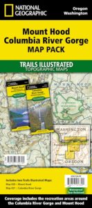
Mount Hood Map, Columbia River Gorge
MAP PACK (2 map set)
National Geographic – Trails Illustrated Map

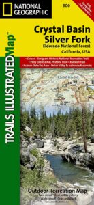
Crystal Basin Silver Fork Map

Crystal Basin Map
Crystal Basin & Silver Fork
of Eldorado NF
NatGeo Map # 806

Loon Lake, Central Sierra Nevada Maps

hikers mapTrails Illustrated Map from National Geographic. Crystal Basin / Silver Fork Map inside El Dorado National Forest map #806. 4×4 routes for the Rubicon Trail – all the way to Tahoe. Loon Lake, Union Valley Reservoir, Ice House Reservoir. Auburn State Recreation Area (Auburn SRA) and Carson – Emigrant Historic National Recreation Trail. Pony Express National Historic Recreation Trail.

Mountain bike trails, backpacking routes, equestrian and hiking trail mileage. High country map. Many rivers, roads and trails to explore. 2-sided map. Very detailed & colorful. Waterproof Plastic Map; Tear Resistant. GPS data. Scale = 1:63,360 ISBN#9781566952644

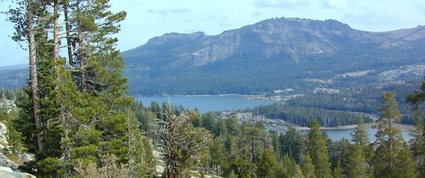
Silver Lake @ Carson Pass

Crystal Basin Silver Fork

The Crystal Basin spreads over 85,000 acres north of Highway 50 and west of Desolation Wilderness. Wonderful views of the Crystal Range extends north along the ridge from prominent Pyramid Peak (9963′ elev), Mount Price, Red Peak, and Silver Peak.

The Crystal Basin Recreation Area is a joint development between the Sacramento Municipal Utility District and the National Forest Service. SMUD operates a series of reservoirs and hydroelectric powerhouses which furnish energy to the Sacramento area.

Plasses

see also –

Carson Iceberg Wilderness Map
Desolation Wilderness Trail Map
Eldorado National Forest Map
Gold Country Maps

Siskiyou Map

Northern Cal Rivers and Forests

Siskiyou Topo Maps, NorCal

The Siskiyou Mountains border the Oregon state line at deep rivers and dense wild land. Bigfoot country, or so they say. Forested, hard to access country, whitewater creeks and river canyons of northern California.

  • Siskiyou Wilderness is located inside California, northwest of the Klamath River and CA Highway 96.
  • Siskiyou National Forest is public land USDA in southern Oregon, west of Interstate 5, portions of which span into California.

hiking

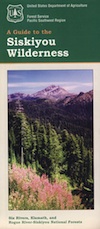
Siskiyou Wilderness Trail Map

Siskiyou Wilderness MapSiskiyou Wilderness Map

2024: CURRENTLY OUT OF PRINT

Wilderness Area located inside California, west of the Klamath River and north of SR 96. Indian Creek marks the northern wilderness boundary, while Blue Creek defines the south end.

Elk Valley trailhead camp is a prime spot, tucked deep into the Wilderness, accessible by a paved back road from Highway 96.

Siskiyou Wilderness, part of Klamath & Six Rivers National Forest. California – Oregon border area. Northern California @ Happy Camp, Klamath River, Clear Creek, Independence Creek, Baldy Mountain, Curry Homestead, Poker Flat, Kelly Lake, Youngs Peak, Patrick Creek, Smith River, Raspberry Lake, Chicago Peak, Oregon Hikes, Devils Punchbowl, Buck Lake, Island Lake, Little Bear Valley, South Kelsey National Recreation Trail, Ship Mountain Lake, Bear Basin Butte, Little South Fork Waterfall, Harrington Lake, Elk Valley, Blue Creek, Muslatt Mountain, Deer Lick Lake, Beans Camp.

Scale 1″ = 1 mile; Waterproof plastic map paper. Perfect for a day hike reference or extended backpacking adventures. ISBN# 9781593514730

hiking


Wild Rivers OR

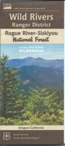
Siskiyou National Forest Maps

Oregon Camping & Hiking Topo Map

Siskiyou National Forest Map, Coos Bay, Northern California – Oregon border.
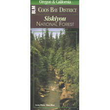
coos bay oregon

Siskiyou Hiking Maps, Topographical Maps Grant Pass, Brookings, Gold Beach, Cave Junction, Powers, Merlin, OR. Hwy 199, Snow Camp Lookout, Agness, Big Pine Trail, Port Orford, Pearsoll Fire Lookout Tower, Oregon Maps, Whitehorse Campground, Schroeder, Lake Selmec, Almeda Park Camping, Indian Mary Campground, Hog Creek, Harris Beach State Park, Humbug Mountain State Park Oregon. Printed on paper in 1997
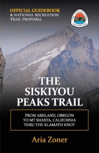
Siskiyou Peaks:
Klamath Knot to Ashland 

NFS

USFS, United States Forest Service – aka National Forest Service