Zion National Park Map

Zion National Park Map

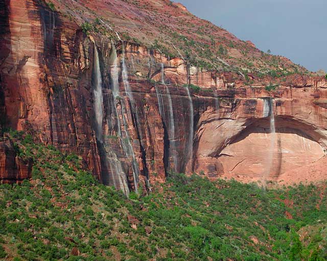
Waterfalls appear after a big sudden thunderstorm.

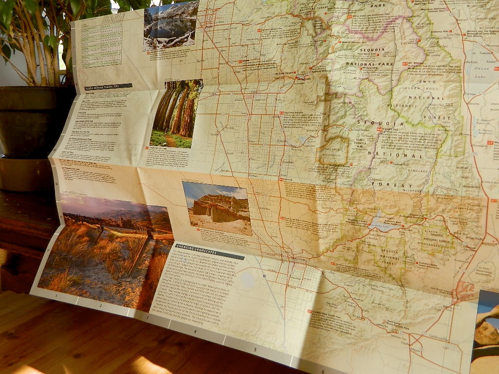
National Geographic Trails Illustrated Map #214
Zion Canyon, Virgin River, Zion NP

Zion National Park, UT – Zion Narrows, Kolob Canyons, La Verkin Creek Trail, Hop Valley Trail, Wildcat Canyon, West Rim Trail, Floor of the Valley Road, East Rim Trail, Telephone Canyon, and the Virgin River.

Waterproof Map Paper. Printed in 2019, ISBN 9781566952972


hikers map

Zion National Park Map

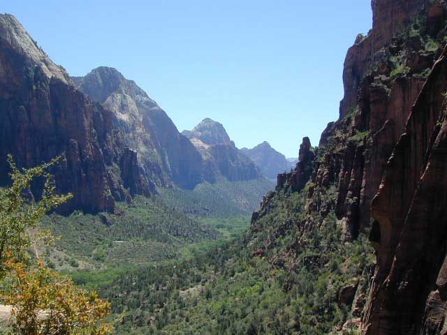
Zion Canyon is a mini Yosemite Valley, in red rock, in the high desert.

A terra cotta colored wonderland.

Zion National Park is one of the most visited of all the Utah National Parks Loop, due primarily to its proximity to Las Vegas, NV and Interstate 15.

Zion National Park Map

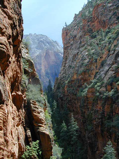
Zion Canyon, from hiking trail to Angel’s Landing

ZION NP OVERVIEW: To prevent traffic jams and preserve the wildness, the NPS offers a common parking lot (on Hwy 9 @ Springdale, UT) with tram/shuttle service to and from the valley. Plan to be away from your car most of the day when visiting the main canyon. Unless of course, you have reservations at the main lodge. Numerous hiking trails, the Virgin River, Zion Lodge and a restaurants.

Utah Highway 9 leads east through tunnels and more amazing rock scenery, with abundant pullouts for RVs and visitors. Nice uncrowded hikes can be found on the east side of the National Park at many of these random parking lots along the highway.

A small portion of Zion National Park parallels Interstate 15. This Kolob Area is far less crowded than the rest of the park, but no camping is allowed.

Abundant boondock camps can be found all over the Zion area, even along the freeway.

Awesome camps that we discovered in the late 1990’s are now well known and crowded, all year long.

Free river beach campsites W of Rockville, high country of the Smithsonian Butte trail, above Grafton ghost town. These areas are NO LONGER a secret, and are very crowded. BLM camping at Leeds exit is on a first come basis and limited, so you better arrive before dark for the best spots.

EXPERTS TIP – Buy a real map and learn to find campsites, that no one else knows about. Mark a GPS waypoints for future reference. Have the whole place to yourself for once!

Benchmark Atlas: Utah

Zion National Park Map

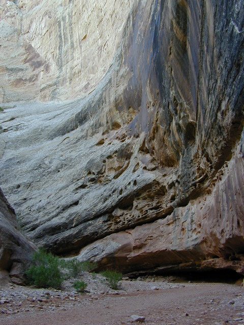
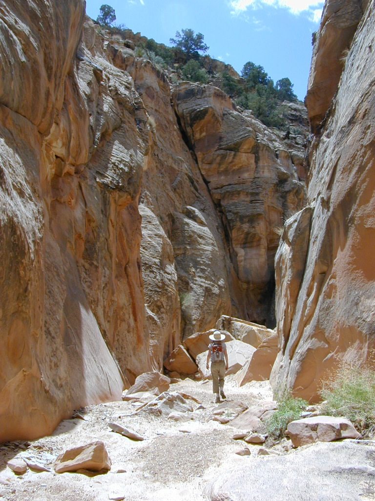
Hiking Zion National Park – Refrigerator Canyon. Refreshingly cool breezes pass through this canyon, so even hot summer days are okay. A great place to escape the mid-day heat.

avenzabar

apps/maps:
download digital topos & maps

driftwood

more maps on Utah


Zion National Park Map

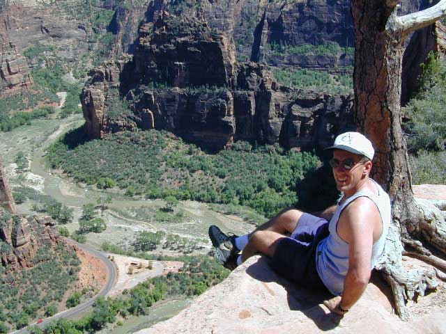
Atop Angel’s Landing, Zion National Park, Utah

see also –

Bryce Canyon National Park Map
Capital Reef National Park Map 
Utah Maps
Utah Books

Capital Reef Map

Capital Reef Map

hiking slot canyons

Capital Reef National Park Map

NPSCapt Reef NP

Utah’s National Parks are unbelievably beautiful. Enjoying one National Park at a time would require months. Hiking, off-roading and camping are always popular during the summer months, yet most of the parks are open all year long.

NPS
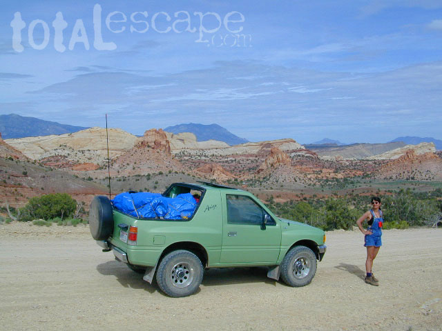
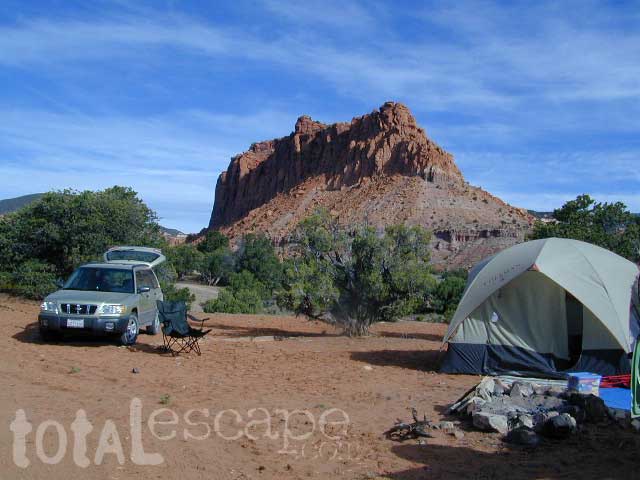
Capital Reef is a fertile high desert canyon with plenty of great slot canyons and archways to explore. The main campground on the highway is located next to a historic fruit orchard.

Capital Reef Map

Capital Reef MapCathedral Valley is a cool off-road destination for secluded camping, way off the paved highway. Self sufficient campers only!

The Burr Trail is a historic graded road, with steep switchbacks and red rock scenery. This main backcountry route connects the National Park to remote BLM land, south of the park.

Capital Reef Map

Hiking in Capital Reef National Park

get a digital version of this mapavenza maps
NatGeo #267 – Capitol Reef NP Map

Capital Reef Map

May is generally the best month for camping & hiking in southern Utah. Summer can bring triple digit heat and late season thunderstorms. Flash floods are common and life threatening in this mountainous high desert region. Winter snow is typical in this region.

NFSFishlake National Forest is neighboring the National Park on the west side of Capital Reef NP. Free camping is available on dirt roads in the National Forest; Capital Reef Mapcampfire permits are required for back country camping. RV park, motels, market and restaurants available in Torrey.

nearest town:
Torrey, UT

Capital Reef Map

Capital Reef Map

Historic Burr Trail is a very long, yet drivable, graded dirt road connecting many public lands in south central Utah. High clearance is recommended, 4WD may be required during wet weather or snow.

avenzabar

apps/maps:
download digital topos & maps

BLM Map: West Wayne County UT (free)
Fishlake National Forest Topo Atlas
Fishlake NF Utah – Off Road Map (free)
Fishlake NFS Visitor Map – North Half
Glen Canyon Lake Powell Map NPS (free)
Glen Canyon Recreation Area – Lake Powell Map
Grand Staircase Escalante Map BLM
Motorized Routes Map, Emery County UT
NatGeo #707 – Fish Lake, Manti Map (Interstate 70)

Capital Reef Map

Free Camping @ Fishlake NF – Torrey, Utah

see also –Utah Maps

Canyonlands Map
Utah Maps
Utah Books

Capital Reef Map

Giant Walls of Capital Reef

Mammoth Lakes & Mono Divide Map

Mammoth Mono Map
NatGeo Map #809

Mammoth Lakes Map
Mammoth Lakes & Mono Divide Map

Trails Illustrated Map from National Geographic. Mammoth Lakes & the Sierra Nevada Mono Divide on one map #809. This map covers areas inside Inyo National Forest & Sierra National Forest.

Many know the Eastern Sierra & US Hwy 395, but few know about the Mono Divide, deep in the majestic Sierra Nevada, way up behind Mammoth Lakes.  Mono Hot Springs, Highway 168, back beyond Huntington Lake & Kaiser Pass. Florence Lake, Edison Lake, Vermillion Camp.

Only on foot connects the Western Sierra with the steep granite ridges and deserts on the east side.

Ansel Adams Wilderness, Dinkey Lakes Wilderness. The Minarets, Devils Postpile National Monument. Hike PCT, John Muir Trail. Sierra Nevada High Country Hiking Map. Many alpine lakes to fish, hike and explore in the wilderness – the high country. Very detailed & colorful. Waterproof Plastic Map; Tear Resistant. GPS data. Printed 2010. ISBN# 9781566952668

Convict Lake w/ dogs

Mammoth Lakes, Mono Divide High Country, Topographic Maps, Topo, Hike, Backpack, Fishing, Camping, Mountain Bike, Trail Maps, All Outdoor Recreation

nearby towns:

minarets

The Minarets @ Mammoth

see also –

Devils Postpile Trail Map
Mono Divide High Country Map
Ansel Adams Wilderness Maps
John Muir Wilderness Maps
Inyo National Forest Map USDA
Sierra National Forest Map USDA

Lake Genevieve

Lake Genevieve

Sierra Nevada Topo Map

Sierra Nevada Maps

Lake Maps

Sierra Buttes, North Sierra Nevada

Sierra Nevada: NatGeo Destination Map

National Geographic makes a really nice overview map for the Sierra Nevada mountains. They call it a “Destination Map” and it has color photos, features areas of interest, highways, park boundaries. Shaded relief topographic, 2-sided, full color and folded. ISBN# 9781597754491

Sierra Nevada map

Decent overview map for planning out trips and getting a good feel as to the ‘lay of the land’. Much of the mountain range can only be crossed on foot, as there are no roads across the mid-section!

Sierra Map National Geographic

Click to Expand

  • canyons
  • forests
  • highways
  • lakes
  • parks
  • peaks
  • reservoirs
  • rivers
  • small towns

Sierra Mountains Map

Sonora Pass, Highway 108, Central Sierra Nevada

natgeo maps

imus map

IMUS Sierra Nevada Topo Map

Sierra Nevada Map published by Imus Geographics, features all outdoor recreation – for just about any adventure seeker or tourist. A great overview map w/ trail heads, paved roads & camping. Map shows Sierra Rivers & Lakes, Sierra hiking trails, backpacking routes, National Parks, all Sierra Wilderness Areas, towns, Campgrounds. From Mount Lassen to Tehachapi Pass. Topographical map can be used for trip planning, routing, driving to Sierra destinations, reference. Map SCALE 500K; High-strength paper map. Folded size = 6 inches x 9 inches / Topo California High Sierra. First Edition 2006. ISBN# 9780966534528

Imus Sierra Nevada Wall Map

Imus Sierra Nevada Map, mounted wall map


Sierra Maps

Eastern Sierra = extreme mountain peaks

pct topo map
PCT TOPO MAP

see all
Sierra Nevada wilderness
& topo maps