Lake Tahoe Basin Map

Two different recreation maps for the Lake Tahoe Basin are created by the USDA & NatGeo. Several smaller brands for regional topographic trail maps. The US Forest Service has the Tahoe National Forest Map that encompasses a much larger area. Numerous books exist for backpacking and hiking around Tahoe.

Lake Tahoe Basin Map

NatGeo Map #803 Tahoe Basin

tahoebasin803

Lake Tahoe Trails Illustrated Map from National Geographic

Recreation Map for Lake Tahoe Basin, Topographic Lake Map, Backroads Hiking Maps, Tahoe Backpacking, Tahoe Camping, All Campgrounds, Trailheads, Creeks and Lakes. Sierra Nevada Back Roads, Truckee River Camping and Hiking Map. Very detailed and especially colorful, topo map. In this case, a 2 -sided map, waterproof plastic map; tear resistant. GPS data. Map scale 1:63,360 / Contour Interval = 50 feet. ISBN# 9781566953344

Lake Tahoe Basin Map

Lake Tahoe Basin MapMany believe that Lake Tahoe was formed by the collapse of an ancient volcanic crater, but the natural lake and mountain basin was actually formed by the rise and fall of the landscape due to faulting.

The Tahoe Basin which spans approximately 22 miles long (and 12 wide), is located on top of the Sierra Nevada mountain range. Separating California from Nevada state, a year-round, mountain resort destination. In particular, this is considered the north part of the majestic Eastern Sierra range. Furthermore, Lake Tahoe is often referred to as “Jewel of the Sierra”.camp map

Largest freshwater, alpine lake in North America.
Second deepest lake in the U.S.
Second highest lake in the U.S.

LAKE TAHOE – 6625′ elevation above sea level

Equally as relevant, our wide range of Tahoe maps listed below are current, full color publications – covering wildlife to wildflowers, forest back roads to 4WD routes, horseback trailheads to hiking trails, mountain peaks to meadows, creeks to waterfalls, trail camps to campgrounds, and of course cross country skiing to backcountry ski tours.

NatGeo Tahoe Map Pack

NatGeo Wilderness Maps

Adventure Maps Tahoe

Tahoe Heritage Foundation Map

Fine Edge Tahoe Maps

Tahoe Backcountry Ski Maps


Lake Tahoe Basin Map

Lake Tahoe Basin Management Unit, USDA Map


tahoebasin

Lake Tahoe Map USDA
Lake Tahoe Basin Management Unit

NFS Lake Tahoe Basin Map USDA

Lake Tahoe Basin & Vicinity

USGS Map California: Lake Tahoe Basin Map; Sierra Nevada Mountains, Lake Tahoe, Desolation Wilderness, Granite Chief, Fallen Leaf Lake. Tahoe Recreation, Camping Map. USDA NFS Recreation Area. Certainly all forest lands, trails and roads surrounding Lake Tahoe; 10 miles all the way around lake. Printed on waterproof plastic. Pictured published 2010. ISBN# 9781593514808.

LAKE TAHOE
OUTDOOR RECREATION

  • backpackinghikers map
  • boating
  • camping
  • casinos
  • cycling
  • fishing
  • hikinghorse trail maps
  • horseback
  • kayaking
  • mountain biking
  • mountaineering
  • off-roading
  • sailing4x4 maps
  • snow skiing
  • snowboarding
  • swimming
  • water skiing
  • xc skiing

see also –
Tahoe Rim Trail
Tahoe National Forest Map
Lake Tahoe Maps
Tahoe 4×4 Map Guide

Lake Tahoe Basin Map

Tahoe National Forest

nearby towns:

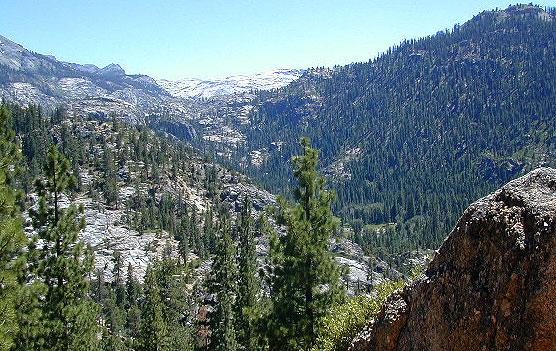
In the distance, Desolation Wilderness can be seen on the opposite side of the lake, typically covered in snow more than half the year.

snowridge

Desolation Wilderness on the Westside of Lake Tahoe

Agua Tibia Wilderness Map

Agua Tibia Wilderness
& San Mateo Wilderness 

hiking agua tibia

Agua Tibia Wilderness

Agua Tibia Map, Cleveland National Forest, San Diego Hiking Map; Temecula Hiking, Southern California

Both Agua Tibia Wilderness & San Mateo Canyon Wilderness are included in this waterproof plastic hiking topo map. Printed on plastic in 2004. ISBN# 9781593514198

Dripping Springs Campground

Dripping Springs Trailhead @ Campground

nearby towns –
Fallbrook, CA
Palomar Mountain, CA
Rainbow, CA
Temecula, CA

temecula campground

Campground near Temecula, CA

see also –

Cleveland National Forest Map
Cleveland Forest Topo Atlas
San Diego Backcountry Map

Mokelumne Wilderness Maps

Mokelumne Maps

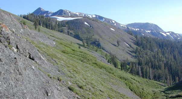
Mokelumne sits in between Carson Pass (Hwy 88) and the Ebbetts Pass (Hwy 4) – a vast Sierra mountainous area, south of Lake Tahoe. With high elevation passes that are usually closed more than half the year due to deep snow, this area becomes summer vacation haven for outdoor seekers. Mokelumne Wilderness Maps can show you the details for picnics, day hikes, trailheads, backpacking routes, horse packing trail camps, alpine lakes, reservoirs and the Mokelumne River.

Wilderness Topographic Map

Mokelumne Wilderness is located in the Central Sierra Nevada mountains, above the Gold Country foothills, in between Hwy 88, 89 and 4; due south of Lake Tahoe. Fish, mountain bike, kayak, camp, backpack, horseback. It is all out here in gorgeous-ville. Lakes and peaks, rivers and creeks. All of this beauty and adventure waiting for you, but only accessible half the year (or less) – due to snow. Certain areas are designated Hiking Mapfor winter recreation, cross country skiing and snowmobiling.

Mokelumne is bordered by 3 National Forests, in the middle of the Sierra Nevada mountain range: Stanislaus NF, El Dorado NF & Toiyabe NF.

Mokelumne Map USDA
found on USGS

mokelumne map USDA

Mokelumne Map

PREVIOUS EDITION MAP

Hiking Topo Map
Mokelumne Wilderness Map
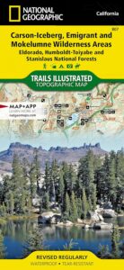
#807 NatGeo

National Geographic produces high quality topo maps with Trails Illustrated. High elevation, outdoor recreation highlights, trailhead parking, all roads, all trails, all campgrounds, peaks, lakes. GPS info. Full color, 2 sided map. Map 807

Topo Maps Mokelumne

Salt Springs Reservoir

Mokelumne Wilderness

Bordering the wilderness lands for day hikes and car camp on the outskirts. Plenty of dirt road in this region will lead to dispersed camp sites. Or do a backpacking week, or a horse pack adventure – deep into the untouched wild country of the Sierra Nevada mountains.

towns nearby:

Camgrounds Maps

Free Camgrounds in the Sierra

see also –

National Forest Maps

Gold Country Books

The Gold Rush of California

california independentThe largest migration in world history, of Overland pioneers traversing the continent on foot with wagons and horses, took place right here – beginning in 1848. The discovery of the precious metal gold, that set this rolling, was centered around the western Sierra rivers and mountains of California. The migration west began much earlier, but it increased dramatically after the news spread.

Gold Country Books can relate the historic details of yesteryear.

Within only a decade the entire West Coast was transformed into a developed landscape, with people coming from all over the world to stake out their claims, dreaming of fortunes or simply, just to find work and create a new life. Hence, California became a U.S. state in 1850. Consequently, the railroads followed soon after.

Find Gold Country Maps

Gold Rush Map Books

Columbia State Historic Park, California

California’s Gold Country Books

Gold Country Books

Coloma Gold Centennial Stamp 1948

Our Favorites on California History

Little did I know what pleasure reading California historical books would bring me in my middle years of life. Transport yourself to the dusty trails and hardships of Overland pioneer life, or imagine a two year journey sailing around the bottom of South America to reach this desolate coast in the early 1800’s. Read these books below to get a glimpse into an Old California story. One you can only dream about, knowing what has become of it today.

Gold Country Books

Gold Country Goofballs in Auburn, CA