El Dorado National Forest Map

El Dorado
National Forest Map

Eldorado National Forest Map / El Dorado Camping
Eldorado National Forest Dispersed Camping Map
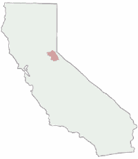
El Dorado NF

Eldorado National Forest Map
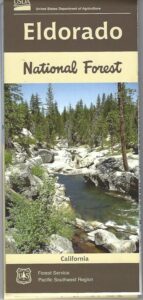
USGS map California: Northern Sierra, Gold Country, Mokelumne Wilderness, South Lake Tahoe.PAPER MAP. Ranger Map – NFS issued map. GPS: Longitude & Latitude; Rivers, Creeks, Peaks, Elevations, 4WD & every dirt Back Road, Hot Springs, Equestrian Areas, all Campgrounds, Hiking Trails & Backpacking Trailheads.camp map

Areas include: Northern Sierra, Gold Country, Mokelumne Wilderness, Desolation Wilderness, South Lake Tahoe, Lower Bear River Reservoir, Silver Lake, Caples Lake, Lake Aloha, Union Valley Reservoir, Cosumnes River, American River, Jenkinson Lake, Crystal Basin and Rubicon Lake and Rubicon Trail. Quality USDA maps created for the National Forest Service. Map Size: 27″x 36″ overall / 4″x9″ folded; Printed on paper un 2015. ISBN# 9781593514921

Gold Country Mountains, California

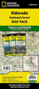
NatGeo is now making a map package with 3 colorful, waterproof maps for the El Dorado forest region. What a deal!!
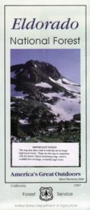
eldorado map pak

El Dorado Forest

Sierra Rivers Map

California: Sierra Rivers

EldoradoNF

OLD PAPER MAP

see also –

Mokelumne Wilderness Map
Desolation Wilderness Maps
Stanislaus National Forest Map
Toiyabe National Forest Maps
Tahoe Basin Map
Tahoe National Forest Map
Tahoe Rim Trail Map
Lake Tahoe Topo Atlas
4×4 Trail Tahoe Map
Eldorado National Forest Map

Central Sierra Mountains / Gold Country Foothills : El Dorado National Forest

hikers mapWilderness areas near El Dorado Forest:

Mokelumne Wilderness
Desolation Wilderness

Granite Chief Wilderness
Red Lake Wildlife Area

nearby towns:

driftwood

Eldorado National Forest Camping Maps

grizzly flat forest


Angeles Maps

Angeles Hiking Maps

Topo Maps by Tom Harrison, National Geographic, USDA

Angeles Maps

Angeles Forest
NatGeo Map #811

NatGeo Map Angeles

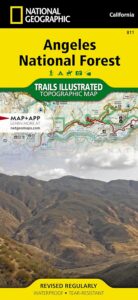
National Geographic Trails Illustrated Angeles National Forest Map #811. Los Angeles National Forest. Angeles Crest Highway 2, California State Route 14, Scenic Byways, Pacific Crest Trail, Mount Wilson, Mount Lowe, Mount Baldy, San Gabriel Mountains, Santa Clarita Trails, Magic Mountain Wilderness, Pleasant View Ridge Wilderness, San Gabriel River, San Gabriel Wilderness, Sheep Mountain Wilderness, Castaic Lake, Pyramid Lake, Piru Lake, Bouquet Canyon, Bouquet Reservoir, Elizabeth Lake, Lake Hughes, San Dimas, Azusa, Crystal Lake, Angeles Hiking Trails. GPS Compatible, Full UTM Grid. Waterproof ISBN# 9781566955775

Angeles Maps

Angeles Front Country Map
by Tom Harrison Maps
Angeles Hiking Map

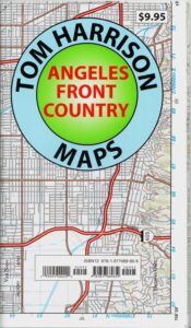
Tom Harrison Trail Map: Angeles Front Country, local LA maps for Angeles Crest. Los Angeles Forest Maps, Los Angeles Hiking Map, Backpacking Maps. Angeles National Forest, San Gabriel Mountains, Hiking Angeles Crest Highway 2 California. La Canada, Pasadena, Palmdale, Wrightwood California. Durable, waterproof plastic map; Folded. Map Scale: 63K; ISBN# 9781877689659

Angeles Maps

Angeles High Country Map
by Tom Harrison Maps

Angeles Highcountry Map

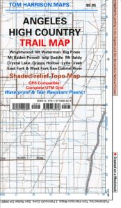
Tom Harrison Trail Map: Angeles High Country Map, local LA maps. Los Angeles Forest Maps, Tujunga Canyon, Los Angeles Hiking Map, Backpacking Maps. Angeles National Forest, San Gabriel Mountains, Angeles Crest Highway 2 California. La Canada Hiking Trails Pasadena, Palmdale, Wrightwood Hiking Maps. Durable, waterproof plastic map; Folded. Map Scale: 63K; ISBN# 9781877689628

Angeles Maps

san gabriel mountains

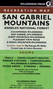
San Gabriel Mountains Recreation Map
by Wilderness Press
[CURRENTLY UNAVAILABLE 2024]

Wilderness Press Map for Los Angeles mountains region. Southern California areas include – Angeles NF, Cucamonga Wilderness, San Gabriel Wilderness, Sheep Mountain  Wilderness, Pleasant Valley Ridge, Magic Mountain Wilderness, Big Tujunga, Mount Baldy, Crystal Lake, Azusa Canyon, Liebre Mountain

Angeles Maps

see also –

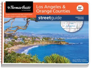
L.A. Thomas Guide
Los Angeles & Orange County Street Map

Thomas Guide Los Angeles

Angeles Maps

Angeles Crest Hwy 2

Desolation Maps

Desolation Wilderness Maps
Westside of Lake Tahoe

High Sierra Granite, Lakes Sierra Nevada California

Several maps and books cover this Sierra Wilderness Area located right next to Lake Tahoe, the premier alpine lake destinations on the West Coast. Granite Chief Wilderness and Desolation Wilderness featured on the same map from NatGeo.

Desolation Maps

Desolation Maps

Desolation Wilderness USDA Map

Desolation Map / Desolation Wilderness / Hikes Tahoe

Backpacking & Hiking Trail Map for Desolation Wilderness (Part of El Dorado NF) Waterproof Plastic Paper. Perfect for a day hike reference or extended backpacking adventures. Map Scale = 2″ to mile; ISBN# 9781593514402

Desolation Maps

Tom Harrison & Wilderness Press
publish Desolation Maps too

Desolation Maps

Desolation Wilderness Trail Map
Tom Harrison MapsDesolation Maps

Desolation Wilderness Map Trail Map, Tahoe Lake Camping. Lake Tahoe, CA; Tahoe Westside, Loon Lake camping, Lake Aloha, Emerald Bay, Fallen Leaf Lake, DL Bliss State Park, Echo Lake, Velma Lake, Wrights Lake, Rubicon River, Rubicon 4×4 Trail, Rockbound Valley, Tahoe Rim Trail hiking PCT Pacific Crest Trail; Sierra Nevada High Country Tahoe hiking; Durable, waterproof plastic map; Folded. Map Scale: 42.24K; ISBN# 9781877689611

Desolation Maps

see also –
Lake Tahoe Basin Maps
Tahoe Rim Trail Map
Tahoe Basin Topo Atlas

Desolation Maps

Desolation Books –

Trail Tools Desolation Maps (1996) by Dennis O’Neill

Whitney Map

Mount Whitney
by NatGeo Map #322

Whitney MapMount Whitney is universally famous as the highest peak in the contiguous United States, as well as the highest point in California. National Geographic’s Trails Illustrated map of Mount Whitney delivers unmatched detail and valuable information to assist you in your exploration of this beautiful region. Expertly researched and created in partnership with local land management agencies, this map features key areas of interest including Sequoia, Kings Canyon NP, Inyo NF and John Muir Wilderness; South Fork Kern River; Diaz Lake; and Cottonwood Lakes.

Whitney MapWith miles of mapped trails including the popular Pacific Crest and John Muir trails, this map can guide you off the beaten path and back again in some of the most breathtaking scenery in the region. The clearly marked trails include mileage between intersections. A Mount Whitney trail profile inset showing the changes in altitude from various points along the Pacific Crest Trail Junction and the Whitney Portal Trailhead provides a handy tool for hikers. Scenic byways are noted for those wishing to take in the scenery by car. The map base includes contour lines and elevations for summits, passes and many lakes. Some of the many recreation features noted are campgrounds, trailheads, boat launches, swimming and fishing areas, and pack stations. Map includes helpful information about climbing Mount Whitney. (which you should do online and offline, months in advance, if you really plan to hike the peak)

Inyo National Forest National Forest Maps

Whitney Lottery?

USEFUL LINKS:

amigo on whitney

waterfalls

mount whitney

Whitney Portal is a tourists attraction, as well as a NFS campground, and trailhead for the thousands of hikers who visit the area. Whitney Portal Road leads uphill 20 miles from US 395 @ Lone Pine, CA

see also –

Mt Whitney Zone Map & Mount Whitney Highcountry Map, both by Tom Harrison Maps

Inyo National Forest Map USDA

Inyo National Forest Topo Atlas 

Bishop Pass Trail Map

John Muir Wilderness / JMT Maps

Golden Trout Wilderness Maps

Whitney Map

Mount Whitney Topo

by Wilderness Press Maps

Whitney Map

whitneystore

Whitney Portal Store & Cafe

EASTERN SIERRA US 395

nearby towns: