PCT Map #7 S Oregon

Pacific Crest Trail
Pacific Crest National Scenic Trail
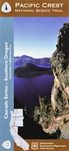
PCT – Hiking Map #7

USDA PCT Map 7

Cascade Mountains in Southern Oregon

USDA PCT Map 7PNW, Pacific Northwest
MAP number 7
Pacific Crest Trail, Southern Oregon, PCT, OR, day hikes, overnight hikes, backpacking trails, outdoor vacations, Oregon recreation, rivers, kayaking, camping, canoeing, swimming, river rafting, hiking, mountain biking, traveling.

USDA PCT Map 7

USDA PCT Map 7

PCT Map Siskiyou Mountains. by NatGeo

The Pacific Crest Trail Map Pack Bundle of Oregon includes 2 Topographic Map Guides that cover the entire PCT as it traverses the incredible terrain of the Beaver State. The maps start at the lowest point of the PCT, Cascade Locks, where it passes over the Columbia River, and continue past the many volcanic cones of the Cascade Range. The Oregon South booklet ends at the border of California in the Siskiyou Mountains.


Oregon is a state in the Pacific Northwest region of the United States. The Columbia River delineates much of Oregon’s northern boundary with Washington, while the Snake River delineates much of its eastern boundary with Idaho. The 42° north parallel delineates the southern boundary with California and Nevada.

Oregon is one of the most geographically diverse states in the U.S., marked by volcanoes, abundant bodies of water, dense evergreen and mixed forests, as well as high deserts and semi-arid shrublands. Mount Hood, a stratovolcano, at 11,249 feet elevation is the state’s highest point. Oregon’s only national park, Crater Lake National Park, comprises the caldera surrounding Crater Lake, the deepest lake in the United States. The state is also home to the single largest organism in the world, Armillaria ostoyae, a fungus that runs beneath 2,200 acres of the Malheur National Forest.

Oregon is 295 miles north to south at longest distance, and 395 miles east to west. With an area of 98,381 square miles, Oregon is slightly larger than the United Kingdom. It is the ninth largest state in the United States. Crater Lake National Park, the state’s only national park, is the site of the deepest lake in the United States at 1,943 feet.

National Geographic Reference Map for PCT


see also –

Columbia River Map
Oregon Hiking Books
Oregon Dunes Map
Rogue River Guide Book

Outdoor Deaths

Outdoor Deaths

The books below are warnings to all who wish to be enlightened on wilderness skills and reality. Come all clumsy, clueless and naive. Outdoorsman, weekend campers or highway stranded motorists. Learn from true stories on disappearances.

City folks beware, hundreds of people go missing, vanish or die every year in the wild lands of this country. Most disappear inside popular National Parks and numerous State Parks.

If you are indeed interested to discover how easy it is for people to get lost, fall off of a cliff, get injured or attacked, drown, be kidnapped or die in the mountains – then these books may be good reading material.

On foot, by truck or by car, the stories are long and ever detailed, often ending with more questions than answers.

Books on National Park Deaths and other outdoor fatalities

Tales for Cautious Campers

Outdoor Deaths

Outdoor Deaths

Outdoor Deaths

Outdoor Deaths

Outdoor Deaths


Outdoor Deaths

Outdoor Deaths

see also – 

Outdoor Books
Outdoor Gear

State Atlases 

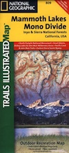
Mammoth Lakes & Mono Divide Map

Mammoth Mono Map
NatGeo Map #809

Mammoth Lakes Map
Mammoth Lakes & Mono Divide Map

Trails Illustrated Map from National Geographic. Mammoth Lakes & the Sierra Nevada Mono Divide on one map #809. This map covers areas inside Inyo National Forest & Sierra National Forest.

Many know the Eastern Sierra & US Hwy 395, but few know about the Mono Divide, deep in the majestic Sierra Nevada, way up behind Mammoth Lakes.  Mono Hot Springs, Highway 168, back beyond Huntington Lake & Kaiser Pass. Florence Lake, Edison Lake, Vermillion Camp.

Only on foot connects the Western Sierra with the steep granite ridges and deserts on the east side.

Ansel Adams Wilderness, Dinkey Lakes Wilderness. The Minarets, Devils Postpile National Monument. Hike PCT, John Muir Trail. Sierra Nevada High Country Hiking Map. Many alpine lakes to fish, hike and explore in the wilderness – the high country. Very detailed & colorful. Waterproof Plastic Map; Tear Resistant. GPS data. Printed 2010. ISBN# 9781566952668

Convict Lake w/ dogs

Mammoth Lakes, Mono Divide High Country, Topographic Maps, Topo, Hike, Backpack, Fishing, Camping, Mountain Bike, Trail Maps, All Outdoor Recreation

nearby towns:

minarets

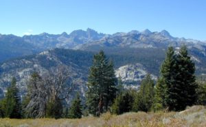
The Minarets @ Mammoth

see also –

Devils Postpile Trail Map
Mono Divide High Country Map
Ansel Adams Wilderness Maps
John Muir Wilderness Maps
Inyo National Forest Map USDA
Sierra National Forest Map USDA

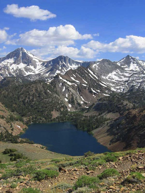
Lake Genevieve

Lake Genevieve