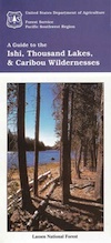
Ishi Wilderness Map

Ishi Hiking Map

Ishi Wilderness Map

This Northern California map issued by the USDA National Forest includes 3 separate wilderness areas –

Ishi @ Cohassett / Chico Hikes / Lassen Maps

Caribou Wilderness, Ishi Wilderness & Thousand Lakes Wilderness

Lassen National Forest

Caribou Wilderness, Ishi Wilderness, Thousand Lakes Wilderness are all featured on this USDA topo map. Perfect for a day hike reference or extended backpacking adventures. Map Scale = 1″ to mile; Printed on waterproof plastic paper in 1997.

This map might still be found at USFS Ranger Stations in Oroville or Red Bluff, CAIshi Wilderness Map

towns nearby:

downhill from a volcano, Lassen Peak

This mountain foothill land is etched by wind and water, and dotted with basalt outcroppings, caves, and unusual pillar lava formations. The land is a series of east-west running ridges framed by rugged river canyons, with the highest ridges attaining elevations of 4000′. Deer Creek and Mill Creek are the principal drainages and flow into the Sacramento River.

oak forestsThe sun-baked south slopes are covered with chaparral brush. Pines and oaks thrive on the moister slopes facing north and lush damp forests line the river banks. This area is home to pine clusters, dense areas of ponderosa pine growing on terraces in river cut canyons.

Oh Deer! The largest migratory deer herd in California, the Tehama deer herd, winters in this Ishi wilderness area. In addition, wild hogs, mountain lions, black bears, coyotes, bobcats and jack rabbits also live out here. A State Game Refuge, where hunting is not permitted, occupies most of the Ishi Wilderness.

However, special fishing regulations are in effect for fishing in Deer and Mill Creeks, home to many fish species. And of course, a valid California fishing license is required.

A variety of raptors including hawks, eagles, falcons, and owls nest in the rock cliffs. Wild turkey, quail, mourning doves, canyon wrens, band-tailed pigeons, bats and many songbirds are frequently seen.

Ishi Wilderness Map

Luckily, there are additional choices for Lassen Maps:

see also – 

Lassen Books
Lassen Forest Topo Atlas
Lassen National Forest Map USDA
Lassen Park Maps
Bucks Lake Wilderness Map
Fishing Maps


4×4 Guide Tahoe NF

4×4 Tahoe Trail Maps
Off Roading Routes

4x4 maps4×4 Tahoe Trail Maps: Explore the 4WD (four wheel drive) dirt and gravel roads inside the Lake Tahoe region. The Lake Tahoe off roading trail maps shown on this page are only a few of the maps of what is available. Featuring locations like Truckee, Lake Tahoe, SLT, PCT, plus all lakes at Donner Pass, Canyon Creek, the Sierra Buttes, the American River and Yuba River watersheds. Please follow the links listed at the bottom of this page for more Tahoe Maps.

Camping Lake Map

Sawmill Lake, Tahoe NF – N of Donner Pass I-80

4Wheeler’s Guide to Trails of the Tahoe National Forest, CA; Lake Tahoe to the North Yuba River; Northern Sierra Nevada mountains, N Gold Country California

4Wheeler’s Guide to the Rubicon Trail

driftwood

California off roading with 4×4 Tahoe Trail Maps. Topographical hard copy maps show contour lines, routes, trailheads, campgrounds, alpine lakes, mountain peaks, wilderness boundaries.  Maps for use by nomad campers, mountain bikers, dirt bikers, jeeps, SUVs, ATVs, and all off roading rigs. Overland camping options in the high elevation Sierra Nevada mountains.

see also –dirt bikes trail map

Lake Tahoe Basin Topo Atlas

Tahoe National Forest Map USDA

Lake Tahoe Basin – Recreation @ Lake Tahoe

Tahoe Rim Trail Topo Map by Tom Harrison

USDA Lakes Basin, Sierra Buttes Map

bowman cliff shoreline

Bowman Lake, narrow cliff shoreline

Tahoe Forest Maps
by National Geographic

Tahoe East – Sierra Buttes & Donner Passfishing maps tahoe

Tahoe West – Yuba River & American River

sierra buttes maps

Back Roads @ N Yuba, Lakes Basin

Lakes Basin Recreation Area: Sierra Buttes
GOLD LAKE HWY. North Sierra Nevada – where granite spires touch the sky and river canyons run deep. Alpine lakes are covered in snow half the year w/ Gold Lake being the largest.

Totally worth a weekend visit! Spending a full week here is ideal. Summer destination for cabins, camping, hiking, fishing, waterfalls, and even off road routes; Winter offers snow recreation: cross country ski, snow shoe trails, and snow mobile access.


forest roads map tahoe

Tire Tools: roadside assistance
doesn’t do dirt roads

Jawbone Canyon OHV Map

Jawbone Canyon Map
Jawbone Canyon is North Mojave Desert,
US Hwy 395 @ Hwy 14

Jawbone Canyon Map

12th edition. jawbone.org

Jawbone Canyon Map

New features on map include – restroom and kiosk locations, updated GPS coordinates, updated trail routes and revised points of interest.

Off Road Map: Jawbone Canyon / Kelso Valley / Randsburg Ghost Town

Jawbone Canyon OHV North Mojave Desert Map; Topo features, Waterways, Trails & Roads. Motorized & no-motorized trails. Eastern Kern County High Desert. Spangler Hills OHV, Trona Pinnacles National Monument, Randsburg OHV, Red Mountain, Johannesburg, Red Rock Canyon State Park, Last Chance Canyon, El Paso Mountain Wilderness, Desert Tortoise Preserve, Kiavah Wilderness, Dove Springs OHV, Bright Star Wilderness, Tehachapi Loop, Walker Basin, California City, BLM Camping Mojave California Desert Trails, Southern Sierra OHV.  Map by Friends of Jawbone w/ California Trail Users Coalition

SoCal Off-Road, OHV Parks, Dove Springs, Jawbone Canyon, Dirt Bike Maps, offroad, North Mojave Desert, Trona Road


avenza mapsget a digital version of this map
CTUC Jawbone Canyon OHV Map

driftwood

Jawbone Canyon Map

Camping Last Chance Canyon

Jawbone Canyon Map

California Mojave Desert OHV Camping:

Do the off-roader RVs really roast a turkey in the ground at Jawbone Canyon?

Death Valley National Park is a land to be visited, during winter months (NOV-APRIL)

Randsburg – Living Ghost Town, off US Highway 395

Jawbone Canyon Map

Jawbone Canyon leads up to Kelso Valley & Bright Star Wilderness, eventually up to Lake Isabella near Kern River, Southern Sierra California

see also –

Inyo National Forest Map
Inyo Forest Topo Atlas
Sequoia National Forest Map
Sequoia Forest Atlas
Southern Sierra Map

Utah Maps

views of UTAH: topo

camping, hiking, mountain biking, off roading, fishing

the historic burr trail

Historic Burr Trail, south of Capital Reef NP

HIGH DESERT: Southern Utah is a magical place to explore. Red rock and National Parks, State Parks – too numerous to name. Outdoor recreation around every corner – from river rafting to rugged canyon hikes, wildlife watching to wheeling. Dispersed camping, very abundant. Dirt back roads, by the many miles. Hiking and biking, all over!

The east-west Interstate 70 splits the state, so most parks are located south of the freeway. Green River is a highway town, along I-70 and the mecca, Moab, is south of the interstate.

hiker

MOAB, UT (southeast Utah) – is a hot bed of recreation activities, tourism, hotels, shopping, plus the 2 National Parks.

TORREY, UT (south central Utah) – hip mountain village, next to Fish Lakes National Forest and Capital Reef National Park. Restaurants, motels, RV Campground with showers, and a grocery stop.

SPRINGDALE, UT (southwest Utah) – the small river town that has merged with neighboring Zion National Park. Tourists everywhere.

Seek the small back roads to get you up and around the outskirts of Zion – very scenic drives. Ghost towns, pinyon & juniper forests, hidden canyons, watrfalls, kolobs and buttes. North of Zion NP, Navajo Lake and Cedar Breaks National Park @ 8000′ elevation – can have snow more than half the year, so plan according.

UTAH TIP = Beware: Thunderstorms and heavy rains are part of the package here in this desert state. Extreme flash floods possible, know the weather forecast and the warnings. Stay out of slot canyons during rainy season. Watch out for wet, muddy, red dirt roads. You’ll get stuck, even in 4WD.

Small farming towns are scattered throughout the National Park areas, some more geared for travelers than others. Many National Forests and BLM areas to camp (for free). Usually just a few miles outside the National Park boundaries. The further you get off pavement, the more seclusion you can find. Find the nearest ranger station and ask some questions – if needbe.

utahremote

utah = remote

Utah Park Maps by NatGeo

National Geographic makes these colorful, durable, waterproof maps for all the Utah Parks.

Angeles Landing

Atop Angel’s Landing, Zion NP

Utah Maps

cool canyon hikes


Utah Maps

RED DIRT TRAILS

Utah Maps

Utah Maps

Utah Maps

Schaffer Trail, Canyonlands NP