Desolation Wilderness Trail Map

Desolation Wilderness Trail Map
Tom Harrison

Desolation Wilderness Trail Map

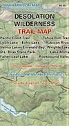
Desolation Wilderness Map, Tahoe Lake Camping. Lake Tahoe, CA; Tahoe Westside, Loon Lake camping, Lake Aloha, Emerald Bay, Fallen Leaf Lake, DL Bliss State Park, Echo Lake, Velma Lake, Wrights Lake, Rubicon River, Rubicon 4×4 Trail, Rockbound Valley, Tahoe Rim Trail hiking PCT Pacific Crest Trail; Sierra Nevada High Country Tahoe hiking; Durable, waterproof plastic map; Folded. Map Scale: 42.24K; ISBN# 9781877689611

avenza mapsdownload digital version of this map –
Desolation Wilderness Trail Map

Desolation Wilderness Trail Map

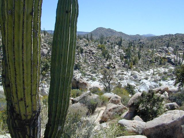
Desolation Wilderness on the Westside of Lake Tahoe

Desolation Wilderness Trail Map

Desolation Wilderness Trail Map

NEWER VERSION

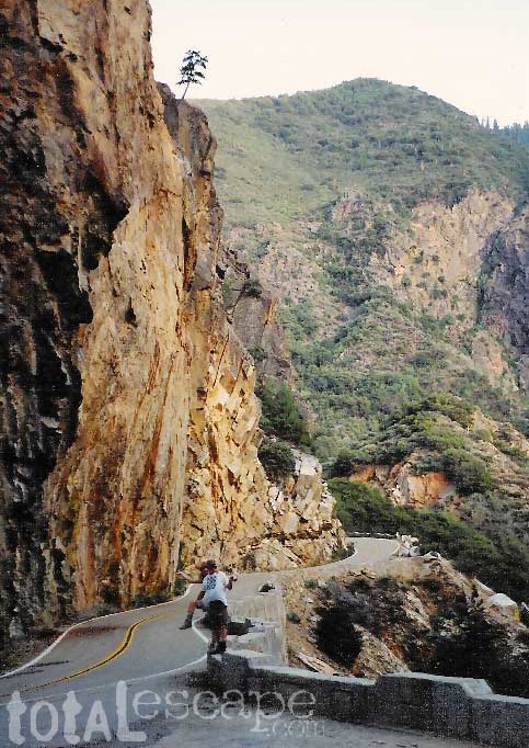
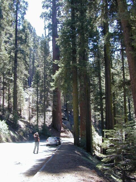
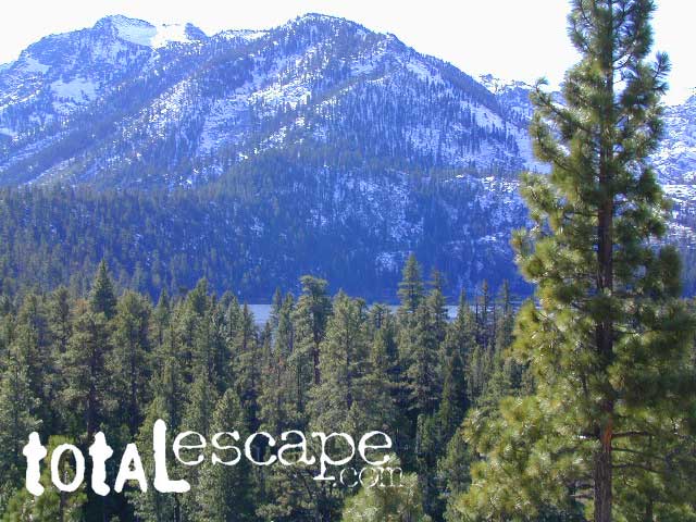
Desolation Wilderness is a popular backpacking destination next to Lake Tahoe, with much barren rocky terrain at the edge of the tree line. It has extensive areas of bare granite rock formations. The Tahoe Rim Trail and Pacific Crest Trail pass through the wilderness.

Permits are required for both day use and overnight camping. In the summer, a quota system is used for overnight trips to limit the number of visitors on any given day in the wilderness. Desolation Wilderness is one of the most heavily used protected areas in the United States. This Wilderness area is split up into 45 different zones, with each having a specific permitting quota.

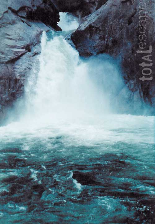
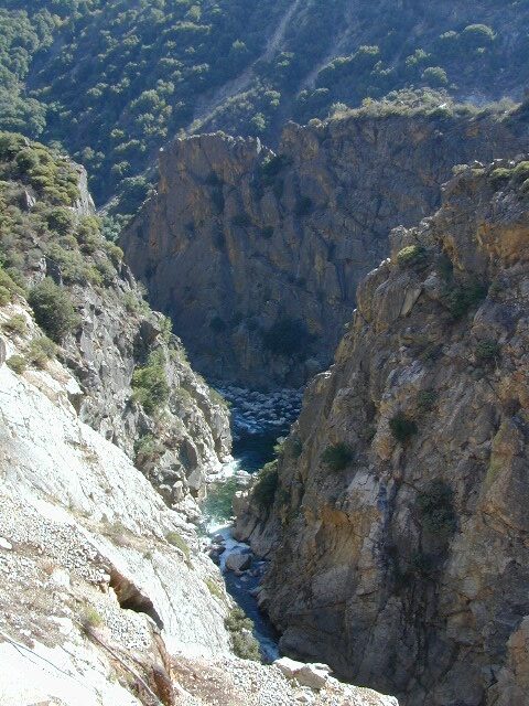
The Crystal Range is within the wilderness area, with Pyramid Peak as the highest point in the range and the wilderness at 9,985 feet in elevation. Among the many waterfalls within the wilderness is Horsetail Falls.

Its largest body of water is Lake Aloha, a reservoir with shallow, clear waters sitting in a wide granite basin carved by glaciers of the last ice age. Many other alpine and wooded lakes of various sizes are scattered throughout the area.


see also –

Crystal Basin Silver Fork Map
Eldorado National Forest Map
Lake Tahoe Books
Lake Tahoe Maps
PCT Map #4 Mid Sierra
PCT Map #5 N Sierra

NatGeo Baja Maps

NatGeo Baja Maps

National Geographic
Baja Maps

NatGeo Baja Maps

  • camp
  • fish
  • hike
  • kayak
  • missions
  • off-road
  • petroglyphs
  • RV
  • scuba
  • surf
  • travel

NatGeo Baja Map Pack Bundle

Baja California, North & SouthNatGeo Baja Maps

The Baja California Map Set from National Geographic. Includes both maps: Baja Norte & Baja Sur Maps. #3103 & #3104. Topographical features, towns, ranchos, main dirt roads, coves, beaches, fishing spots, surf spots, sailing; beautifully detailed. GPS compatible w/ full UTM grid. Printed on plastic in 2008. Waterproof, tear-resistant. ISBN# 9781597752237

Baja California Mexico, BC MX, Baja Norte, Baja Sur, Baja Maps, Map Set, Bundle, National Geographic Maps

avenza mapsget a digital version of this 2 map set
Baja Map Pack by NatGeo


NatGeo Baja Maps

Gonzaga Bay, Baja California

NatGeo Baja Maps

Baja Norte NatGeo Mapbajanorte

Baja California Norte Map / Map of Baja Norte / Baja California

Baja California maps by National Geographic #3103. Baja Norte Map. This map covers the northern portion of Baja California Mexico. Topographical features, towns, ranchos, main dirt roads, coves, beaches, fishing spots, surf spots, sailing; beautifully detailed. GPS compatible w/ full UTM grid. Waterproof, tear-resistant. ISBN# 9781566952439

avenza mapsget a digital version of this map
NatGeo Map 3103 – Baja California North

NatGeo Baja Maps

Guadalupe Canyon Hot Springs, Baja California

driftwood

Baja Sur NatGeo Map bajasur

Baja Road Map / Baja Sur Mexico Map

Baja Sur Map from National Geographic #3104. This map covers the southern portion of Baja California Mexico. Topographical features, towns, ranchos, main dirt roads, coves, beaches, fishing spots, surf spots, sailing; beautifully detailed. GPS compatible w/ full UTM grid. Waterproof, tear-resistant. ISBN# 9781566952446

avenza mapsget a digital version of this map
NatGeo Map 3104 – Baja California South

NatGeo Baja Maps

Cacti at Catavina

NatGeo Baja Maps

NatGeo Baja Maps

Todos Santos, Baja California Sur

see also – 

Anza Borrego Desert Map
Baja California Almanac
San Diego Backcountry Map

bajarigready

Topanga Canyon Map

Topanga Trail Map
Topanga Canyon Map

Topanga Canyon Map

Topanga State Park Map
Tom Harrison

Topanga Canyon Map
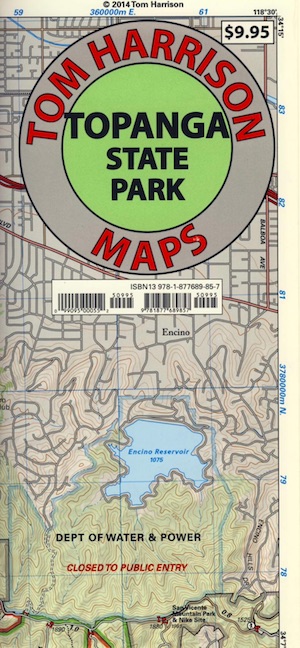
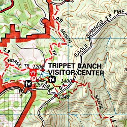
Topanga Canyon Map, Topanga State Park Map, Topanga Hiking Maps, Backpacking Topanga, Malibu Maps; Will Rogers Park, Tuna Canyon, Biking Trail, Red Rock Canyon Malibu, Temescal Canyon, Temescal Gateway Hike. Durable, waterproof plastic map; Folded. Map Scale: 31.7K; ISBN# 9781877689857

BACKBONE TRAIL
on Santa Monica Mountains NRA

Los Angeles County

Topanga Canyon Road is California State Route 27 (Hwy 27) a paved highway connecting the San Fernando Valley to the Malibu coast. Hiking and mountain biking trails, waterfalls, hidden restaurants and a large residential population in these hills.

horse trail maps

Topanga Canyon
Topanga Hiking Topo Map

  • hike
  • horseback
  • mountain bike
  • picnic

Topanga Canyon Map

nearby towns:

Topanga Canyon Map

Topanga State Park

Covering 11,000 acres, with 36 miles of trails and unimproved roads, the boundaries stretch from Topanga Canyon to Pacific Palisades and Mullholland Drive. There are more than 60 trail entrances. Topanga State Park is the largest park in the Santa Monica Mountains.

Topanga State Park was opened to the public in 1974. Land includes more than 7,500 acres from the original Rancho San Vicente y Santa Monica land grant. Additional acreage has been added in the form of 1,500 acres from the Palisades Highlands and another 1,600 acres added in 2002, near the mouth of the Topanga Creek

The word Topanga is an old Shoshonean language word meaning ‘above’ and referring to the canyon settlement being above the flood waters of Topanga Creek. The Tongva and Chumash peoples inhabited the area for thousands of years

california indpendent

see also – 

Santa Monica Mountains Map
Malibu Creek Map
Zuma Canyon Map
Point Mugu Map
Channel Islands Map
L A Hiking Maps

Sequoia Kings Canyon Maps

Sequoia Maps
Kings Cyn Map

Roaring River Falls
One of the most visited areas of the Sierra Nevada Mountains – Kings Canyon & Sequoia NP sit next door to each other, just south of Yosemite National Park.

Kings Canyon National Park has a deep granite gorge with lower elevations, along the Kings River (the longest river in the Sierra). Plus Kings also has an expansive back-country – accessible only by foot, to High Sierra peaks and many alpine lakes.

On the south side, Sequoia National Park has a higher terrain with a highway skirting the ancient groves, on the west side of the Sierra range.

Several Maps for this Sierra National Parks region:NPS

Sequoia Kings Canyon Maps

Sequoia Kings Map

Sequoia Kings Canyon
NatGeo Map #205


Trails Illustrated Map from National Geographic. NatGeo map #205. Sequoia National Park Map w/ Kings Canyon National Park. Mount Whitney, Giant Sequoia National Monument, John Muir Wilderness, Pacific Crest Trail. Topographic Hiking Maps, Sequoia Backpacking, Sequoia Camping, Sierra Lakes. Back Roads, Kings River Camping & Hiking Map.

Very detailed & colorful. Waterproof Plastic Map; Tear Resistant. GPS data. Scale 1:80,000 Contour Interval = 100 feet. Updated 2013. ISBN# 9781566952989

Sequoia Kings Canyon Maps

Kings Canyon Highway 180

  • backpack
  • camp
  • canyons
  • climb
  • creeks
  • fish
  • hike
  • horseback
  • lakes
  • mountain peaks
  • picnic
  • rivers
  • waterfalls

hiker

pinetree

Sequoia National Park &
Kings Canyon NP

Generals Highway Map

Sequoia Kings Canyon Maps

Sequoia Kings Canyon Maps

CALIFORNIA HWY 198: The Generals Highway is the main paved road that runs the ridge, north to south inside Sequoia National Park.  Since they have named the giant redwood trees after famous military generals, the road name mirrors that theme.

Now-a-days, our ancient and massive trees are fighting for their lives in a new type of war. Wildfires, drought and bark beetle infestations are taking their toll and killing these beauties. They have stood the test of time for thousands of years and withstood fires in the past, but recent blazes are hotter and more destructive than previous.

Kings Canyon Highway 180: A long, scenic, dead end road which descends dramatically into the river canyon. Elevation spans from 6600′ at Grant Grove to 4000′ at Cedar Grove at the end of the paved route.

biggest115