Los Padres Forest Topo Atlas

Los Padres Atlas
Topographic Map USDA

Los Padres Atlas USDA

Los Padres Forest Atlas

USFS, United States Forest Service – aka National Forests

Ventura, Ojai, Santa Barbara Mountains, Mount Pinos, San Luis Obispo, Big Sur Coast
Mountains: Central Coast California

Los Padres National Forest

Los Padres Forest Atlas

a spiral bound book – a collection of all the quads. (7.5 minute topographical maps, of all of Los Padres National Forest) It includes both Los Padres NORTH (Monterey) & SOUTH (Ojai/Pinos). This book map has detailed topo lines, mountain peaks, streams, lakes, hiking trails & back roads. Perfect for all kinds of recreational needs.

camp maps

Los Padres Forest Atlas

Older version of Los Padres Atlas

Los Padres Forest Atlas

Big Sur Coastal Mountains

Los Padres Forest Atlas

camping & exploring, Los Padres –
links and destinations

Pine Mountain @ Mil Potrero, as seen from top of Mount Pinos, CA

Mt Pinos California

pinos trails

Hiking Trails on Mount Pinos

see also –

Big Sur Maps
Los Padres National Forest Map
Sespe Wilderness Map 

California DeLorme Atlas

DeLorme California

The Delorme brand used to have two separate atlas books for Northern California & Southern California, but they recently figured out how to combine them into one single atlas.
Delorme California

California DeLorme AtlasUniquely versatile DeLorme Atlas & Gazetteer. These topographic atlases cover individual states with the most comprehensive detail available, including back roads, backwater lakes and streams, boat ramps, forests, wetlands, trailheads, campgrounds, public lands, prime hunting and fishing spots, and countless landmarks and points of interest. You’ll also find a wealth of information on everything from family outings to wilderness adventures. The Atlas & Gazetteer is ideal for outdoor recreation, business travel, home or office reference, and countless other uses.

California DeLorme Atlas  California Camping

California DeLorme Atlas

Free Camping on California National Forest Roads

California DeLorme Atlas

see also – 

Benchmark California
National Forest Atlas
State Atlases

Benchmark Baja Atlas

Benchmark Baja Atlas

Newest MAP ATLAS for Baja!!!

Benchmark Baja California
Road & Recreation Atlas

baja benchmark atlas

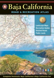
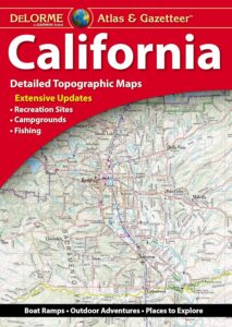
Benchmark Baja Atlas – the newest, full color atlas for Baja California, created by Benchmark Maps. 

The first edition Baja California Road & Recreation Atlas showcases the diverse recreation opportunities found along the full length of the Baja California Peninsula. Regional maps provide a wider view of the region and Recreation Guides list an array of attractions for trip planning.

Published May 2021. ISBN: 9781734315059

Benchmark Baja Atlas

Covers both Baja states:
Baja California Norte & Baja California Sur

Large scale maps (1:300,000) with detailed road classifications and points-of-interest

  • Kilometer markers on major highways
  • National Parks and Wildlife Areas
  • Recreation categories include
  • Parks, Monuments, Natural Wonders
  • Boating and Fishing Access, Beaches
  • Historic Missions & Ruins
  • Campgrounds and RV Parks

Regional maps at medium scale (1:1,000,000) illustrate broader views and longer routes.

Focused maps for La Paz, Los Cabos, and wineries of Valle de Guadalupe

Benchmark Baja Atlas

xterraroad

Baja California Mexico

Lower California

as opposed to Alta California (US state of California)

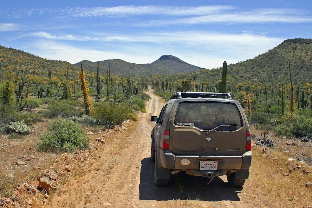
Baja California encompasses a territory within the Californias region of North America, which exhibits diverse geography for a relatively small area. The Peninsular ranges of the California cordillera run down the geographic center of the state. The most notable ranges of these mountains are the Sierra de Juárez and the Sierra de San Pedro Mártir. These ranges are the location of forests reminiscent of Southern California’s San Gabriel Mountains. Picacho del Diablo is the highest peak on the peninsula.

Valleys between the mountain ranges are located within a farm growing climate zone, that is particularly suitable for agriculture. Such valleys include the Valle de Guadalupe and the Valle de Ojos Negros, areas that produce citrus fruits and grapes. The mineral-rich mountain range extends southwards to the Gulf of California, where the western slope becomes wider, forming the Llanos del Berrendo on the border with Baja California Sur. The mountain ranges located in the center and southern part of the state include the Sierra de La Asamblea, Sierra de Calamajué, Sierra de San Luis and the Sierra de San Borja.

Baja Climate

Temperate winds from the Pacific Ocean and the cold California Current make the climate along the northwestern coast pleasant year-round. Rains from the north barely reach the peninsula, thus leaving southern areas drier. South of the El Rosario River, the terrain changes from a Mediterranean landscape to a desert one. This desert exhibits diverse succulent species that flourish in part due to the coastal fog.

There are numerous islands on the Pacific shore. Guadalupe Island is located in the extreme west of the state’s boundaries and is the site of large colonies of sea lions. Cedros Island exists in the southwest of the state’s maritime region. The Todos Santos islands are located off the coast of Ensenada; Coronado Islands are located off of Tijuana.

Petroglyphs in Baja

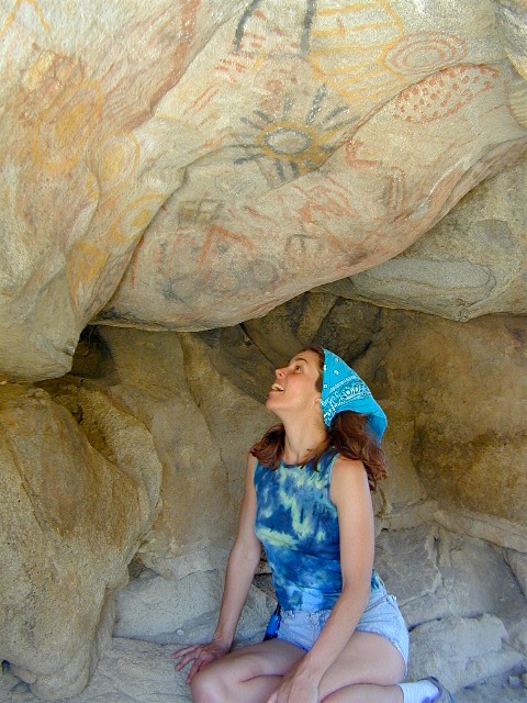
Rock Art Petroglyphs @ Catavina

see also –

NatGeo Baja Maps
Baja California Books

camp map

Lassen Topo Atlas

Mount Lassen Atlas
Lassen National Forest Topo Map

Lupine Hikes to Lassen Peak

Atlas includes both the Lassen Volcanic National Park & the surrounding Lassen National Forest.

Lassen Atlas

Lassen Peak, Lake Almanor, Buttes Meadows, Westwood, Susanville, Eagle Lake, Hat Creek, Burney Mountain, Lassen National Park

The LASSEN atlas, is a spiral bound book – a collection of all the quads. (7.5 minute topographical maps, of all of Lassen National Forest, plus the Lassen Volcanic National Park) This book map has detailed topo lines, mountain peaks, streams, lakes, hiking trails & back roads. Perfect for all kinds of recreational needs. USDA printed in 2012. ISBN# 9781593519216

road17autumn

Lassen Road #17 in Autumn

Lassen National Forest
Lassen National Park

Lassen National Forest QUADS:hikers map
from south to north –

PDF maps


Lassen Lakes

Lassen Lakes – for camping, fishing, hiking and kayaking

PCT Lassen Map

see also –
Lassen National Forest Map USDA
Lassen Park Maps
Lassen Books
Lassen Camping
Lassen Lakes
Lassen Forest Roads

Lassen Forest Atlas

lassen_atlas

Old version of Lassen Forest Atlas