Tahoe Rim Trail Map

Tahoe Tom Harrison Map
Tahoe Rim Trail Map

Lake Tahoe Recreation Map
by Tom Harrison MapsTahoe Rim Trail Map

California’s Jewel of the Sierra

Tahoe Rim Trail Topo Map: Lake Tahoe Recreation Map, Tahoe Topo Maps, Hiking Trails Backpacking Maps, Lake Tahoe Hikes; Meeks Bay, Martis Peak, Tahoe Rim Trail, King Beach, Emerald Bay, Granlibakken, Spooner Lake, Martlett Lake, Tahoe Meadows, Desolation Wilderness Trails, Sugar Pine Point, South Lake Tahoe, Alpine Meadows, Fallen Leaf Lake Hiking Trails. Durable, waterproof plastic map; Folded. Map Scale: 72K; ISBN# 9781877689598
Tahoe Rim Trail Map

PREVIOUS EDITION

digital maps download digital versions of this map

Tahoe Rim Trail Maps
Lake Tahoe Rim Trail Map (East/NV)
Lake Tahoe Rim Trail Map (West/CA)

driftwood

hikers mapTRT

The Tahoe Rim Trail is 165 miles of single-track trail that circum-navigates perimeter of Lake Tahoe, CA.  while passing through 2 states, 6 counties, one state park, 3 national forests, and 3 wilderness areas. Forty-nine miles overlap with the Pacific Crest Trail. A network of additional trails connects to this popular rim trail.

Elevations along the trail range from 6,300′ at Tahoe City to 10,338′ at the top of Relay Peak. Numerous creeks and lakes, ridges and meadows, conifer forests, scree slopes and alpine terrain with wildflowers.

wildflowerThere are 10 official trailheads that access the eight trail segments which form a continuous loop in the mountains above the lake. The segments range from 12.2 to 32.5 miles in length. Unofficial entry points also provide a means of getting onto the trails. Trail conditions are best during the usually snow-free months of July through October, and the height of the wildflower bloom is usually July and August.

National Geographic Maps also makes a trail map for Tahoe Rim Trail.
TAHOE RIM TRAIL NG

Lake Tahoe Rim Trail, Sierra Nevada, California

  • day hikes
  • mountain bike
  • backpacking
  • horseback trails
  • meadows
  • wildflowers

Tahoe Rim Trail Map

see also –

Tahoe National Forest Maps
Tahoe Topo Atlas
Tahoe Basin USDA Map
Lake Tahoe Maps
4×4 Routes Tahoe Map

Lake Tahoe Basin Map

Two different recreation maps for the Lake Tahoe Basin are created by the USDA & NatGeo. Several smaller brands for regional topographic trail maps. The US Forest Service has the Tahoe National Forest Map that encompasses a much larger area. Numerous books exist for backpacking and hiking around Tahoe.

Lake Tahoe Basin Map

NatGeo Map #803
Tahoe Basin

Tahoe NatGeo Map

Lake Tahoe Trails Illustrated Map from National Geographic

Recreation Map for Lake Tahoe Basin, Topographic Lake Map, Backroads Hiking Maps, Tahoe Backpacking, Tahoe Camping, All Campgrounds, Trailheads, Creeks and Lakes. Sierra Nevada Back Roads, Truckee River Camping and Hiking Map. Very detailed and especially colorful, topo map. In this case, a 2 -sided map, waterproof plastic map; tear resistant. GPS data. Map scale 1:63,360 / Contour Interval = 50 feet. ISBN# 9781566953344

Lake Tahoe Basin Map

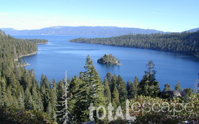
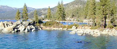
Lake Tahoe Basin MapMany believe that Lake Tahoe was formed by the collapse of an ancient volcanic crater, but the natural lake and mountain basin was actually formed by the rise and fall of the landscape due to faulting.
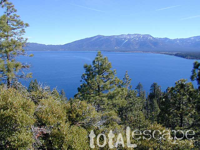
The Tahoe Basin which spans approximately 22 miles long (and 12 wide), is located on top of the Sierra Nevada mountain range. Separating California from Nevada state, a year-round, mountain resort destination. In particular, this is considered the north part of the majestic Eastern Sierra range. Furthermore, Lake Tahoe is often referred to as “Jewel of the Sierra”.camp map

Largest freshwater, alpine lake in North America.
Second deepest lake in the U.S.
Second highest lake in the U.S.

LAKE TAHOE – 6625′ elevation above sea level

Equally as relevant, our wide range of Tahoe maps listed below are current, full color publications – covering wildlife to wildflowers, forest back roads to 4WD routes, horseback trailheads to hiking trails, mountain peaks to meadows, creeks to waterfalls, trail camps to campgrounds, and of course cross country skiing to backcountry ski tours.

NatGeo Tahoe Map Pack

Map Pack NG

NatGeo Wilderness Map:
Desolation & Granite Chief

desolation map

Adventure Maps Tahoe Trails

Trail Map Lake Tahoe

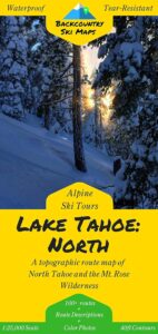
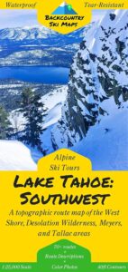
Tahoe Backcountry Ski Maps

Ski Maps Tahoe N

Tahoe Ski Map
Lake Tahoe Basin Map

Lake Tahoe Basin Management Unit, USDA Map


tahoebasin

Lake Tahoe Map USDA
Lake Tahoe Basin Management Unit

NFS Lake Tahoe Basin Map USDA

Lake Tahoe Basin & Vicinity

USGS Map California: Lake Tahoe Basin Map; Sierra Nevada Mountains, Lake Tahoe, Desolation Wilderness, Granite Chief, Fallen Leaf Lake. Tahoe Recreation, Camping Map. USDA NFS Recreation Area. Certainly all forest lands, trails and roads surrounding Lake Tahoe; 10 miles all the way around lake. Printed on waterproof plastic. Pictured published 2010. ISBN# 9781593514808.

LAKE TAHOE
OUTDOOR RECREATION

  • backpackinghikers map
  • boating
  • camping
  • casinos
  • cycling
  • fishing
  • hikinghorse trail maps
  • horseback
  • kayaking
  • mountain biking
  • mountaineering
  • off-roading
  • sailing4x4 maps
  • snow skiing
  • snowboarding
  • swimming
  • water skiing
  • xc skiing

see also –
Tahoe Rim Trail
Tahoe National Forest Map
Lake Tahoe Maps
Tahoe 4×4 Map Guide

Lake Tahoe Basin Map

Tahoe National Forest

nearby towns:

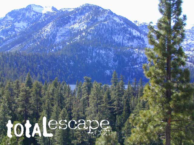
In the distance, Desolation Wilderness can be seen on the opposite side of the lake, typically covered in snow more than half the year.

snowridge

Desolation Wilderness on the Westside of Lake Tahoe

Yosemite Valley Trail Map

Yosemite Valley Map
by Tom Harrison

valleyfloor

  • bike
  • camp
  • climb
  • hike
  • picnic
  • river
  • waterfalls

Tom Harrison Yosemite Valley Map, Topo Trail Map Yosemite Parks, Hiking Trails Yosemite Valley Trails, Yosemite National Park Maps Hiking Trails Topo Map; Regions include – Yosemite Valley Mirror Lake, Yosemite Falls, Half Dome Hiking, Nevada Falls, Mist Trail, Vernal Falls, Yosemite National Park Campgrounds, Trailheads, Shuttle Stops, Merced River. Easily understood w/ several languages too!

Durable, waterproof plastic map; Folded. Map Scale: 24K; ISBN# 9781877689604

valleyfloor

The Valley Floor of Yosemite

avenza mapsdownload digital version of this map –
Yosemite Valley Trail Map

Yosemite Valley Trail Map

OLDER VERSION

Yosemite Valley Trail Map

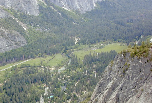
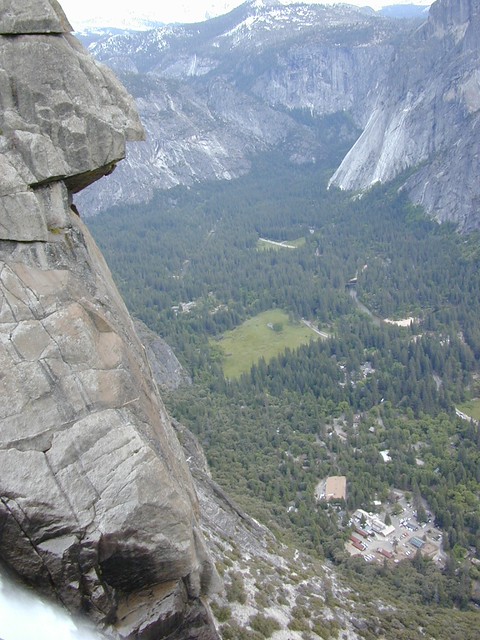
TOP of Yosemite Falls (see water on lower left)

Yosemite Valley represents only one percent of the park area, but this is where most visitors arrive and stay. The Tunnel View is the first view of the Valley for many visitors and is extensively photographed. El Capitan, a prominent granite cliff that looms over Yosemite Valley, is one of the most popular rock climbing destinations in the world because of its diverse range of climbing routes in addition to its year-round accessibility. Granite domes such as Sentinel Dome and Half Dome rise 3,000 and 4,800 feet, respectively, above the valley floor at 4000 feet.

The high country of Yosemite contains beautiful areas such as Tuolumne Meadows, Dana Meadows, the Clark Range, the Cathedral Range, and the Kuna Crest. The Sierra crest and the Pacific Crest Trail run through Yosemite, with peaks of red metamorphic rock, such as Mount Dana and Mount Gibbs, and granite peaks, such as Mount Conness. Mount Lyell is the highest point in the park, standing at 13,120 feet. The Lyell Glacier is the largest glacier in Yosemite National Park and is one of the few remaining in the Sierra Nevada today.
Yosemite Books
The park has three groves of ancient giant sequoia trees; the Mariposa Grove (200 trees), the Tuolumne Grove (25 trees), and the Merced Grove (20 trees). Many of the trees in Mariposa Grove were recently toppled by severe winds in 2020; Groves may be closed due to cleanup efforts.

see also –
All Yosemite Maps by Tom Harrison
Yosemite Books
Half Dome Trail Map

Yosemite Books

Find Yosemite Maps by National Geographic
Find Yosemite Maps by Tom Harrison

Yosemite National Park Books

Yosemite Books

Yosemite Books

Yosemite Books

Yosemite Books

Yosemite Books

Yosemite Books

Yosemite Books

Yosemite Books

Yosemite Books

Yosemite Books

Yosemite Books

Yosemite Books

Yosemite Books

Yosemite National Park is internationally recognized for its granite cliffs, waterfalls, clear streams, giant sequoia groves, lakes, mountains, meadows, glaciers, and biological diversity. Nearly 95% of the park is designated wilderness.

Yosemite is one of the largest and least fragmented habitat blocks in the Sierra Nevada, and the park supports a diversity of plants and animals. The park has an elevation range from 2,127 to 13,114 feet and contains five major vegetation zones: chaparral and oak woodland, lower montane forest, upper montane forest, subalpine zone, and alpine. Of California’s 7,000 plant species, about 50% occur in the Sierra Nevada and more than 20% are within Yosemite. The park contains suitable habitat for more than 160 rare plants, with rare local geologic formations and unique soils characterizing the restricted ranges many of these plants occupy.

The geology of the Yosemite area is characterized by granitic rocks and remnants of older rock. About 10 million years ago, the Sierra Nevada was uplifted and then tilted to form its relatively gentle western slopes and the more dramatic eastern slopes. The uplift increased the steepness of stream and river beds, resulting in the formation of deep, narrow canyons. About one million years ago, snow and ice accumulated, forming glaciers at the higher alpine meadows that moved down the river valleys. Ice thickness in Yosemite Valley may have reached 4,000 feet during the early glacial episode. The downslope movement of the ice masses cut and sculpted the U-shaped valley that attracts so many visitors to its scenic vistas today.

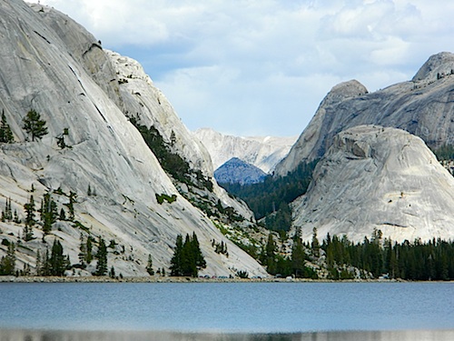
domes of yosemite