Zion National Park Map

Zion National Park Map

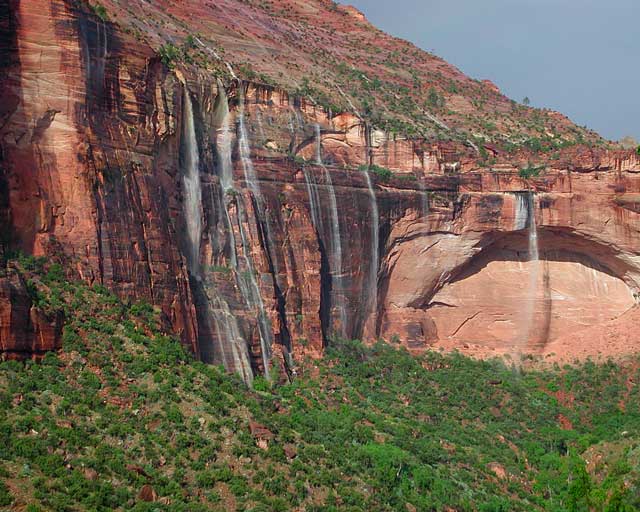
Waterfalls appear after a big sudden thunderstorm.

National Geographic Trails Illustrated Map #214
Zion Canyon, Virgin River, Zion NP

Zion National Park, UT – Zion Narrows, Kolob Canyons, La Verkin Creek Trail, Hop Valley Trail, Wildcat Canyon, West Rim Trail, Floor of the Valley Road, East Rim Trail, Telephone Canyon, and the Virgin River.

Waterproof Map Paper. Printed in 2019, ISBN 9781566952972


hikers map

Zion National Park Map

Zion Canyon is a mini Yosemite Valley, in red rock, in the high desert.

A terra cotta colored wonderland.

Zion National Park is one of the most visited of all the Utah National Parks Loop, due primarily to its proximity to Las Vegas, NV and Interstate 15.
Zion National Park Map

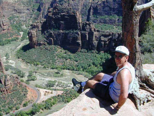
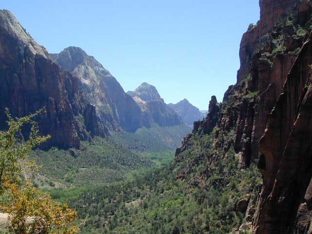
Zion Canyon, from hiking trail to Angel’s Landing

ZION NP OVERVIEW: To prevent traffic jams and preserve the wildness, the NPS offers a common parking lot (on Hwy 9 @ Springdale, UT) with tram/shuttle service to and from the valley. Plan to be away from your car most of the day when visiting the main canyon. Unless of course, you have reservations at the main lodge. Numerous hiking trails, the Virgin River, Zion Lodge and a restaurants.

Utah Highway 9 leads east through tunnels and more amazing rock scenery, with abundant pullouts for RVs and visitors. Nice uncrowded hikes can be found on the east side of the National Park at many of these random parking lots along the highway.

A small portion of Zion National Park parallels Interstate 15. This Kolob Area is far less crowded than the rest of the park, but no camping is allowed.

Abundant boondock camps can be found all over the Zion area, even along the freeway.

Awesome camps that we discovered in the late 1990’s are now well known and crowded, all year long.

Free river beach campsites W of Rockville, high country of the Smithsonian Butte trail, above Grafton ghost town. These areas are NO LONGER a secret, and are very crowded. BLM camping at Leeds exit is on a first come basis and limited, so you better arrive before dark for the best spots.

EXPERTS TIP – Buy a real map and learn to find campsites, that no one else knows about. Mark a GPS waypoints for future reference. Have the whole place to yourself for once!

Benchmark Atlas: Utah
Zion National Park Map

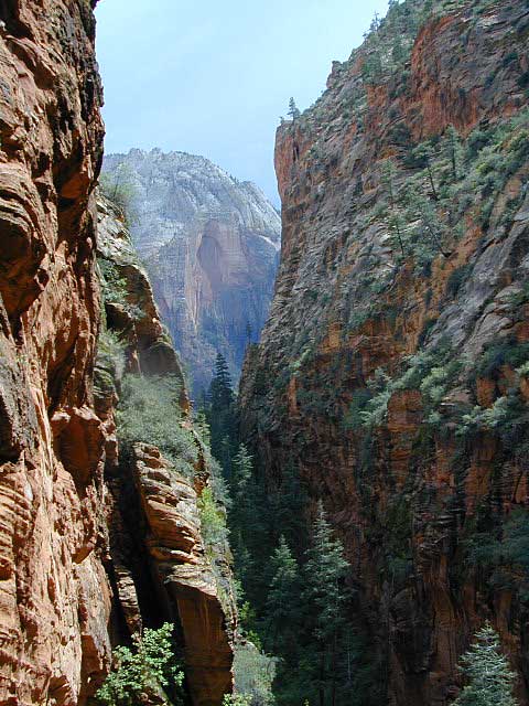
Hiking Zion National Park – Refrigerator Canyon. Refreshingly cool breezes pass through this canyon, so even hot summer days are okay. A great place to escape the mid-day heat.

avenzabar

apps/maps:
download digital topos & maps

driftwood

more maps on Utah


Zion National Park Map

Atop Angel’s Landing, Zion National Park, Utah

see also –

Bryce Canyon National Park Map
Capital Reef National Park Map 
Utah Maps
Utah Books

Lassen Books

Lassen Peak, Lassen Volcanic National Park, Mount Lassen

Lassen Books

Lassen Books

Lassen Books

Lassen Books

Lassen Books

The Lassen Volcanic National Park is visited by more than 350,000 people every year. Incorporating more than 150 miles of hiking trails, it is visited by people looking to hike or backpack during the summers. Popular winter activities include snowshoeing and backcountry skiing. As the second-tallest volcano in Northern California, trailing only Mount Shasta, Lassen Peak is frequently visited by climbers and hikers from around the world. The summit opens for use most years near the end of June, remaining in use until snow falls in October or November.

The mountain’s summit trail can be accessed from a parking lot on the northern side of the California State Route 89. The Lassen Peak Trail, which starts from this parking area, runs for 2 ½ miles with switchback turns, a round-trip hike 5 mi in length that ascends approximately 2,000 feet from the trailhead at 8,500 feet to the summit at 10,457 feet. From the northeast summit, Lassen’s 1915 mudflow and Prospect Peak are visible; the northwestern summit offers views of Lassen’s two bowl-shaped craters and Mount Shasta, 80 miles to the north. The southern entrance to the park area has a winter sports area where visitors can ski, snowshoe, and within the Lassen National Forest, visitors can also bicycle, go boating, or use snowmobiles.

see also –

Lassen National Forest Map 
Lassen Forest Atlas 
Lassen Park Map 
Ishi Wilderness Map 

Yosemite Valley Trail Map

Yosemite Valley Map
by Tom Harrison

valleyfloor

  • bike
  • camp
  • climb
  • hike
  • picnic
  • river
  • waterfalls

Tom Harrison Yosemite Valley Map, Topo Trail Map Yosemite Parks, Hiking Trails Yosemite Valley Trails, Yosemite National Park Maps Hiking Trails Topo Map; Regions include – Yosemite Valley Mirror Lake, Yosemite Falls, Half Dome Hiking, Nevada Falls, Mist Trail, Vernal Falls, Yosemite National Park Campgrounds, Trailheads, Shuttle Stops, Merced River. Easily understood w/ several languages too!

Durable, waterproof plastic map; Folded. Map Scale: 24K; ISBN# 9781877689604

valleyfloor

The Valley Floor of Yosemite

avenza mapsdownload digital version of this map –
Yosemite Valley Trail Map

Yosemite Valley Trail Map

OLDER VERSION

Yosemite Valley Trail Map

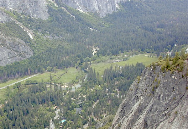
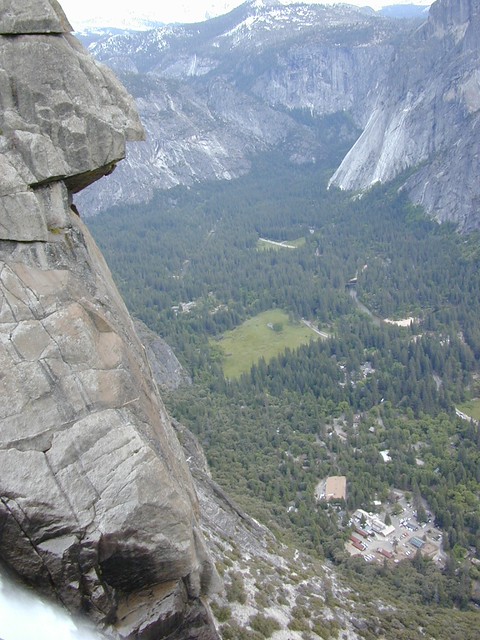
TOP of Yosemite Falls (see water on lower left)

Yosemite Valley represents only one percent of the park area, but this is where most visitors arrive and stay. The Tunnel View is the first view of the Valley for many visitors and is extensively photographed. El Capitan, a prominent granite cliff that looms over Yosemite Valley, is one of the most popular rock climbing destinations in the world because of its diverse range of climbing routes in addition to its year-round accessibility. Granite domes such as Sentinel Dome and Half Dome rise 3,000 and 4,800 feet, respectively, above the valley floor at 4000 feet.

The high country of Yosemite contains beautiful areas such as Tuolumne Meadows, Dana Meadows, the Clark Range, the Cathedral Range, and the Kuna Crest. The Sierra crest and the Pacific Crest Trail run through Yosemite, with peaks of red metamorphic rock, such as Mount Dana and Mount Gibbs, and granite peaks, such as Mount Conness. Mount Lyell is the highest point in the park, standing at 13,120 feet. The Lyell Glacier is the largest glacier in Yosemite National Park and is one of the few remaining in the Sierra Nevada today.
Yosemite Books
The park has three groves of ancient giant sequoia trees; the Mariposa Grove (200 trees), the Tuolumne Grove (25 trees), and the Merced Grove (20 trees). Many of the trees in Mariposa Grove were recently toppled by severe winds in 2020; Groves may be closed due to cleanup efforts.

see also –
All Yosemite Maps by Tom Harrison
Yosemite Books
Half Dome Trail Map

Half Dome Hiking Map

Half Dome Hiking Map

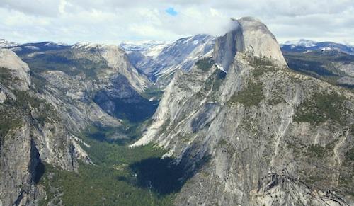
Half Dome view from Glacier Point (photo SKIP JONES)

Half Dome Trail Map

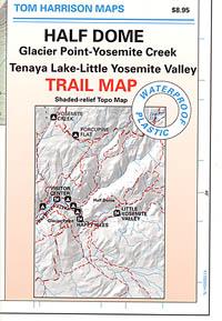
Hiking to Half Dome is very long day trip, on foot, uphill half the way, with excessive elevation gain and loss. Leave toward the trailhead before day break and get back after sundown. No kidding: 17 miles round trip. You must be in excellent shape to tackle this trail, as it involves discipline and strength. Super scenic waterfalls and viewpoints all along the way. Some prefer to do an overnight trek w/ backpack, food and permits.

Half Dome Hiking Map
Tom Harrison Maps

Half Dome Hiking Map

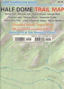
Hike Half Dome Yosemite Trails, Backpacking Yosemite National Park, Climbing Half Dome, Yosemite Day Hikes, Backpacking Maps; Areas include: Glacier Point Hike, Yosemite Creek, Yosemite Falls, Tenaya Lake, Yosemite Valley, Vernal Falls, Nevada Falls, North Dome, Clouds Rest, Teneya Lake, Yosemite Creek, Panorama Trail, Mono Meadow, Little Yosemite Valley.

Durable, waterproof plastic map; Folded. Map Scale: 31.7K; ISBN# 9781877689703

avenza mapsdownload digital version of this map –
Half Dome Hiking Map

Half Dome Yosemite

Yosemite National Park

The geology of the Yosemite area is characterized by granitic rocks and remnants of older rock. About 10 million years ago, the Sierra Nevada was uplifted and then tilted to form its relatively gentle western slopes and the more dramatic eastern slopes. The uplift increased the steepness of stream and river beds, resulting in the formation of deep, narrow canyons. About one million years ago, snow and ice accumulated, forming glaciers at the higher alpine meadows that moved down the river valleys. Ice thickness in Yosemite Valley may have reached 4,000 feet during the early glacial episode. The downslope movement of the ice masses cut and sculpted the U-shaped valley that attracts so many visitors to its scenic vistas today.

Half Dome Hiking Map

OLD MAP HALFDOME

Half Dome Hiking Map

OLDER VERSION

see also –

Yosemite Books
Yosemite Valley Trail Map
All NatGeo Yosemite Maps
All Tom Harrison Yosemite Maps

Half Dome Hiking Map

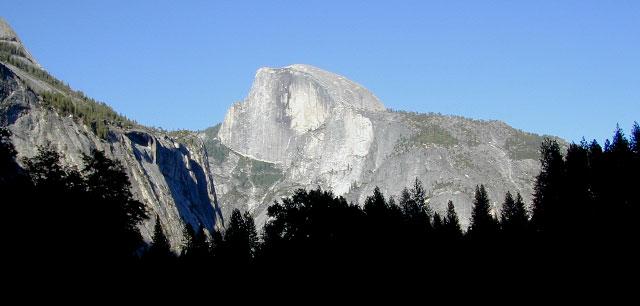
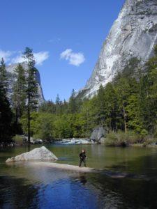
Below Half Dome, Mirror Lake