Red Rock Canyon Map

Red Rock Canyon Map

Spring Mountains
Red Rock Canyon
Vegas Hiking Map

Red Rock BLM Map

Spring Mountains National Recreation Area / Red Rock Canyon National Conservation Area / Las Vegas District BLM

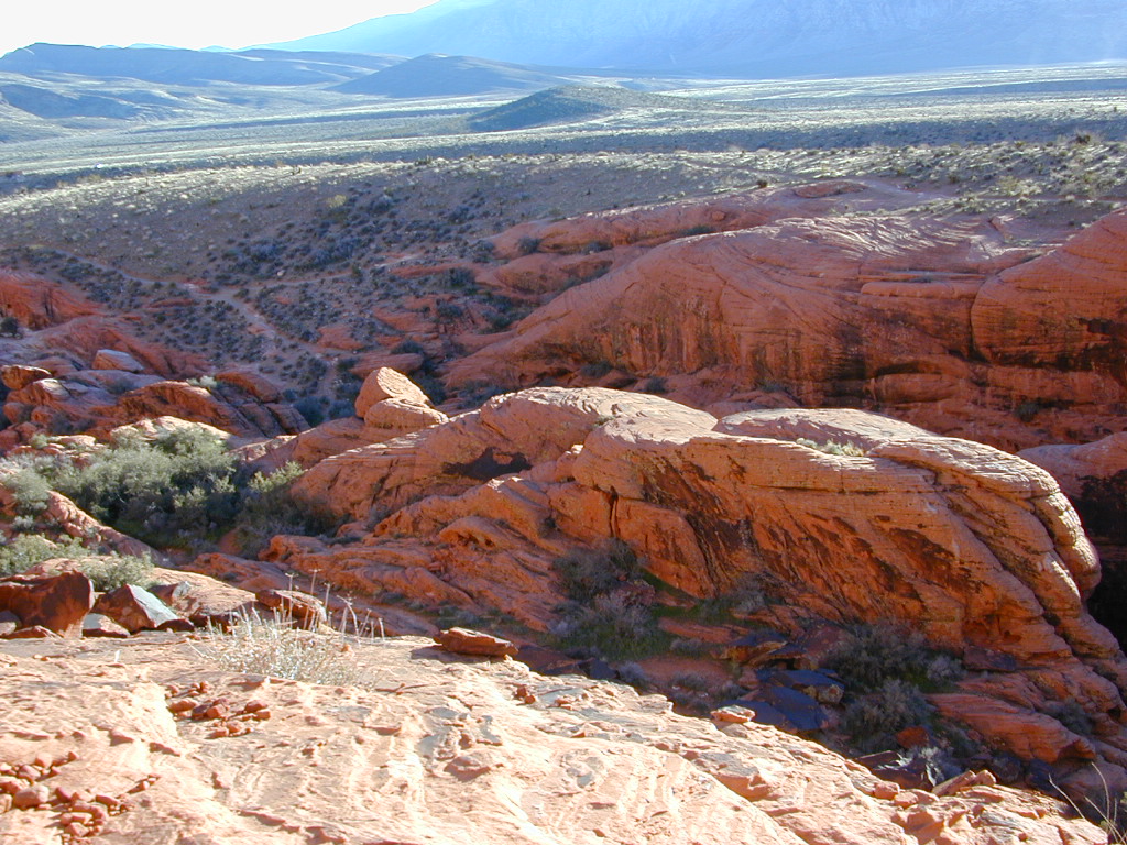
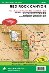
Red Rock Canyon Map – VEGAS RED ROCK: BLM & USFS paper map includes a few parks and hiking trails near Las Vegas, NV. Humboldt Toiyabe National Forest, BLM lands, Spring Mountains National Recreation Area, plus the very popular attraction, Red Rock Canyon (only minutes outside of the city). Nevada Travel Outdoors. USDA National Forest Map. Printed on paper in 1997.

Red Rock Canyon Map

Red Rock Canyon Maps

Red Rock Canyon Map

Franko Map Vegas

hikers map

best vegas outdoors

One of the cheapest winter vacations around – ONLY IF you can stay outta the casinos!

Desert day hikes, snow play, waterfalls (Mt Charleston) and petroglyphs (Valley of Fire), plus cheap hotel at night. Make VEGAS an outdoor destination, instead of an indoor, air-conditioned fantasy land.

camp map

Camping near Las Vegas can be windy during any time of year, or brutal triple-digit heat during the summer months.

Red Rock BLM Campground is located in a very windy location and situated near a busy main road. Best bet is to camp further up the mountain (Mount Charleston) – up in the canyons, with the trees, for a better experience. It can be colder in higher elevations, so always bring a jacket (at any time of year).

LOCALS TIP:
Valley of Fire State Park actually has a much better Campground than Red Rock. 
Vegas Hiking Map

see also –

Lake Mead Map
Flagstaff Sedona Map
Grand Canyon Maps
Mojave National Preserve Map
Death Valley Park Maps
Desert Maps
Eastern Sierra Maps
Arizona Books & Maps
Utah Maps

Half Dome Hiking Map

Half Dome Hiking Map

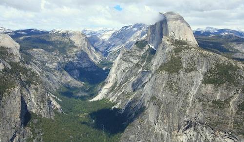
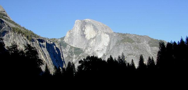
Half Dome view from Glacier Point (photo SKIP JONES)

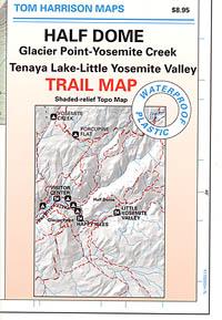
Half Dome Trail Map

Hiking to Half Dome is very long day trip, on foot, uphill half the way, with excessive elevation gain and loss. Leave toward the trailhead before day break and get back after sundown. No kidding: 17 miles round trip. You must be in excellent shape to tackle this trail, as it involves discipline and strength. Super scenic waterfalls and viewpoints all along the way. Some prefer to do an overnight trek w/ backpack, food and permits.

Half Dome Hiking Map
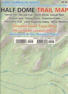
Tom Harrison Maps

Half Dome Hiking Map

Hike Half Dome Yosemite Trails, Backpacking Yosemite National Park, Climbing Half Dome, Yosemite Day Hikes, Backpacking Maps; Areas include: Glacier Point Hike, Yosemite Creek, Yosemite Falls, Tenaya Lake, Yosemite Valley, Vernal Falls, Nevada Falls, North Dome, Clouds Rest, Teneya Lake, Yosemite Creek, Panorama Trail, Mono Meadow, Little Yosemite Valley.

Durable, waterproof plastic map; Folded. Map Scale: 31.7K; ISBN# 9781877689703

avenza mapsdownload digital version of this map –
Half Dome Hiking Map

Half Dome Yosemite

Yosemite National Park

The geology of the Yosemite area is characterized by granitic rocks and remnants of older rock. About 10 million years ago, the Sierra Nevada was uplifted and then tilted to form its relatively gentle western slopes and the more dramatic eastern slopes. The uplift increased the steepness of stream and river beds, resulting in the formation of deep, narrow canyons. About one million years ago, snow and ice accumulated, forming glaciers at the higher alpine meadows that moved down the river valleys. Ice thickness in Yosemite Valley may have reached 4,000 feet during the early glacial episode. The downslope movement of the ice masses cut and sculpted the U-shaped valley that attracts so many visitors to its scenic vistas today.

Half Dome Hiking Map

OLD MAP HALFDOME

Half Dome Hiking Map

OLDER VERSION

see also –

Yosemite Books
Yosemite Valley Trail Map
All NatGeo Yosemite Maps
All Tom Harrison Yosemite Maps

Half Dome Hiking Map

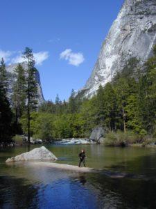
Below Half Dome, Mirror Lake

Yosemite Books

Find Yosemite Maps by National Geographic
Find Yosemite Maps by Tom Harrison

Yosemite National Park Books

Yosemite Books

Yosemite Books

Yosemite Books

Yosemite Books

Yosemite Books

Yosemite Books

Yosemite Books

Yosemite Books

Yosemite Books

Yosemite Books

Yosemite Books

Yosemite Books

Yosemite Books

Yosemite National Park is internationally recognized for its granite cliffs, waterfalls, clear streams, giant sequoia groves, lakes, mountains, meadows, glaciers, and biological diversity. Nearly 95% of the park is designated wilderness.

Yosemite is one of the largest and least fragmented habitat blocks in the Sierra Nevada, and the park supports a diversity of plants and animals. The park has an elevation range from 2,127 to 13,114 feet and contains five major vegetation zones: chaparral and oak woodland, lower montane forest, upper montane forest, subalpine zone, and alpine. Of California’s 7,000 plant species, about 50% occur in the Sierra Nevada and more than 20% are within Yosemite. The park contains suitable habitat for more than 160 rare plants, with rare local geologic formations and unique soils characterizing the restricted ranges many of these plants occupy.

The geology of the Yosemite area is characterized by granitic rocks and remnants of older rock. About 10 million years ago, the Sierra Nevada was uplifted and then tilted to form its relatively gentle western slopes and the more dramatic eastern slopes. The uplift increased the steepness of stream and river beds, resulting in the formation of deep, narrow canyons. About one million years ago, snow and ice accumulated, forming glaciers at the higher alpine meadows that moved down the river valleys. Ice thickness in Yosemite Valley may have reached 4,000 feet during the early glacial episode. The downslope movement of the ice masses cut and sculpted the U-shaped valley that attracts so many visitors to its scenic vistas today.

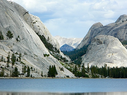
domes of yosemite