Mojave National Preserve Map

Mojave National Preserve Map

Joshua Trees in Mojave NP

Mojave Map
by Tom Harrison Maps

Mojave National Preserve MapTom Harrison Mojave Desert Recreation Map: Mojave National Preserve Essex California, Mojave Desert Trails; Cima Dome, Mojave Road, Hole in the Wall, Mid Hills, Mid-hills, Providence Mountains, New York Mountains, Kelso Dunes, Kelso Depot, Kelso Road Map Mojave. Durable, waterproof plastic map; Folded. Map Scale: 250K; ISBN# 9781877689369

avenza maps

download digital version of this map –

Tom Harrison Map – Mojave National Preserve

Mojave National Preserve Map

Providence Mountains SRA

Mojave National Preserve Map

Mojave National Preserve Map

OLDER VERSION

Mojave National Preserve Map

REAL OLD MAP

New York Mountains

Free Camp @ New York Mountains

see more maps in the Mojave –

Trails Illustrated Mojave Map
from National Geographic
Jawbone Canyon Map
Death Valley National Park Maps
Lake Mead NRA Map
Red Rock Canyon Map – Las Vegas, NV

Hiking Desert Canyons

avenzabar

download digital maps of Mojave desert

CTUC Amboy OHV Map
CTUC Mojave Desert OHV Map
CTUC Needles CA OHV Map
CTUC Panamint Valley OHV Map
CTUC San Berdu & Barstow BLM Map

BLM Topo Map – AZ Lake Havasu Guide (free)
BLM Topo Map – AZ Havasu Palms, Sara Park (free)
NPS Map Brochure – Death Valley (free)
NPS Map Brochure – Lake Mead NRA (free)
NPS Map Brochure – Mojave NP (free)
USGS Topo Map – KINGMAN, AZ (free)

Ring Trail

Hiking the Ring Trail @ Hole in The Wall

 Metal Rings for Climbing

Metal Rings for Climbing

climbing

Utah Maps

views of UTAH: topo

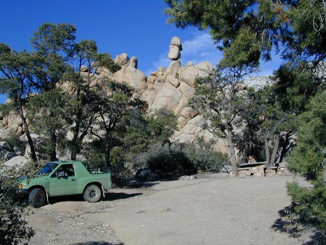
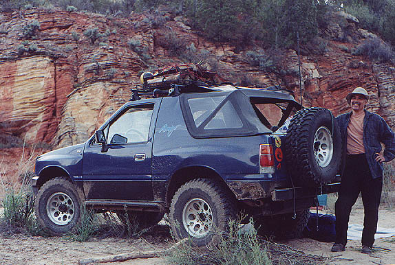
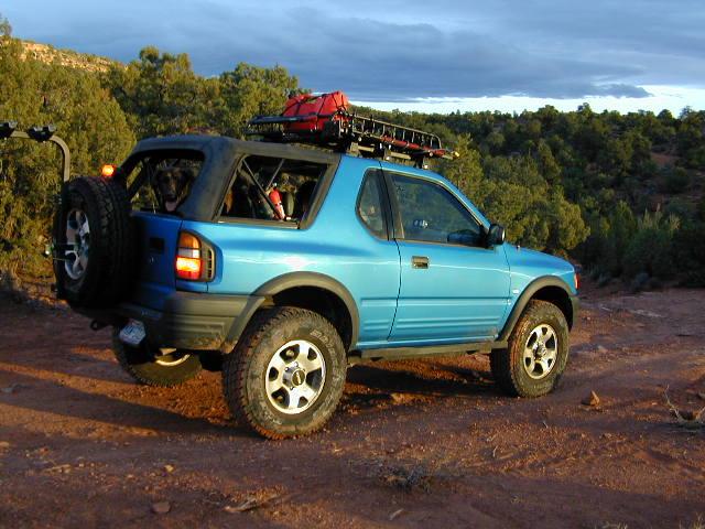
camping, hiking, mountain biking, off roading, fishing

the historic burr trail

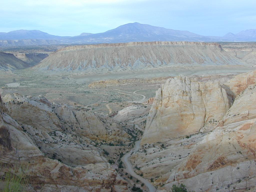
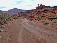
Historic Burr Trail, south of Capital Reef NP

HIGH DESERT: Southern Utah is a magical place to explore. Red rock and National Parks, State Parks – too numerous to name. Outdoor recreation around every corner – from river rafting to rugged canyon hikes, wildlife watching to wheeling. Dispersed camping, very abundant. Dirt back roads, by the many miles. Hiking and biking, all over!

The east-west Interstate 70 splits the state, so most parks are located south of the freeway. Green River is a highway town, along I-70 and the mecca, Moab, is south of the interstate.

hiker

MOAB, UT (southeast Utah) – is a hot bed of recreation activities, tourism, hotels, shopping, plus the 2 National Parks.

TORREY, UT (south central Utah) – hip mountain village, next to Fish Lakes National Forest and Capital Reef National Park. Restaurants, motels, RV Campground with showers, and a grocery stop.

SPRINGDALE, UT (southwest Utah) – the small river town that has merged with neighboring Zion National Park. Tourists everywhere.

Seek the small back roads to get you up and around the outskirts of Zion – very scenic drives. Ghost towns, pinyon & juniper forests, hidden canyons, watrfalls, kolobs and buttes. North of Zion NP, Navajo Lake and Cedar Breaks National Park @ 8000′ elevation – can have snow more than half the year, so plan according.

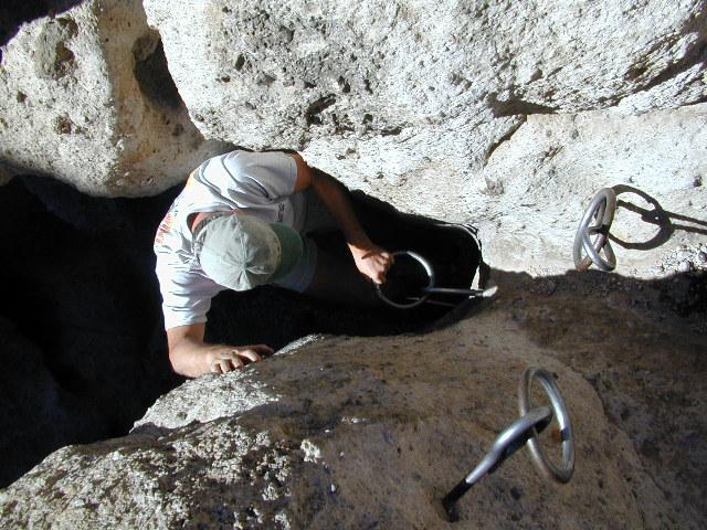
UTAH TIP = Beware: Thunderstorms and heavy rains are part of the package here in this desert state. Extreme flash floods possible, know the weather forecast and the warnings. Stay out of slot canyons during rainy season. Watch out for wet, muddy, red dirt roads. You’ll get stuck, even in 4WD.

Small farming towns are scattered throughout the National Park areas, some more geared for travelers than others. Many National Forests and BLM areas to camp (for free). Usually just a few miles outside the National Park boundaries. The further you get off pavement, the more seclusion you can find. Find the nearest ranger station and ask some questions – if needbe.

utahremote

utah = remote

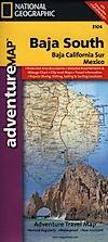
Utah Park Maps by NatGeo

National Geographic makes these colorful, durable, waterproof maps for all the Utah Parks.

Angeles Landing

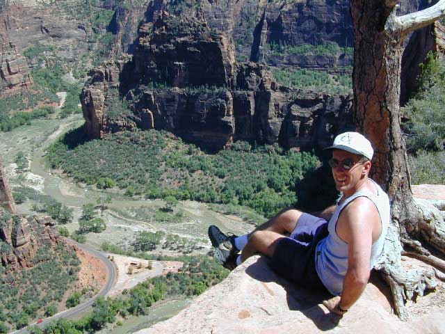
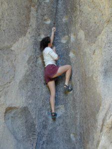
Atop Angel’s Landing, Zion NP
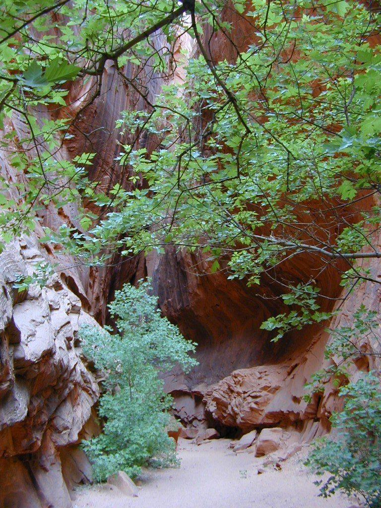
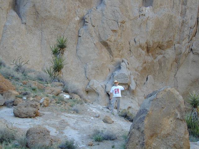
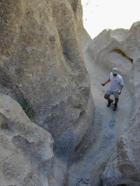
Utah Maps

cool canyon hikes


Utah Maps

RED DIRT TRAILS

Utah Maps

Utah Maps

Utah Maps

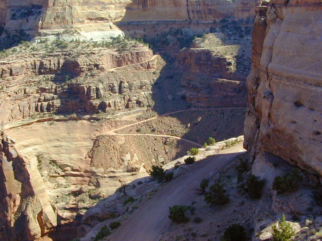
Schaffer Trail, Canyonlands NP

BLM Maps

Bureau of Land Management
BLM Maps

BLM Maps

Desert BLM lands, California

Download PDF maps
from BLM website:
blmhttps://www.blm.gov/maps

BLM’s Story Maps (web app gallery) via Web App Viewer
https://blm-egis.maps.arcgis.com/

BLM South Yuba River

Paper BLM Maps can be ordered online from Jawbone.org
jawbone.org/ohvmap/index.php/maps-guides/agency-maps

Alturas
Amboy4x4 maps
Beatty
Big Bear Lake
Bishop
Blythe
Borrego
Cuddeback Lake
Darwin Hillstrail map
Davis Dam
Death Valley Junction
Eagle Mountain
El Cajon
El CentroOHV deserts
Isabella Lake
Ivanpah
Lancaster
Last Chance Canyon
Mesquite Lake
Mount Whitney
Needles
Newberry Springs
Owlshead Mountains
Palm Springs
Parker Mapcamp maps
Ridgecrest
Saline Valley
Salton Sea
San Andreas
San Bernardino
Santa Ana
Sheephole Mountainscamp map
Soda Mountains
Tehachapi
Three Rivers
Trigo Mountain
Victorville
Yosemite Valley
Yuma

BLM Camping Utah

BLM for off-road routes and free camping

BLM stands for the Bureau of Land Management and it is an agency within the United States Department of the Interior responsible for administering federal lands. Headquartered in Grand Junction, Colorado and with oversight over 247.3 million acres, it governs one eighth of the country’s landmass.

The agency manages 221 wilderness areas, 27 national monuments and some 636 other protected areas as part of the National Conservation Lands, totaling about 36 million acres. In addition the Conservation Lands include nearly 2,400 miles of Wild and Scenic Rivers, and nearly 6,000 miles of National Scenic and Historic Trails. There are more than 63,000 oil and gas wells on BLM public lands.

BLM OHV Areas

Nelson @ El Dorado Canyon – Lake Mohave

see also – hikers map

California Desert Maps
National Forest Atlas
State Atlas Maps
Utah Maps

Baja Map Mexico

Detailed Map of Baja Mexico
Baja California MX

Camping Gonzaga Bay

Camping Gonzaga Bay

2021 – New MAP for Baja!!!

Benchmark Baja California
Road & Recreation Atlas

Baja Map Mexico

Release date MAY 2021 – announcing a brand new atlas for Baja California, created by none-other than Benchmark Maps. 

Baja Map Mexico

National Geographic has Adventure Maps for Baja California

full color, 2 sided, waterproof, tear resistant, topographic maps

NatGeo Baja Map NORTH
(Baja Norte)

This travel map covers from San Diego down to Bay of LA. Norte map covers the US/Mexico border from Tijuana to Mexicali, including border crossings, as well as Ensenada & Tecate. Inset maps give extensive detail to these areas: The southern side shows Valle de los Cirios, Bahia de los Angeles, Native Rock Paintings of the Sierra de San Francisco and Whale Sanctuary of El Vizcaino.

Baja Map Mexico

OLDER VERSION

hiking

NatGeo Baja Map SOUTH
(Baja Sur)

The sparsely populated southern half of the peninsula has some of the Gulf of California Islands. The southern side covers the state capital La Paz, Cabo San Lucas, San Jose del Cabo, and Todos Santos. Inset maps give extensive detail to some of these popular areas.

Baja Map Mexico

OLDER VERSION

hiking

Baja Map Mexico

Dining Out in Baja

National Geographic Adventure Map Pack
Baja California 2 Map Set

Baja Map Mexico

OLDER EDITION

Baja Map Mexico

La Paz Coast Baja – Sea of Cortez

see also – 

Baja Almanac
Baja California Books