Yosemite Valley Trail Map

Yosemite Valley Map
by Tom Harrison

valleyfloor

  • bike
  • camp
  • climb
  • hike
  • picnic
  • river
  • waterfalls

Tom Harrison Yosemite Valley Map, Topo Trail Map Yosemite Parks, Hiking Trails Yosemite Valley Trails, Yosemite National Park Maps Hiking Trails Topo Map; Regions include – Yosemite Valley Mirror Lake, Yosemite Falls, Half Dome Hiking, Nevada Falls, Mist Trail, Vernal Falls, Yosemite National Park Campgrounds, Trailheads, Shuttle Stops, Merced River. Easily understood w/ several languages too!

Durable, waterproof plastic map; Folded. Map Scale: 24K; ISBN# 9781877689604

valleyfloor

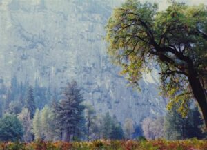
The Valley Floor of Yosemite

avenza mapsdownload digital version of this map –
Yosemite Valley Trail Map

Yosemite Valley Trail Map

OLDER VERSION

Yosemite Valley Trail Map

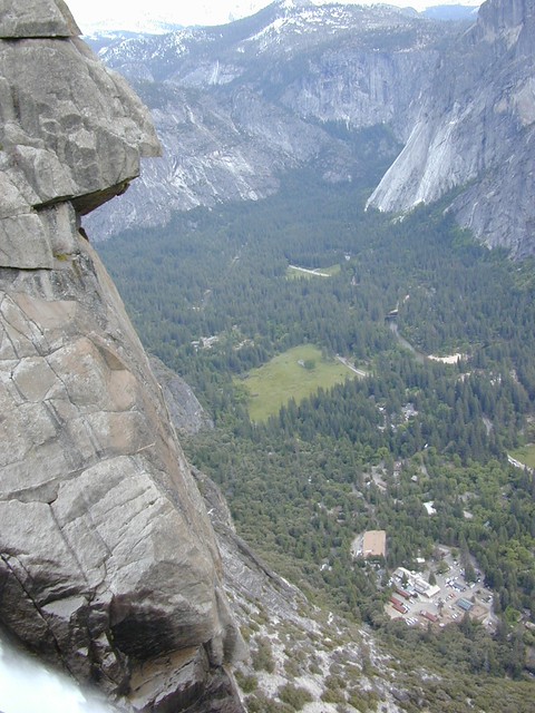
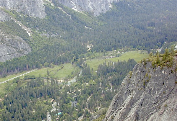
TOP of Yosemite Falls (see water on lower left)

Yosemite Valley represents only one percent of the park area, but this is where most visitors arrive and stay. The Tunnel View is the first view of the Valley for many visitors and is extensively photographed. El Capitan, a prominent granite cliff that looms over Yosemite Valley, is one of the most popular rock climbing destinations in the world because of its diverse range of climbing routes in addition to its year-round accessibility. Granite domes such as Sentinel Dome and Half Dome rise 3,000 and 4,800 feet, respectively, above the valley floor at 4000 feet.

The high country of Yosemite contains beautiful areas such as Tuolumne Meadows, Dana Meadows, the Clark Range, the Cathedral Range, and the Kuna Crest. The Sierra crest and the Pacific Crest Trail run through Yosemite, with peaks of red metamorphic rock, such as Mount Dana and Mount Gibbs, and granite peaks, such as Mount Conness. Mount Lyell is the highest point in the park, standing at 13,120 feet. The Lyell Glacier is the largest glacier in Yosemite National Park and is one of the few remaining in the Sierra Nevada today.
Yosemite Books
The park has three groves of ancient giant sequoia trees; the Mariposa Grove (200 trees), the Tuolumne Grove (25 trees), and the Merced Grove (20 trees). Many of the trees in Mariposa Grove were recently toppled by severe winds in 2020; Groves may be closed due to cleanup efforts.

see also –
All Yosemite Maps by Tom Harrison
Yosemite Books
Half Dome Trail Map

Utah Maps

views of UTAH: topo

camping, hiking, mountain biking, off roading, fishing

the historic burr trail

Historic Burr Trail, south of Capital Reef NP

HIGH DESERT: Southern Utah is a magical place to explore. Red rock and National Parks, State Parks – too numerous to name. Outdoor recreation around every corner – from river rafting to rugged canyon hikes, wildlife watching to wheeling. Dispersed camping, very abundant. Dirt back roads, by the many miles. Hiking and biking, all over!

The east-west Interstate 70 splits the state, so most parks are located south of the freeway. Green River is a highway town, along I-70 and the mecca, Moab, is south of the interstate.

hiker

MOAB, UT (southeast Utah) – is a hot bed of recreation activities, tourism, hotels, shopping, plus the 2 National Parks.

TORREY, UT (south central Utah) – hip mountain village, next to Fish Lakes National Forest and Capital Reef National Park. Restaurants, motels, RV Campground with showers, and a grocery stop.

SPRINGDALE, UT (southwest Utah) – the small river town that has merged with neighboring Zion National Park. Tourists everywhere.

Seek the small back roads to get you up and around the outskirts of Zion – very scenic drives. Ghost towns, pinyon & juniper forests, hidden canyons, watrfalls, kolobs and buttes. North of Zion NP, Navajo Lake and Cedar Breaks National Park @ 8000′ elevation – can have snow more than half the year, so plan according.

UTAH TIP = Beware: Thunderstorms and heavy rains are part of the package here in this desert state. Extreme flash floods possible, know the weather forecast and the warnings. Stay out of slot canyons during rainy season. Watch out for wet, muddy, red dirt roads. You’ll get stuck, even in 4WD.

Small farming towns are scattered throughout the National Park areas, some more geared for travelers than others. Many National Forests and BLM areas to camp (for free). Usually just a few miles outside the National Park boundaries. The further you get off pavement, the more seclusion you can find. Find the nearest ranger station and ask some questions – if needbe.

utahremote

utah = remote

Utah Park Maps by NatGeo

National Geographic makes these colorful, durable, waterproof maps for all the Utah Parks.

Angeles Landing

Atop Angel’s Landing, Zion NP

Utah Maps

cool canyon hikes


Utah Maps

RED DIRT TRAILS

Utah Maps

Utah Maps

Utah Maps

Schaffer Trail, Canyonlands NP

Capital Reef Map

Capital Reef Map

hiking slot canyons

Capital Reef National Park Map

NPSCapt Reef NP

Utah’s National Parks are unbelievably beautiful. Enjoying one National Park at a time would require months. Hiking, off-roading and camping are always popular during the summer months, yet most of the parks are open all year long.

NPS
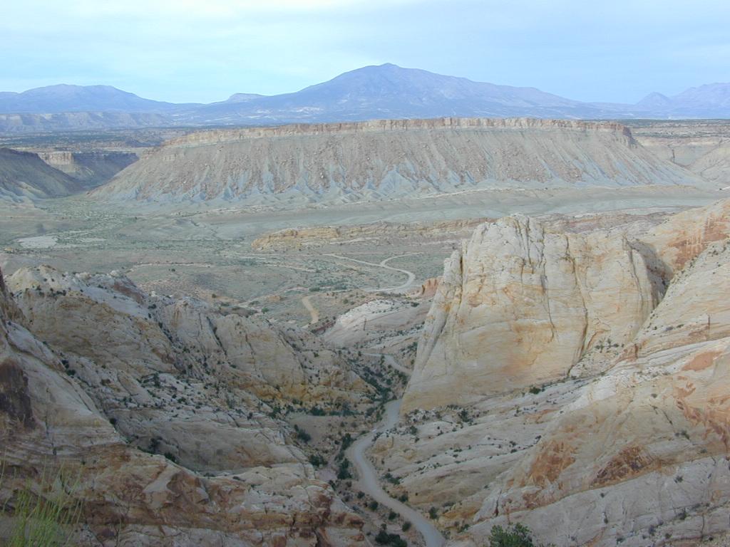
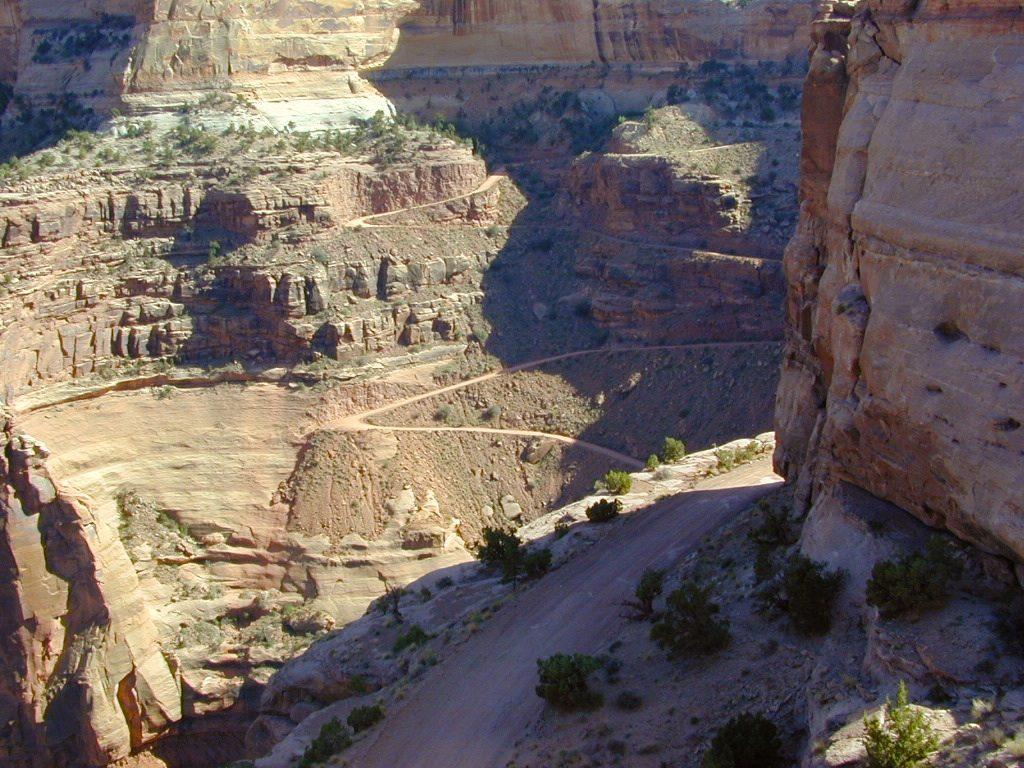
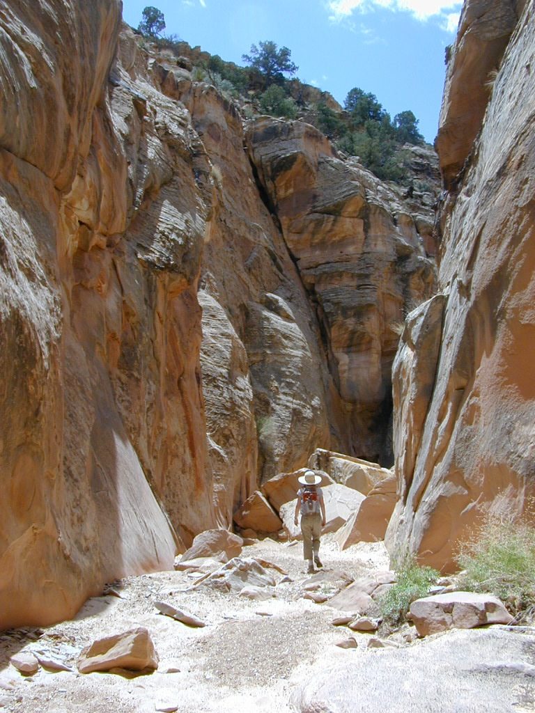
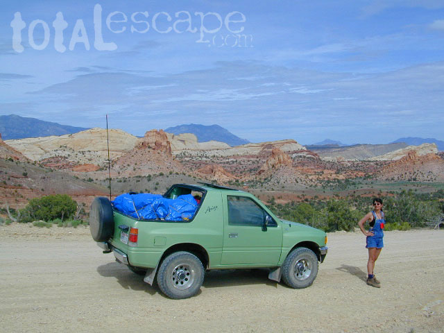
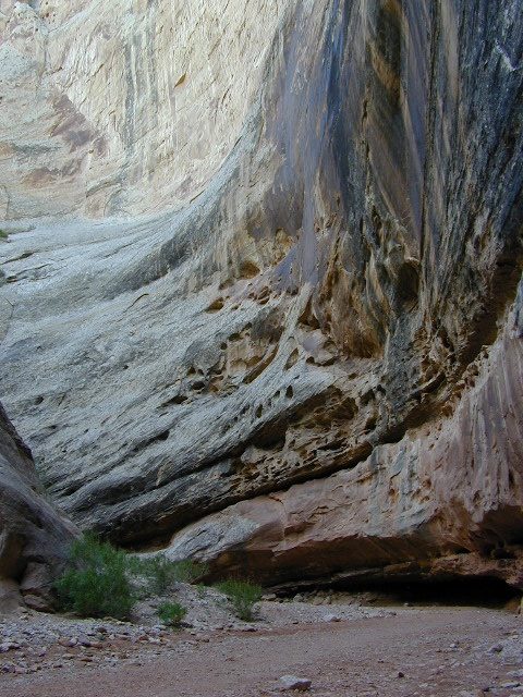
Capital Reef is a fertile high desert canyon with plenty of great slot canyons and archways to explore. The main campground on the highway is located next to a historic fruit orchard.

Capital Reef Map

Capital Reef Map
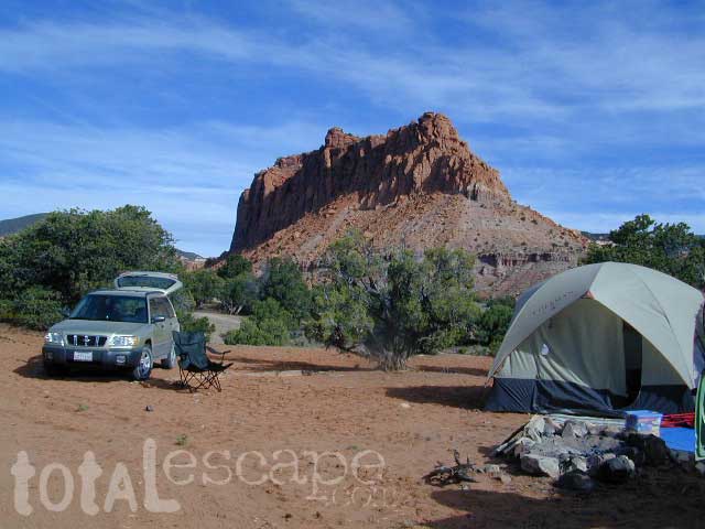
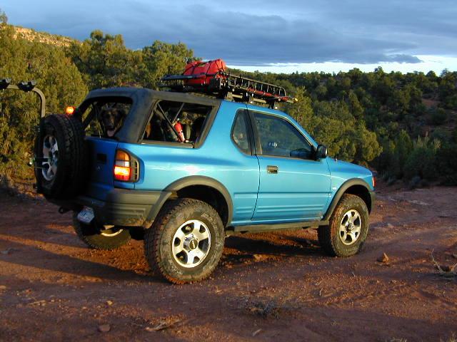
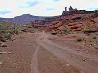
Cathedral Valley is a cool off-road destination for secluded camping, way off the paved highway. Self sufficient campers only!

The Burr Trail is a historic graded road, with steep switchbacks and red rock scenery. This main backcountry route connects the National Park to remote BLM land, south of the park.

Capital Reef Map

Hiking in Capital Reef National Park

get a digital version of this mapavenza maps
NatGeo #267 – Capitol Reef NP Map

Capital Reef Map

May is generally the best month for camping & hiking in southern Utah. Summer can bring triple digit heat and late season thunderstorms. Flash floods are common and life threatening in this mountainous high desert region. Winter snow is typical in this region.

NFSFishlake National Forest is neighboring the National Park on the west side of Capital Reef NP. Free camping is available on dirt roads in the National Forest; Capital Reef Map
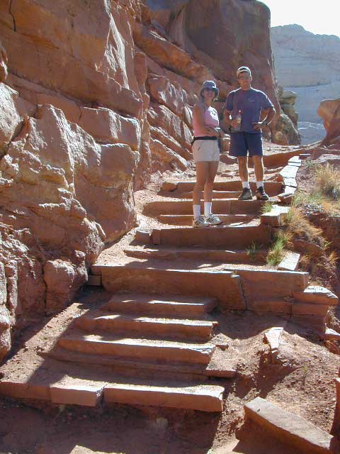
campfire permits are required for back country camping. RV park, motels, market and restaurants available in Torrey.

nearest town:
Torrey, UT

Capital Reef Map

Capital Reef Map

Historic Burr Trail is a very long, yet drivable, graded dirt road connecting many public lands in south central Utah. High clearance is recommended, 4WD may be required during wet weather or snow.

avenzabar

apps/maps:
download digital topos & maps

BLM Map: West Wayne County UT (free)
Fishlake National Forest Topo Atlas
Fishlake NF Utah – Off Road Map (free)
Fishlake NFS Visitor Map – North Half
Glen Canyon Lake Powell Map NPS (free)
Glen Canyon Recreation Area – Lake Powell Map
Grand Staircase Escalante Map BLM
Motorized Routes Map, Emery County UT
NatGeo #707 – Fish Lake, Manti Map (Interstate 70)

Capital Reef Map

Free Camping @ Fishlake NF – Torrey, Utah

see also –Utah Maps

Canyonlands Map
Utah Maps
Utah Books

Capital Reef Map

Giant Walls of Capital Reef

Zuma Canyon Trancas Map

Zuma Canyon Map

Zuma Canyon Map

Zuma Canyon & Trancas Canyon Hiking Map
Tom Harrison

Malibu Beach Map. Zuma/Trancas Canyons Hiking Map, Mountain Biking Trail Maps, Malibu Hiking Trails Coastal Hikes; Rocky Oaks Circle X Ranch, Arroyo Sequit, Biking Backbone Trail, Malibu Springs, Leo Carillo Beach Camping, Leo Carillo State Park, Zuma Canyon, Truncas Cyn, Charmlee Wilderness Park Trails. Durable, waterproof plastic map; Folded. Map Scale: 31.7K; ISBN# 9781877689871

Zuma Canyon Map

The name Zuma is derived from a Chumash word meaning “abundance”. Zuma and Trancas Canyons lies within the Santa Monica Mountains National Recreation Area.

Zuma Canyon contains a number of trails for hikers, of varying severity, and is the home of a range of wildlife, including the wrentit. The eastern boundary is marked by Kanan Dume Road (N-9) and the north end is crossed by the popular Backbone Trail, a 67 mile mountain bike path through the Santa Monica Mountains.

topo maps

see also – 

Malibu Creek Map
Point Mugu Trail Map
Santa Monica Mountains Map
Topanga Canyon Map

trail maps

nearby towns: