San Bernardino Mountains

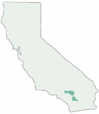
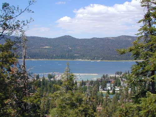
Big Bear Lake Southern California, in the San Bernardino Mountains
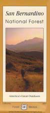
San Bernardino National Forest, or San Berdoo for short.

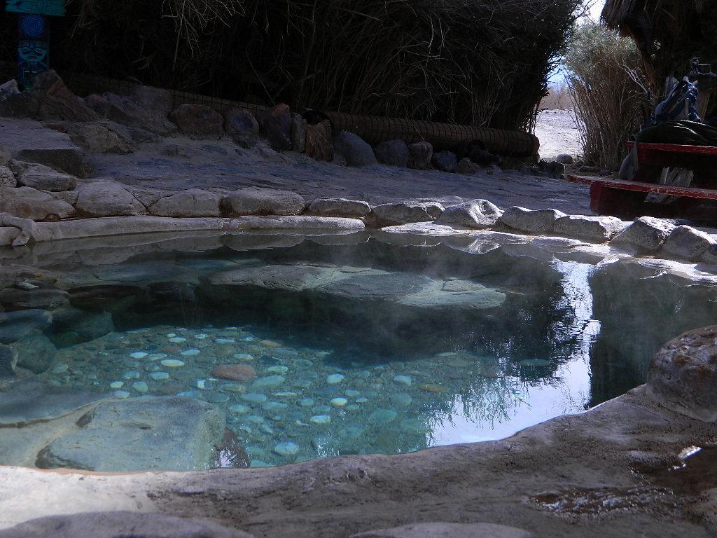
This mountain region is the epic outdoor playground for the Los Angeles region, which offers – snow skiing, snow boarding, snow sledding, cabin rentals, boating, kayaking, horseback riding, fishing, hiking, backpacking, campground camping, rock climbing, mountain biking, dirt biking, off roading routes, and a hike-in hot springs.
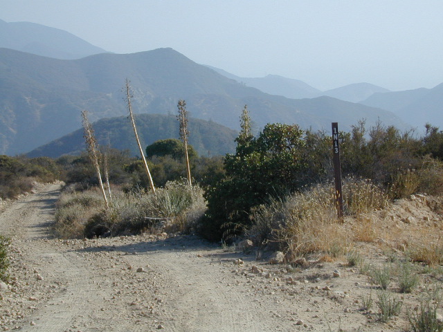
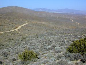
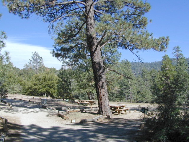
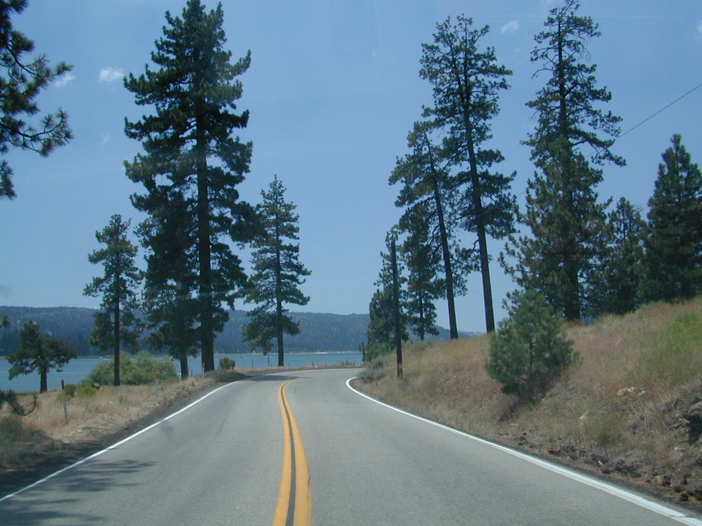
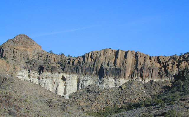
San Bernardino Mountains

Big Bear dirt roads

see also –
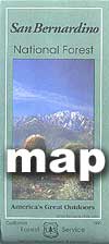
San Berdu National Forest Map USDA
San Bernardino Topo Atlas

Big Bear Trail Guide
San Gorgonio Wilderness Trail Map
San Jacinto Wilderness Trail Map 

San Bernardino Mountains

San Bernardino Mountains

Forest Falls, California

San Bernardino Mountains

The forested, higher elevations cover the Lake Arrowhead, Silverwood Lake and Big Bear Lake area, as well as the San Jacinto mountains – with the adorable village of Idyllwild. All is located in Southern California, in between all the suburban development and cities.

The backside of the of San Berdu National Forest faces the Mojave Desert and the front faces the L.A. Basin. On the Idyllwild side, Hemet lies to the west and Palm Springs desert on the east side.

The famous Palm Springs tram can take you from the desert terrain @ 2463′ elevation, up to the pine forest of San Jacinto State Park @ 8516′ elevation, in a matter of minutes. Totally worth a trip, (a full day outing). Bring a jacket for the cooler temps and extra cash for meals and/or horseback rides.

Inland Empire Google Map

nearby attractions:

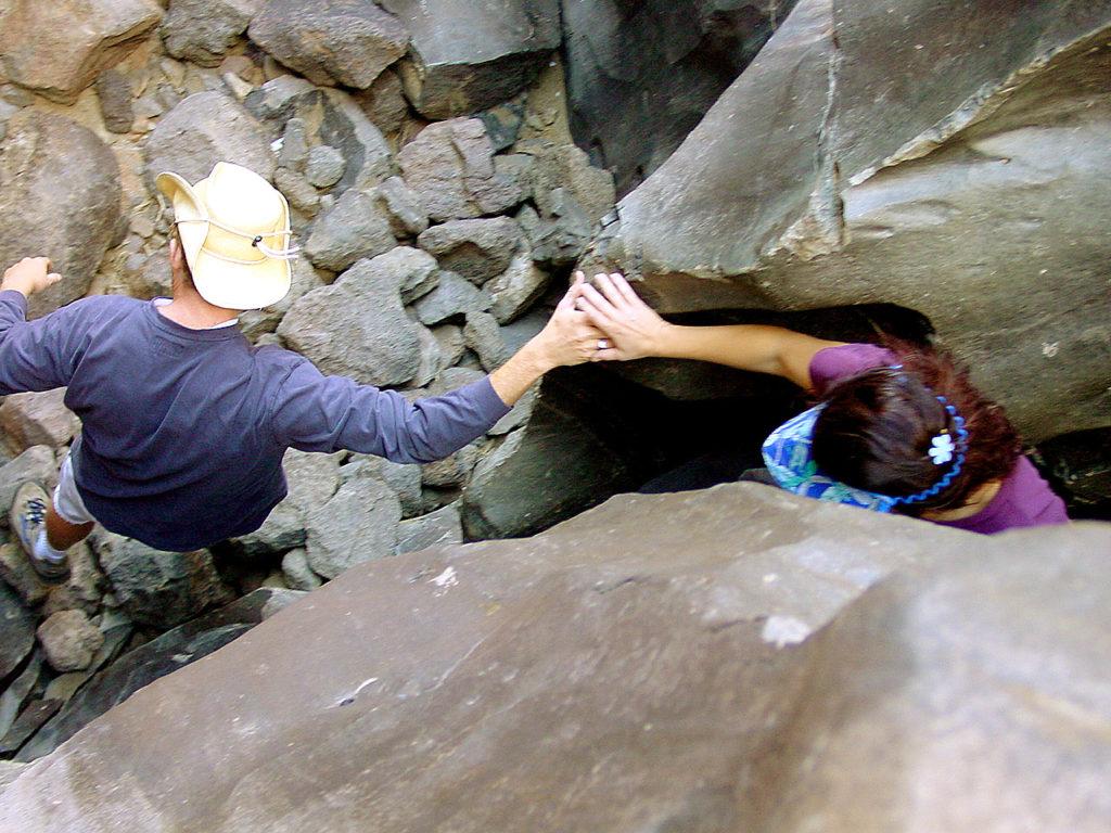
Deep Creek Hot Springs
Forest Falls
Green Valley Lake
Heart Bar Camp
Holcomb Valley
Palm Springs Aerial Tramway
San Gorgonio Wilderness
San Jacinto Camping
San Jacinto Wilderness
Silverwood SRA
Wildhorse Meadows 2N93
Yellow Post Campsites

towns nearby:

San Bernardino Mountains

San Bernardino Mountains

Ironwood Group Campground


San Bernardino National Forest Map

Big Bear Maps

Big Bear Mountains Map

San Bernrdino National Forest Map

San Bernardino National Forest Map

4x4 maps
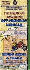
Big Bear Maps / Idyllwild Maps
Big Bear Lake, Fawnskin, San Jacinto, Idyllwild, Lake Arrowhead, Holcolm Creek, San Gorgonio

PLASTIC MAP PAPER; water & tear resistant. Ranger Map – NFS issued map. GPS: Longitude & Latitude; Rivers, Creeks, Peaks, Elevations, 4WD routes & every dirt BackRoad, Hot Springs, Equestrian Areas, all Big Bear & Idyllwild Campgrounds, Hiking Trails & BackPacking Trailheads.

San Bernardino Map

2009 San Bernardino Map

Areas include: Southern California, San Gorgonio Wilderness, Big Bear Lake, Fawnskin, Rim of the World, Moonridge, Bear Mtn, Snow Summit, Lake Arrowhead, Green Valley Lake, Deep Creek, Holcomb Valley, Heart Bar, John Bull, Cleghorn, Cajon Pass, Silverwood Lake, Forest Falls, San Jacinto, Idyllwild, Lake Hemet, Marion Mtn., Thomas Mountain. Also available en espanol.

Map Size: 36″x 36″ overall / 4″x9″ folded; map paper. ISBN# 9781593514846

Southern California Forest / Big Bear Mountains:
San Bernardino National Forest

Big Bear Maps NFS

see also – San Berdoo Topo Atlas

Big Bear Trail Map

previous versions of this map:

Waterproof Map Big Bear Lake

San Bernardino Map

Wilderness Areas near San Berdoo Forest:

Camping Maps Big Bear

nearby towns:

San Bernardino, National Forest, Big Bear, Map, San Bernardino, Mountains, Trails, Map, Big Bear, Idyllwild, Big Bear Map, Topographical Maps, Topo Atlas, San Gorgonio, Backpacking Big Bear, Hiking, Hike Gorgonio, Mount San Gorgonio; Old Gray Back, Grayback, Greyback, Big Bear 4×4

Big Bear Lake Map

Big Bear Lake, Southern California

Big Bear Map

Mojave Desert Maps

Mojave Desert Maps / Mojave Camping
Historic Mojave Trail

We have a nice spread of desert topographic maps listed below for the Mojave Desert region of California. Whether you want to hike, mountain bike, camp, climb, play on the sand dunes or just relax and stargaze, we have you covered. The centrally located historic train station, the Kelso Depot, has been totally restored and is now the area’s Visitors Center.

Camping Map Mojave

Free Camping in the Boulders, off Kelbaker Road, N of I-40.

Mojave National Preserve Map
by Tom Harrison Maps

Tom Harrison Mojave Desert Recreation Map: Mojave National Preserve Essex California, Mojave Desert Trails; Cima Dome, Mojave Road, Hole in the Wall, Rings Trail Hike Mojave, Mid Hills, Mid-hills, Providence Mountains, New York Mountains, Kelso Dunes, Kelso Depot, Kelso Road Map Mojave. Durable, waterproof plastic map; Folded. Map Scale: 250K; ISBN# 9781877689369

avenza maps

download digital version of this map –

Tom Harrison Map – Mojave National Preserve

Mojave Desert Maps

Mojave National Park Map #256
NatGeo California Desert Maps

Trails Illustrated Map from National Geographic. Mojave National Preserve Park map #256.

Camping, hiking and stargazing. Sand dunes, lava tubes and dirt roads! Providence Mountains State Recreation Area, Cinder Cone Lave Beds, Kelso Depot Visitors Center, Cima Road, Kelso Dunes, New York Mountains. Back Roads Mojave, Back Country Hiking Map. Scenic Drives to explore. Very detailed & colorful. Waterproof Plastic Map; Tear Resistant. GPS data. ISBN#749717012561

digital maps

download digital version of this map –

NatGeo Map 256 – Mojave National Preserve Park

driftwood

  • mapsbackpacking
  • camping
  • climbing
  • hiking
  • lava tubes
  • mountain biking
  • off-roading
  • old mines
Hiking Climbing US 395 Mojave

Fossil Falls @ US 395 Mojave

Mojave Road Map & Guide

jawbone canyon trail maps
Jawbone Canyon

North Mojave Desert, US Hwy 395 @ Hwy 14

Jawbone Cyn Map / OHV routes / Randsburg Ghost Town / Old Mines & Tunnels / Joshua Trees / Pinyon Pines / Red Rock Canyon

Jawbone OHV Map
Jawbone Canyon OHV North Mojave Desert Map; Topo features, Waterways, Trails & Roads. Motorized & no-motorized trails. Eastern Kern County High Desert. Spangler Hills OHV, Trona Pinnacles National Monument, Randsburg Mining District, 4×4 OHV, Red Mountain, Johannesburg, Red Rock Canyon State Park, Last Chance Canyon, El Paso Mountain Wilderness, Desert Tortoise Preserve, Kiavah Wilderness, Dove Springs OHV, Bright Star Wilderness, Tehachapi Loop, Walker Basin, California City, BLM Camping Mojave California Desert Trails, Southern Sequoia National Forest OHV; 2008 Map by Friends of Jawbone w/ California Trail Users Coalition


Death Valley, Inyo Mts & Saline Valley

And alas, Death Valley National Park is part of the much larger Mojave Desert. Find Death Valley Maps and Death Valley Books. Inyo Mountains separate US 395 (the Owens Valley) from Death Valley, so Inyo National Forest may also be included as a Mojave Desert map. See all the topo quads on the spiral bound Inyo National Forest Atlas.

Off Road Routes to Hot Springs

Saline Hot Pools @ Saline Valley, DVNP

Download Digital Maps

download digital maps of the Mojave desert

CTUC Amboy OHV Map
CTUC Inyo National Forest South (free)
CTUC Mojave Desert OHV Map
CTUC Needles CA OHV Map
CTUC Panamint Valley OHV Map
CTUC San Berdu & Barstow BLM Map

BLM Topo Map – AZ Lake Havasu Guide (free)
BLM Topo Map – AZ Havasu Palms, Sara Park (free)
NPS Map Brochure – Death Valley (free)
NPS Map Brochure – Lake Mead NRA (free)
NPS Map Brochure – Mojave NP (free)
USGS Topo Map – KINGMAN, AZ (free)

Mojave Canyon Maps BLM

Fossil Falls Canyon BLM – Cinder Road @ US Hwy 395

Anza Borrego Desert Map

Anza Borrego Desert Map

Split Mountain, Anza Borrego State Park

Anza Borrego Map

Both Tom Harrison and Wilderness Press make topographic maps of this beautiful desert region in Southern California. Numerous free digital maps for specific areas are now available from Avenza Maps, however we do suggest always carrying real, hard-copy maps.

Wilderness Press Anza Borrego Desert Map

Anza Borrego MapAnza Borrego Desert State Park, San Diego Mountains, San Diego Desert Hiking, Free Car Camping, Secluded Camping California, Southern California Desert Campgrounds, SoCal Camping, OHV Trails San Diego County Back Roads

Anza Borrego Desert State Park

Anza Borrego Desert Region and in addition the Yuha Desert. Ocotillo Wells SVRA, Bow Willow Campground, Split Mountain, Fish Creek Campground, Coyote Mountains, as well as all Anza Borrego Campgrounds. Roads, highways, dirt roads, 4×4 routes, trails, San Diego back roads. Also Interstate 8, California State Route Highwy 78, San Diego County Rd S-22, San Diego Road S-2, Road S-3, Road S-1 Laguna mountains, Sunrise Highway, Great Stagecoach Route of 1849; Plastic Map ISBN# 9780899974019

This item is a companion map to the book called The Anza Borrego Desert Region, by Lowell and Diana Lindsay (Wilderness Press).

digital maps

apps/maps:
download digital topos & maps

driftwood

nearby towns:

Anza Borrego Maps

SPRINGTIME BLOOM: Ocotillo Camping (for free) in Coyote Wash

San Diego Backcountry Map

Similarly, the Tom Harrison Map for the San Diego Deserts and Anza Borrego. The #1 selling map for the San Diego deserts!

San Diego Backcountry Recreation Map covers the entire Anza Borrego Desert State Park, the largest State Park in California and some eastern portions of Cleveland National Forest; San Diego County Road S-2, S-22, Interstate 8, Highway 78 and Highway 94 to Tecate Mexico.

San Diego Backcountry Map

OLDER VERSION

Also all areas surrounding Borrego Springs, Julian and Warner Springs. PCT access (Pacific Crest Trail) plus Table Mountain, Sheep Canyon, OHV Deserts Ocotillo Wells SVRA, McCain Valley Camping, Carrizo Gorge Trestle Hike, Jacumba Hot Springs, Tierra del Sol 4×4 Trails, San Diego Lake Morena, Barrett Lake, Campo CA Potrero Regional Park, Agua Caliente Hot Springs, Carrizo Goat Trestle and Canyon sin Nombre Badlands.

Tom Harrison Recreation Map; Durable, waterproof plastic map; Folded. Map Scale: 125K; ISBN# 9781877689543

Anza Borrego Map

ANZA BORREGO – Largest State Park in California


borrego map

DanaMite in the Slot Canyon, way back in 2001