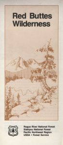
Red Buttes Wilderness Map

Red Buttes Wilderness Map

Red Buttes Map USDA

This map is outta print!
Check Ranger Stations for availability. (see below)

hikers mapRed Buttes Wilderness Map Oregon
Siskiyou National Forest Applegate Ranger District, Rogue River National Forest

OR Topo Maps, Oregon Maps backpacking, hiking, camping, fishing; Illinois Valley Cave Junction, Klamath River California, RedButtes Wilderness Hiking Map, Topo Red Buttes Oregon, Applegate River Topographical Hiking Maps Northern California, Siskiyou NFS, Siskiyou Forest, Whiskey Ridge, at the California Oregon border.

Sierra map

Red Buttes Wilderness is situated in both Oregon and California and includes the crest of the Siskiyou Mountains between the Rogue River and Klamath River drainages. The wilderness is 13 miles long and 6 miles wide, with elevations ranging from 2,800′ in Butte Fork Canyon to 6,740′ at the east summit of the Red Buttes.

The main waterways that flow through Red Buttes Wilderness are all part of the Rogue River watershed, including the Butte Fork and the Middle Fork of the Applegate River, as well as Sucker Creek, a tributary of the Illinois River. The Wilderness contains the headwaters of the Illinois River.

Red Buttes Wilderness takes its name from the dominant peak along the Siskiyou Crest; because of its high iron and magnesium content, the butte’s rock is a reddish-orange color.

The Siskiyou Mountains are part of the larger Klamath Mountains Province of southwestern Oregon and northwestern California, and they include some of the oldest rocks in the region.

The former ocean-bottom sediments that make up most of the Wilderness are several hundred million years old. Over time they were slowly changed by pressure and heat into the complex variety of metamorphic rocks present today: schist, quartzite, gneiss, and several outcrops of white marble. During the last ice age small glaciers sculpted the Siskiyou basins that now contain lakes and meadows.

Red Buttes Wilderness Map

Closest USFS stations:

Happy Camp Ranger Station
Oak Knoll Ranger District
63822 Highway 96,
Happy Camp, CA 96039
530-493-2243

US Forest Service: Star Ranger Station
6941 Upper Applegate Rd,
Jacksonville, OR 97530
541-899-3800

fishing map

see also –

Oregon Dunes Map
Rogue River Float Guide
Rogue River National Forest Map
Columbia River Map
PCT Map #7 Southern Oregon
PCT Map #8 Northern Oregon


Washington Hiking Books

Washington Hiking BooksPNW
The Pacific Northwest region covers both Washington and Oregon, which are directly north of California. Abundant coastlines, waterways, islands, with mountains with forests, rivers and waterfalls. Summer is the best time to camp in this state, as it rains most often in other months.

Books for Washington State: Hike, Bike, Fish, Kayak, Explore

Washington Hiking Books


Washington Hiking Books


Washington Hiking Books

see also – 

Columbia River Map
PCT Map 9 – Southern Washington
PCT Map 10 – Northern Washington

John Muir Trail Books

Find John Muir Trail Maps

John Muir Trail

Photo credit copyright Mike Strickland

JMT: John Muir Trail & John Muir Wilderness

John Muir Trail Books

John Muir Trail Books

John Muir Trail Books

John Muir Trail Books

John Muir Trail Books

JMT

The John Muir Trail is a long-distance trail in the Sierra Nevada mountain range of California, passing through Yosemite, Kings Canyon and Sequoia National Parks. From the northern terminus at Happy Isles in Yosemite Valley and the southern terminus located on the summit of Mount Whitney, the Trail’s length is 213.7 miles, with a total elevation gain of approximately 47,000 feet. For almost all of its length, the trail is in the High Sierra backcountry and wilderness areas. For about 160 miles, the trail follows the same footpath as the longer Pacific Crest Trail. It is named after John Muir, the famous naturalist.

The JMT is 213.7 miles long. From its northern terminus in Yosemite Valley, the trail runs southeast, passing south of Half Dome and then on to Tuolumne Meadows. From Tuolumne Meadows the trail turns south, running parallel to the main range of the Sierra Nevada, through Yosemite National Park, Inyo and Sierra national forests (including the John Muir Wilderness and Ansel Adams Wilderness), passing through Devils Postpile National Monument, Kings Canyon National Park, and ending on Mount Whitney in Sequoia National Park. From the southern terminus of the JMT at the summit of Mount Whitney, an additional 10.6-mile hike on the Mount Whitney Trail is required to reach the nearest trailhead at Whitney Portal, thus making an end-to-end traverse of the JMT effectively 221 miles.

see also

John Muir Wilderness Map 
PCT Pacific Crest Trail Books

John Muir Trail Books

Little Pot Hole Lake, Kearsarge Pass Hike from Onion Valley

John Muir Trailhead locations:

Desolation Wilderness Trail Map

Desolation Wilderness Trail Map
Tom Harrison

Desolation Wilderness Trail Map

Desolation Wilderness Map, Tahoe Lake Camping. Lake Tahoe, CA; Tahoe Westside, Loon Lake camping, Lake Aloha, Emerald Bay, Fallen Leaf Lake, DL Bliss State Park, Echo Lake, Velma Lake, Wrights Lake, Rubicon River, Rubicon 4×4 Trail, Rockbound Valley, Tahoe Rim Trail hiking PCT Pacific Crest Trail; Sierra Nevada High Country Tahoe hiking; Durable, waterproof plastic map; Folded. Map Scale: 42.24K; ISBN# 9781877689611

avenza mapsdownload digital version of this map –
Desolation Wilderness Trail Map

Desolation Wilderness Trail Map

Desolation Wilderness on the Westside of Lake Tahoe

Desolation Wilderness Trail Map

Desolation Wilderness Trail Map

NEWER VERSION

Desolation Wilderness is a popular backpacking destination next to Lake Tahoe, with much barren rocky terrain at the edge of the tree line. It has extensive areas of bare granite rock formations. The Tahoe Rim Trail and Pacific Crest Trail pass through the wilderness.

Permits are required for both day use and overnight camping. In the summer, a quota system is used for overnight trips to limit the number of visitors on any given day in the wilderness. Desolation Wilderness is one of the most heavily used protected areas in the United States. This Wilderness area is split up into 45 different zones, with each having a specific permitting quota.

The Crystal Range is within the wilderness area, with Pyramid Peak as the highest point in the range and the wilderness at 9,985 feet in elevation. Among the many waterfalls within the wilderness is Horsetail Falls.

Its largest body of water is Lake Aloha, a reservoir with shallow, clear waters sitting in a wide granite basin carved by glaciers of the last ice age. Many other alpine and wooded lakes of various sizes are scattered throughout the area.


see also –

Crystal Basin Silver Fork Map
Eldorado National Forest Map
Lake Tahoe Books
Lake Tahoe Maps
PCT Map #4 Mid Sierra
PCT Map #5 N Sierra