PCT Map #10 N Washington

PCT Map 10
North Washington State

PCT WA

Pacific Crest Trail
Pacific Crest National Scenic Trail
PCT – Hiking Map 10
hiker

Northern Washington State

Farthest north portion of the Cascade Mountains, inside Washington state. Spans from central Washington to the PCT’s top end point at the Canadian border. USDA National Forest Map. Large fold out map, durable waterproof paper w/ sturdy cardboard cover. ISBN# 9781593515348

top of PCT map

see also –

PCT Map 9 – South Washington

PCT Map #9 S Washington

PCT Map 9 Southern Washington State

Pacific Crest Trail
Pacific Crest National Scenic Trail
PCT – Hiking Map 9

USDA PCT Map 9

Columbia River to Snoqualmie Pass

Cascade Mountains in Washington state. Areas include – Norse Peak Wilderness, Chinook Pass, Green Pass, Tacoma Pass, Government Meadow, William O Douglas Wilderness, Old Snowy Mountain, White Pass, Carlton Pass, Tieton Pass, Panther Creek Campground, Crest Horse Camp, Goat Rocks Wilderness, Sawtooth Mountain, Surprise Lakes Campground, Wind River, Horse Camp, Indian Heaven Wilderness. USDA National Forest Map. Large fold out map, durable waterproof paper w/ sturdy cardboard cover. ISBN# 9781593515379

USDA PCT Map 9

see also –

Columbia River Map
PCT Map #10 N Washington
PCT Map #8 N Oregon

PCT Map #4 Mid Sierra

USDA PCT Map 4
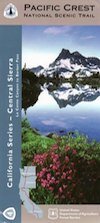
PCT Map #4 Central Sierra Nevada Mountains

Le Conte to Lake Tahoe

Pacific Crest Trail National Scenic Trail
PCT – Hiking Map 4

USDA PCT Map 4

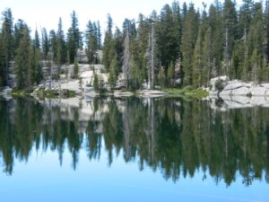
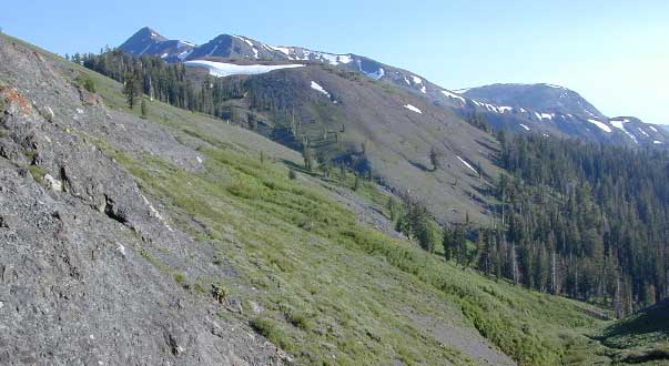
ALPINE LAKES, everywhere!

Sierra Nevada Mountains, spanning from Le Conte Canyon to Barker Pass, on the west side of Lake Tahoe. Kings Canyon National Park northward to Lake Tahoe. Covers most of the High Sierra (N of Whitney) and so much more; from Bishop Pass, Mammoth Lakes, Yosemite National Park, Sonora Pass, Emigrant Wilderness, Ebbetts Pass, Carson Pass, and then overlook the massive mountain lake known as Tahoe. USDA, Large fold out map, durable waterproof paper w/ sturdy cardboard cover. ISBN# 9781593514716

USDA PCT Map 4
USDA PCT Map 4

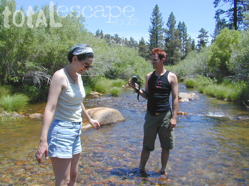
LOCALS TIP: If you must hike only ONE SECTION of the PCT, then this one stretch, LE CONTE to LAKE TAHOE, is by far the best for high altitude beauty.  Granite peaks, passes, total alpine lake bliss, with incredible mountain scenery. When you must limit your big adventure trek, due to time constraints, this portion is some of the most beautiful high elevation terrain in the whole darn nation. Seriously. Better than a movie!

Services like grocery, laundromats, hotels, restaurants, post office, available in SLT (South Lake Tahoe). Postal, food & lodging can be had in numerous locations along certain high country routes – like Vermillion Resort @ Lake Edison. The PCT guide books give good descriptions of these handy trailheads with services, in way more detail.
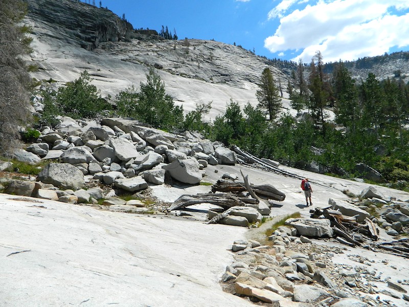
USDA PCT Map 4

Yosemite Granite

see also –
Kearsarge Pass Trail Map
Kings Canyon Highcountry Map
Sequoia Kings NP Maps
Mono Divide Highcountry
Mammoth & Mono Map by NatGeo
Mono Lake Map
Yosemite Maps by NatGeo
Yosemite Maps by Tom Harrison
Emigrant Wilderness Map
Toiyabe National Forest Map
Hoover Wilderness Map
Lake Tahoe Maps

USDA PCT Map 4

Carson Iceberg Wilderness

PCT Map #3 South Sierra

USDA PCT Map 3

PCT Map 3 Southern Sierra Nevada Mountains

Pacific Crest Trail National Scenic Trail
PCT – Hiking Map 3

Tehachapi to La Conte Canyon

Tehachapi Pass, California north to La Conte Canyon @ Kings Canyon National Park. Areas include – Owens Peak Wilderness, Chimney Peak Wilderness, Kennedy Meadows, Deer Mountain, Beck Meadow, Anderson Point, Cow Canyon, Golden Trout Wilderness, Olancha Peak, Grouse Meadow, USDA PCT Map 3Muah Mountain, Cottonwood Lakes, Mount Whitney, Tyndall Creek, Kings Kern Divide, Charlotte Lake, Rae Lakes, Fin Dome, Mount Baxter, Taboose Pass, Vennacher Needle, Mount Jepson, Black Divide, Kings Canyon National Park. USDA PCT Map #3, Large fold out map, durable waterproof paper w/ sturdy cardboard cover. ISBN# 9781593514648

USDA PCT Map 3

Tehachapi

Windmills @ Tehachapi

USDA PCT Map 3

River dip @ Kennedy Meadows

USDA PCT Map 3

Cottonwood Camp

see also –

South Sierra Map
Jawbone Canyon Map
Dome Land Wilderness Map
Golden Trout Wilderness Maps
Sequoia National Forest Map
Inyo National Forest Map
Mount Whitney Trail Maps
Kearsarge Pass Trail Map
Kings Canyon Highcountry Map
Sequoia Kings NP Maps