California Trail Users Coalition

California Trail Users Coalition

The California Trail Users Coalition is a non-profit corporation designed to be a forum for all trail users (hike, mountain bike, horse, wildlife & vehicle) to discuss related issues, problems and alternative solutions; to assist in the planning, development, maintenance and hosting of trails; and to help enforce the rules of the road; and to develop and maintain programs designed to educate users on proper use of trails and trail etiquette.

Find all CTUC Trail Maps @ jawbone.org
jawbone.org/ohvmap/index.php/maps-guides/ctuc-trail-maps
California Trail Users Coalition

avenza maps Avenza Maps, offers apps and digital maps. Below are all the CTUC maps for California.

CTUC: California Trail Users Coalition Digital Maps
OHV,
SVRA, BLM, 4×4, ATV, UTE, SUV

many desert locations, and some mountains

listed from north to south

CTUC Stanislaus NF & Yosemite OHV Map
CTUC High Sierra OHV Map
CTUC Sierra National Forest OHV Map
CTUC Sierra Bass Lake OHV Map

CYUC Inyo National Forest South
CTUC Inyo National Forest North

CTUC Sequoia NF & Kennedy Meadows OHV Map
CTUC BLM Keysville & Sequoia NF OHV Map

CTUC Jawbone Canyon & Randburg OHV Map
CTUC Panamint Valley OHV Map
CTUC Dumont Dunes OHV Map
CTUC Amboy Mojave OHV Map
CTUC Mojave El Mirage OHV Map

CTUC Needles OHV Map
CTUC Blythe OHV Map

CTUC San Bernardino & Barstow BLM OHV Map
CTUC Angeles Forest OHV Map
CTUC Cleveland & Idyllwild OHV Map

CTUC Palm Springs OHV Map
CTUC Ocotillo Wells OHV Map
CTUC Imperial Sand Dunes Map

dirtbikersrandsburg

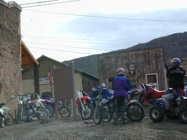
Dirt Bikers @ Randsburg Ghost Town, North Mojave, CA

driftwood

tire

solo_driver

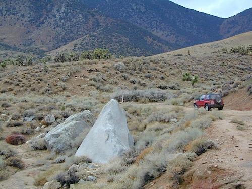
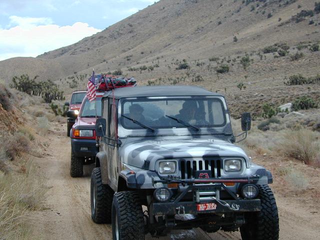
Horse Canyon, North Mojave Desert
Mount Whitney High Country Map


Mount Whitney High Country Trail Map
Whitney High Country Map
Tom Harrison Maps

Mt Whitney is the highest mountain peak in the lower 48!

Mount Whitney High Country Map, Whitney trail map, Topo trails. Tom Harrison Trail Map: Mount Whitney High Country, with Lone Pine California. Pear Lake, Lodgepole, Mineral King, Mt. Whitney Peak, Kern Canyon, Ash Mountain, Whitney Portal, Little Five Lakes, Bearpaw Meadow, Triple Divide Peak, Cottonwoods Lakes, Horseshoe Meadow. Eastern Sierra, High Sierra Backpacking, Mount Whitney Map, Hike, Inyo National Forest, Eastern Sierra, Mount Whitney Map by Tom Harrison, Hike, Inyo National Forest, Eastern Sierra Hikes, Mt Whitney California Topo, Waterproof, Topographic Maps California, Sierra Whitney Hike, High Country Trails, California Sierra Mountains Durable, waterproof plastic map; Folded. Map Scale: 63K; ISBN# 9781877689512

avenza mapsdownload digital version of this map –
Mt. Whitney High Country Map

hikers map

see also –

Mount Whitney Zone Map
Kings Canyon Highcountry Map

Whitney Map

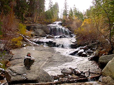
Whitney Portal Falls

A day hike to Mount Whitney and back to the Portal is not possible, so an overnight backpacking trip is a given. High elevations makes for thinner air and more challenging conditions.

Permits are required to hike this popular peak. They limit the amount of people that can be on these trails. A lottery tackles the choice of who gets to go this year. Annual deadline is April 30 @ recreation.gov

Whitney High Country Map

USEFUL LINKS:

Mount Whitney is the tallest mountain in the contiguous United States and the Sierra Nevada, with an elevation of 14,505 feet. It is in East–Central California, on the boundary between California’s Inyo and Tulare counties, 84.6 miles west-northwest of North America’s lowest point, Badwater Basin in Death Valley National Park, at 282 feet below sea level. The mountain’s west slope is in Sequoia National Park and the summit is the southern terminus of the John Muir Trail, which runs 211.9 miles from Happy Isles in Yosemite Valley. The eastern slopes are in Inyo National Forest in Inyo County.

Mount Whitney’s summit is on the Sierra Crest and the Great Basin Divide. It lies near many of the Sierra Nevada’s highest peaks. The peak rises dramatically above the Owens Valley, sitting 10,778 feet or just over 2 miles above the town of Lone Pine 15 miles to the east, in the Owens Valley. It rises more gradually on the west side, lying only about 3,000 feet above the John Muir Trail at Guitar Lake. The mountain is partially dome-shaped, with its famously jagged ridges extending to the sides. Mount Whitney is above the tree line and has an alpine climate and ecology.

nearby towns:

John Muir Trail Books

Find John Muir Trail Maps

John Muir Trail

Photo credit copyright Mike Strickland

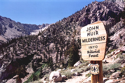
JMT: John Muir Trail & John Muir Wilderness

John Muir Trail Books

John Muir Trail Books

John Muir Trail Books

John Muir Trail Books

John Muir Trail Books

JMT

The John Muir Trail is a long-distance trail in the Sierra Nevada mountain range of California, passing through Yosemite, Kings Canyon and Sequoia National Parks. From the northern terminus at Happy Isles in Yosemite Valley and the southern terminus located on the summit of Mount Whitney, the Trail’s length is 213.7 miles, with a total elevation gain of approximately 47,000 feet. For almost all of its length, the trail is in the High Sierra backcountry and wilderness areas. For about 160 miles, the trail follows the same footpath as the longer Pacific Crest Trail. It is named after John Muir, the famous naturalist.

The JMT is 213.7 miles long. From its northern terminus in Yosemite Valley, the trail runs southeast, passing south of Half Dome and then on to Tuolumne Meadows. From Tuolumne Meadows the trail turns south, running parallel to the main range of the Sierra Nevada, through Yosemite National Park, Inyo and Sierra national forests (including the John Muir Wilderness and Ansel Adams Wilderness), passing through Devils Postpile National Monument, Kings Canyon National Park, and ending on Mount Whitney in Sequoia National Park. From the southern terminus of the JMT at the summit of Mount Whitney, an additional 10.6-mile hike on the Mount Whitney Trail is required to reach the nearest trailhead at Whitney Portal, thus making an end-to-end traverse of the JMT effectively 221 miles.

see also

John Muir Wilderness Map 
PCT Pacific Crest Trail Books

John Muir Trail Books

Little Pot Hole Lake, Kearsarge Pass Hike from Onion Valley

John Muir Trailhead locations:

Mono Lake Map

Mono Lake Map

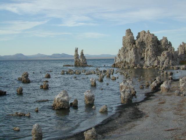
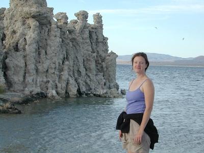
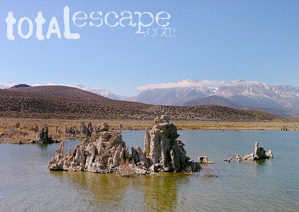
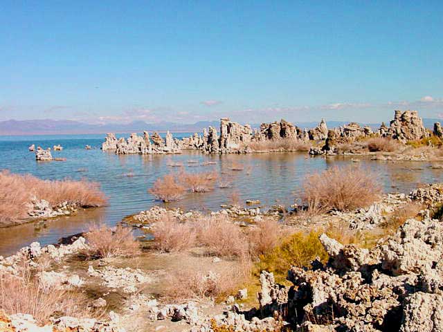
Tufa Towers at Navy Beach, Mono Lake


Mono Lake Topo Map
Mono Lake Topo Map

Mono Lake, Lee Vining & Lundy Canyon

Mono Lake is one of the most popular destinations in the Eastern Sierra region. Tom Harrison is the only topographic map that has all of Mono Lake on one sheet.

Eastern Sierra Lee Vining Trail Map, Lee Vining Canyon South; Areas covered: Lee Vining Hiking, South Tufa Mono Lake, County Park Old Marina, Lundy Canyon, Lundy Topo, Panum Crater.

Durable, waterproof plastic map; Folded. Map Scale: 63K; ISBN# 9781877689789

Mono Lake California 

avenza mapsdownload digital version of this map –
Mono Lake Topo Map

Mono Lake Map

Mono Lake is a saline soda lake in Mono County, California, formed at least 760,000 years ago as a terminal lake in an endorheic basin. The lack of an outlet causes high levels of salts to accumulate in the lake and make its water alkaline.

The high desert lake has an unusually productive ecosystem based on brine shrimp, which thrive in its waters, and provides critical habitat for two million annual migratory birds that feed on the shrimp and alkali flies.

When the city of Los Angeles diverted water from the freshwater streams flowing into the lake, it lowered the lake level, which imperiled the migratory birds. The Mono Lake Committee formed in response and won a legal battle that forced Los Angeles to partially replenish the lake level.

Dissolved salts in the runoff thus remain in the lake and raise the water’s pH levels and salt concentration. The tributaries of Mono Lake include Lee Vining Creek, Rush Creek and Mill Creek which flows through Lundy Canyon.

The basin was formed by geological forces over the last five million years: basin and range crustal stretching and associated volcanism and faulting at the base of the Sierra Nevada.

nearby destinations:

Mono Lake Map

see also –
Ansel Adams Wilderness Map
Bodie Hills Map
Mammoth Lakes Map NatGeo
Toiyabe National Forest Map USDA
Yosemite Highcountry Map

Mono Lake Map


Lundy Canyon
Lundy Lake California