Marble Mountain Wilderness Map

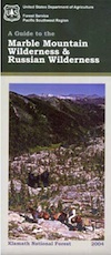
Marble Mountain / Russian Wilderness Map

Marble Mountain Wilderness MapMarble Mountain Wilderness Map USDA

Marble Mountain Wilderness Map

Klamath River / Marble Mountains / Russian Wilderness
Marble Mountain Wilderness

Klamath National Forest

Marble Mountain Wilderness Map

OLDER VERSION

Yreka, Happy Camp, Klamath River, Salmon River, Scott River, Fort Jones, Orleans, Cuddihy Lake, Upper Albert Lake, Russian Wilderness.

Perfect for a day hike reference or extended backpacking adventures. 1″ & 2″ to mile; Waterproof plastic map paper. This map can usually be found at local Ranger Stations. ISBN# 9781593514204

NorCal:
best guide book for wild

Cliff Lake Backpacking Trip, Marble Mountain Wilderness, California, Aug 2007

horse trail maps
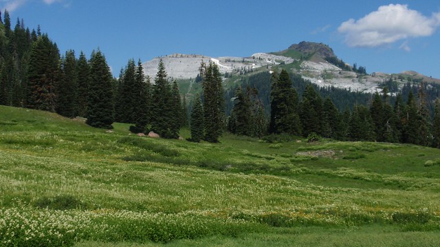
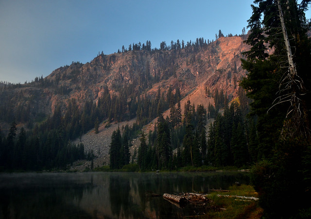
The Marble Mountain  Wilderness is an area of high divides, deep canyons and perennial mountain streams provides habitat for a wide variety of plant and animal life. With more than 7,000 feet of vertical relief, soils from several rock types, and abundant rain and snowfall, the diversity of ecosystems is unequaled anywhere else in the country.

fishing mapWith 89 lakes and two major Wild and Scenic river systems – Wooley Creek and the North Fork Salmon River, as well as 32 miles of the Pacific Crest Trail, there are many recreation opportunities. Elevations range from 400 to 8,299 feet; the wilderness has highly variable terrain with low-elevation canyons and high ridges such as the 22-mile-long English Peak ridge.

Popular activities include fishing, backpacking, mountaineering, rock climbing, and cross-country skiing.

camp map

There are also numerous caves within this wilderness, accessible to prepared spelunkers. They all feature stalactites and other flowstone formations, and are accessible mostly by vertical drops. Due to the hidden nature of most of the cave mouths, caving is not regulated, though the Forest Service and National Speleological Society request only experienced cavers attempt to access these dangerous caves. Signs at the trail heads that access the Marble Rim warn of white nose syndrome. One of the deepest caves in the continental US is located in the wilderness, Bigfoot Cave.

Sky High Basin 05

Summit Lake


Dinkey Lakes Wilderness Map

Dinkey Lakes Map

Dinkey Wilderness

Dinkey Wilderness Map USDA

currently unavailable on Amazon. may be available at local ranger stations

Dinkey Lakes Wilderness Map / Dinkey Lakes Trails / Dinkey Creek Camping

Dinkey Creek and the hike-in only, wilderness lakes are part of a bigger Sierra National Forest

hikerPerfect for a day hike reference or extended backpacking adventures. Scale = 2″ to mile; Usually only found at Ranger Stations – Hard to find maps. Printed on paper; Last updated in 1991.

see also –

Dinkey Lakes Wilderness Trail Map by Tom Harrison

dinkey map

CREEK FIRE 2020: Much of the Sierra National Forest was badly burned in a recent wildfire, but this Dinkey Creek area was spared. The huge fire moved the other direction – from Shaver Lake north and then eastward.

That means this Dinkey Creek Area may become more popular, along with high elevation lakes – Courtright and Wishon Reservoirs – now that this the only unburnt region around.

At least the nearby Sequoia trees in the McKinley Grove didn’t go up in flames.

NOTE: Much of the Sierra National Forest may be closed to the public (for years) due to forest hazards, loggers working, and general fire cleanup. Contact the local USFS Ranger station at Tollhouse to find out what areas are indeed open.

Dinkey Lake Wilderness

Minimal Snow, Maximum Mud

4×4 Fun – Minimal Snow, Maximum Mud


San Jacinto Wilderness Trail Map

San Jacinto Trail Map
Mt San Jacinto Map
Tom Harrison

Tahquitz Peak / Idyllwild Mountains / Palm Springs

Mount San Jacinto Map. Southern California

Tahquitz Peak Climb, Tom Harrison Trail Map: San Jacinto Wilderness CA; Mount San Jacinto State Park Idyllwild Camping Backpacking; San Jacinto Peak, Palm Springs Hiking. Durable, waterproof plastic map; Folded. Map Scale: 42K; ISBN# 9781877689437

San Jacinto Peak, also known as Mount San Jacinto, is a 10,834 foot mountain peak in the San Jacinto Mountains, in Riverside County, California. Lying within Mount San Jacinto State Park it is the highest both in the range and the county, and serves as the southern border of the San Gorgonio Pass.

San Jacinto Map

OLD VERSION

To the east the peak towers over the city of Palm Springs (elevation 479′); to the west, it borders the mountain community of Idyllwild (elevation 5,413′). The steep escarpment of its north face, above Snow Creek, climbs over 10,000′ in 7 miles. This is one of the largest gains in elevation over such a small horizontal distance in the contiguous United States.

tree huggers

Tram Ride to the Top

Tram Ride to the Top

Take the Tram

San Jacinto Peak is easily accessible, as many trails penetrate the Santa Rosa and San Jacinto Mountains National Monument. One popular route starts with a ride on the Palm Springs Aerial Tramway from Valley Station at 2,643′ feet near Palm Springs up to Mountain Station at 8,516′. From there, one can easily climb the mountain face via trails.

Another route is to hike the Marion Mountain Trail near the mountain town of Idyllwild, off Highway 243. The Cactus to Clouds Trail involves an arduous climb of approximately 10,700′ feet from the desert floor in Palm Springs to the summit. This trail has no water sources until 8,500′, so early starts are advised to avoid the temperatures which often soar above 100°F.

San Jacinto Mountains National Monument
San Jacinto State Park
San Jacinto Wilderness

SanJacinto SP

see also –

San Bernardino National Forest Map 
San Bernardino Forest Atlas
San Gorgonio Wilderness Trail Map

Sonoma Maps

Sonoma County Maps

Explore more trails in parks, on beaches, in forests and on mountain peaks with a Sonoma County Trails Map. Covers the whole county and is suitable for all kinds of outdoor recreation.

California Wine Country / Sonoma Map / Hiking Trail Maps
Sonoma Coast State Park, Hiking, Biking, Horseback Trail Maps

horseback


Gualala

nearby towns:

Bodega Bay, CAhikers map
Cazadero, CA
Cloverdale, CA
Duncans Mills, CA
Forestville, CA
Freestone, CA
Geyserville, CA
Glen Ellen, CA
Guerneville, CAfishing map
Healdsburg, CA
Jenner, CA
Kenwood, CA
Monte Rio, CA
Occidental, CA
Petaluma, CA
Santa Rosa, CA
Sea Ranch, CAcamp
Sebastopol, CA
Sonoma, CA
Valley Ford, CA
Windsor, CA

see also –
Mendocino National Forest Map
Mendocino Topo Atlas
Redwoods Map
SF Bay Area Maps
San Francisco Trail Maps