Cuyamaca Rancho State Park Map

Cuyamaca Rancho State Park
San Diego Mountains

cuyamaca map
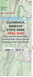
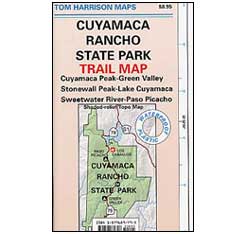
Rancho Cuyamaca State Park Map
Tom Harrison

  • Cuyama Peak
  • Cuyama Lake nearby

Hiking San Diego Mts.
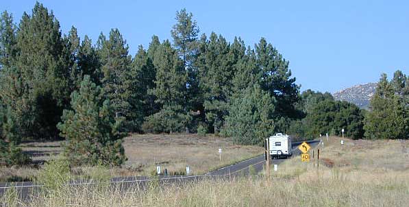
Campground Camping

hikers map
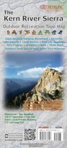
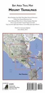
Rancho Cuyamaca State Park inside Cleveland National Forest; Hiking Map San Diego Mountains, Laguna Mountains Camping, Julian Campgrounds, Cuyamaca Peak, Stonewall Peak, Paso Picacho, Lake Cuyamaca, Green Valley Falls, Sweetwater River. Cuyamaca Maps Backpacking San Diego Maps; Durable, waterproof plastic map; Folded. Map Scale: 32K; ISBN# 9781877689796

cuyamaca map

  • campCuyamaca Map
  • climb
  • hike
  • horseback
  • mountain bike
  • picnic
  • waterfalls
Cuyamaca Map

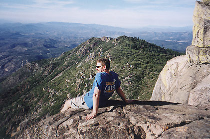
Cuyamaca Peak, East San Diego County

San Diego Hiking Maps

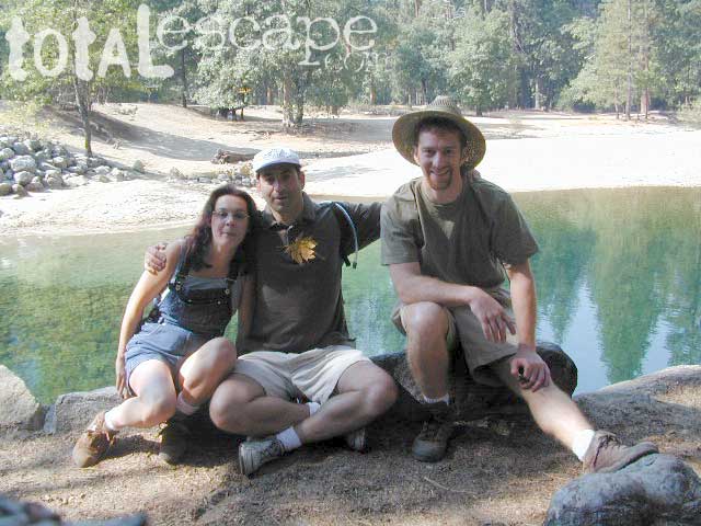
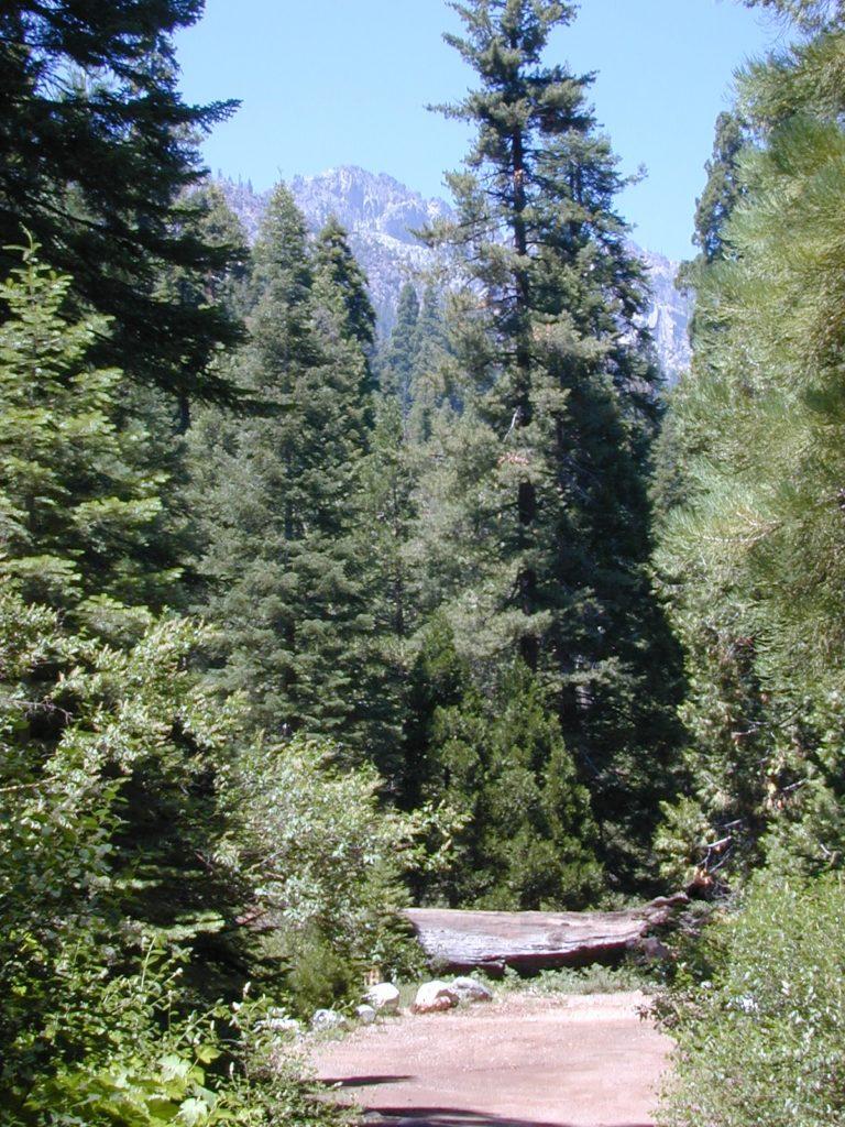
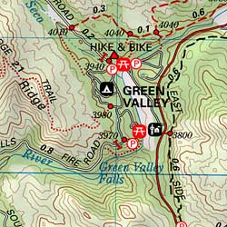
Day use areas and overnight camping in the San Diego mountains. Located along Highway 79, in between Julian and Interstate 8, Rancho Cuyamaca State Park is a popular spot for family camping, day hikes and picnics. Oak foothills, pine forests, meadows, boulder peaks, waterfalls, campgrounds, trailheads and picnicking areas.Cuyamaca Map

  • Cuyamaca Peak
  • Green Valley
  • Lake Cuyamaca
  • Paso Picacho
  • Stonewall Peak
  • Sweetwater River
Cuyamaca Map

older edition

Lake Cuyamaca is a recreation area offering boating, fishing, and camping at the reservoir. Campground, store, cafe, and tackle shop are available at the lake. The small reservoir is stocked with trout annually, and is the only San Diego lake that is able to stock trout all year long.

Conical Middle Peak is above the lake on the east, and North Peak is on the north side. Hiking trails reach the summit of Cuyamaca Peak, located to the southwest of Cuyamaca Reservoir and inside Cuyamaca Rancho State Park.

The dam at Cuyamaca lake is the second oldest in California still in use, completed in 1888. It was built to supply drinking water to the city of San Diego. It was originally piped down to San Diego in wooden flumes. It continues to be part of the municipal water supply system for San Diego County.

cuyamaca maps

see also –

Cleveland National Forest Map
Cleveland Forest Atlas

Mount Laguna Trail Map
San Diego Backcountry Map
San Diego County Trail Map
Pine Creek – Hauser Wilderness Map 
Anza Borrego Desert Map

Merced Tuolumne Rivers Map

Merced & Tuolumne Rivers Map

BLM Merced River

Merced River Map

Merced Tuolumne Rivers MapNational Geographic Trails Illustrated
Merced River & Tuolumne River
NatGeo Map #808

Stanislaus National Forest

NatGeo Wild & Scenic Rivers, Calaveras Big Trees State Park, Ebbetts Pass, Hwy 4, Route 140 Scenic Byways, Pinecrest Lake National Recreation Trail, River Access Points. Campgrounds, trailhead parking, picnic grounds, all paved roads & dirt roads.

Full Color, 2 -sided map. GPS Compatible, Full UTM Grid. Waterproof ISBN# 9781566952415

river map

fishing map

Merced Tuolumne Rivers Map

see also –

Emigrant Wilderness Books
Emigrant Wilderness Maps
Gold Country Maps
Stanislaus National Forest Map
Stanislaus Forest Atlas
Tuolumne Meadows Trail Map
Yosemite Maps by NatGeo
Yosemite Trail Maps by Tom Harrison

Yosemite River Map

Merced River in Yosemite NP

Merced River in Yosemite NP

Golden Trout Wilderness Map

Golden Trout
Wilderness Area Maps

Mtn Home

Golden Trout as seen from Mountain Home SF (2010)

Golden Trout / South Sierra Map
Golden Trout Wilderness USDA
Kern River Gorge
South fork of Kern River
Upper Kern River
Backcountry Sequoia
California

    • backpack trails
    • hiking trails
    • fishing lakes/streams
    • horse packing
    • hot springs
    • kern river
    • horse trails

Tom Harrison
Golden Trout Trail Map

Tom Harrison Map Kern

hiker

Golden Trout Wilderness
and South Sierra Wilderness

NFS

goldentrout
Golden Trout Wilderness Map
US Forest Service USGS

Official Trail Map for the U.S. National Forest Service. Map scale 1:63,360. Contour lines at 80 foot intervals show elevation. Detailed road network shown. Encompassing 475 square miles in the Sequoia and Inyo National Forests. Map Scale = 1″ to mile; Usually only found at Ranger Stations. MAY BE DISCONTINUED. Printed on paper in 1995.

Golden Trout Wilderness Trail Map, Sequoia National Forest, South Sierra Backpacking Maps, Forks of the Kern River Map, Jerky Meadow Trailhead, Big Whitney Meadow, Kern Peak, Coyote Peaks, Grey Meadow, Little Kern River, Kern Canyon, Jordan Hot Springs, Casa Vieja Meadow, Monache Meadows. Topo Sequoia Camping Kern River.

horseback

see also –
Golden Trout Wilderness Trail Map
Dome Land Wilderness Map
South Sierra Wilderness Map
Kern River Maps

goldencold

Creek dipping at Camp 4, Sequoia NF

JERKY MEADOW trailhead Forks of the Kern, located at the end of Sequoia forest road #22S82 also has numerous primitive camp sites located near the Kern Gorge. A moderate day hike will lead to waterfalls, swimming holes and granite bowls like these. Steep trails lead further down to the river 1000′ below. Forks of the Kern, Upper Kern River, Kern Hot Springs, Golden Trout Kern, Golden Trout Wilderness Area, South Sierra, Kern River Fishing, Camping, Backpacking Jerky Trailhead. Kennedy Meadows, California.

recent wildfires in this area:

Windy Fire 2021
Castle Fire / SQF Complex 2020forestKern River Map

Mount Tam Trail Map

Mount Tam Trail Map

Mt Tam Topo Map
Mount Tam Trail Map


Mount Tamalpais Trail Map
Marin Hiking Map
by Tom Harrison

Tom Harrison Trail Maps: Mount Tamalpais Trail Map, Mount Tamalpais State Park Map; Marin County Open Space, Marin Municipal Water District, San Francisco Hiking Maps, San Francisco Hikes, Backpacking Point Reyes. Camping Point Reyes Redwoods. Mount Tam Hiking, Golden Gate National Recreation Area.

Durable, waterproof plastic map; Folded. Map Scale: 24K; ISBN# 9781877689741

    • backpackMount Tam Trail Map
    • camp
    • hike
    • mountain bike
    • picnic


Mount Tam Trail MapMount Tamalpais is considered the birthplace of mountain biking. This State Park is one of the most popular hiking areas in Marin County, California. Mount Tamalpais is the most prominent physical feature north of the Golden Gate in the San Francisco Bay area. Its slopes are covered with a variety of forests, hiking and biking trails, accessible from trailhead and campgrounds around its perimeter.

california

other local maps for
Marin County & Mount Tamalpais:

Mt Tamalpais Map

Muir Woods Map Marin

nearby towns:

Mount Tam Trail Map

see also –
Point Reyes Map
All Mount Tamalpais Maps