Flagstaff Sedona Map

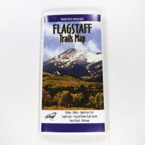
NatGeo Trails Illustrated
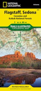
Flagstaff Sedona Map #856

NatGeo AZ map

Sedona Camping & Hiking Trails
Flagstaff Arizona, Sedona, AZ Hikes, Campgrounds

Map covers Coconino National Forest, Kaibab National Forest, South Rim Grand Canyon, Kachina Peaks, Kendrick Mountain, Strawberry Crater Wilderness Area, San Francisco Peaks, Arizona Trail, Game Management Units, Cinder Hills OHV Area. GPS Compatible, Full UTM Grid. National Geographic, Waterproof Plastic Map, ISBN# 9781566955157

Flagstaff Sedona MapSedona Map of Arizona, Northern Arizona Tourism, Arizona Maps, Flagstaff AZ, Flagstaff Hiking, Camping North AZ

Flagstaff Sedona Map

Trail Map Flagstaff

see also – 

Grand Canyon Maps
Mojave National Preserve Map

Red Rock Canyon Vegas
Lake Mead NRA Map
Anza Borrego Desert Map
San Diego Backcountry Maps

Cleveland National Forest Map

San Diego Mountains
Cleveland Forest Map

2010 Map Cleveland

NFS – USDA – U.S. Forest Service
Cleveland Forest Map / San Diego Mountains
Cleveland National Forest Map
Cleveland National Forest

Mount Laguna, Sunrise Highway, Palomar Mountain, Julian, Cuyamaca, San Diego Mts, OC, Ortega Highway, Wildomar OHV, TemeculaCleveland National Forest Map

WATERPROOF MAP plastic & tear resistant. Ranger Map – NFS issued map. GPS: Longitude & Latitude; Rivers, Creeks, Peaks, Elevations, 4WD & every dirt BackRoad, Hot Springs, Equestrian Areas, all Campgrounds, Hiking Trails & BackPacking Trailheads. Areas include: Southern California, Orange County, Palomar Mountain, San Diego Backcountry, Julian, Descanso, Ramona, Rancho Cuyamaca, Ortega Hwy. 74, Tucker, Trabuco Canyon, San Mateo Canyon, Caspar, San Juan Capistrano Hot Springs, Mount Laguna, Lake Cuyamaca, Wildomar, Corral Canyon, Lake Morena. Also available en espanol. Quality USDA maps created for the National Forest Service. Size: 36″x 43″ overall / 4″x9″ folded; Printed on plastic map paper in 2006. ISBN# 9781593514983

Laguna Meadows

Laguna Meadows

Cleveland National Forest Map

USDA cleveland NF

OLDER EDITION 2006

see also –
Anza Borrego Desert Map
Cleveland Forest Atlas
Pacific Crest Trail Map #1
Pine Creek / Hauser Wilderness Map
Rancho Cuyamaca Hiking Map
San Diego Backcountry Map

Cleveland National Forest Map

Snow @ Mount Laguna, CA

Southern California Forest / San Diego Mountains: Cleveland National Forest

San Diego Mountains

Fred Canyon off I-8

Cleveland National Forest Map: San Diego Hiking, Mount Laguna, Palomar Mountain, Julian, Cuyamaca, Ortega Hwy, Cleveland National Forest Map, Topo, Atlas, San, Diego, Mountains, San Diego Mountains, Laguna Mountains, Anza Borrego West

  • antiques
  • backpack
  • bike
  • boulders
  • camp
  • desert canyons
  • dirt bike routes
  • dirt roads
  • fish
  • forests
  • hang glide
  • hike
  • historical sights
  • horseback ride
  • hot springs
  • hunt
  • meadows
  • mines
  • mountain bike
  • observatory
  • off road routes
  • picnic
  • sightsee
  • stagecoach route
  • stargaze
  • train museum
  • wildflowers
  • wildlife
Oriflamme

Oriflamme Canyon, Mason Truck Trail

Columbia River Map

Columbia River Gorge

On the border between Oregon and Washington state, this huge river gorge is a recreation paradise. Fishing, camping, kayaking, wind surfing, hiking and much more.

Columbia River Gorge National Scenic Area

USDA Columbia River
Columbia River Map NFS

Columbia River Camping, Oregon Hikes, Columbia River Gorge Campgrounds

Recreation Map Oregon Washington. Topographic Map. Pacific Northwest Recreation, Outside in Oregon, Columbia River National Scenic Area, Maps, Mount Hood National Forest, Gifford Pinchot National Forest

On the borders of southern Washington state and the north boundary of Oregon lies the Columbia River Gorge, which cuts through the Cascade Mountain Range, and is the deepest, spectacular river canyon on the entire west coast. 80 miles long and 4,000′ deep. Bird watching, boating, camping, fishing, hiking, mountain biking, picnicking, rock climbing, windsurfing, wildflowers. Waterfalls in Oregon. Multnomah Falls is the second highest in the United States.

Map Scale: 1 inch = 1 mile; BLM & USDA. Printed in 2007 on waterproof plastic. This map can also be found at USFS Ranger Stations.

Columbia River Map

National Geographic has a full color map for this region

Columbia River Gorge NSA
Map #821

Columbia River Map

Mt Hood OR

Mount Hood Map, Columbia River Gorge
MAP PACK (2 map set)
National Geographic – Trails Illustrated Map

Coconino National Forest Map

Coconino Forest Map

coconino map

Camping Prescott / Arizona Map Prescott / AZ National Forest Maps

hikers mapUSDA Coconino National Forest Map, Prescott National Forest Map, Prescott Arizona Hiking Map, Williams AZ, Prescott Backpacking Maps, Topo Map AZ, Chino Valley, Camp Verde, Fort Verde, Hiking Sycamore Canyon Wilderness, Red Rock Secret Mountain Wilderness Pine Mountain, Cedar Bench AZ, Mingus Mountain Campground, Powell Springs, Apache Creek Wilderness, Juniper Mesa Wilderness, Granite Mountain Wilderness, Granite Mtn. AZ, Castle Creek Wilderness Map. Waterproof plastic map paper. Printed in 2013. ISBN# 9781593512439

Coconino Map

OLDER VERSION

Explore the super scenic deserts of the Southwest US. These current Arizona Maps will help with road trip planning, sightseeing, driving routes, overnight camping and lodging options, not to mention trailheads, forest boundaries and flowing creeks. Discover more wilderness and less people, with a detailed, official USDA map.

Scenic views of red rock canyons, stands of old-growth pine, streams, lakes, golden aspen groves in autumn, and snow covered slopes in the winter.  Backpacking, hiking, horseback riding, mountain biking, snow ski.

Coconino National Forest covers 1.8 million acres – varying from enchanting semi-arid desert, magnificent ponderosa pine forests, to incredible views from alpine tundra. Elevations range from 2,600′ in canyon bottoms to 12,643′ at the peak of San Francisco Mountain.


camping maps

see also – 

Flagstaff Sedona Map by NatGeo
Anza Borrego Desert Map