Santa Barbara Books

Santa Barbara Books

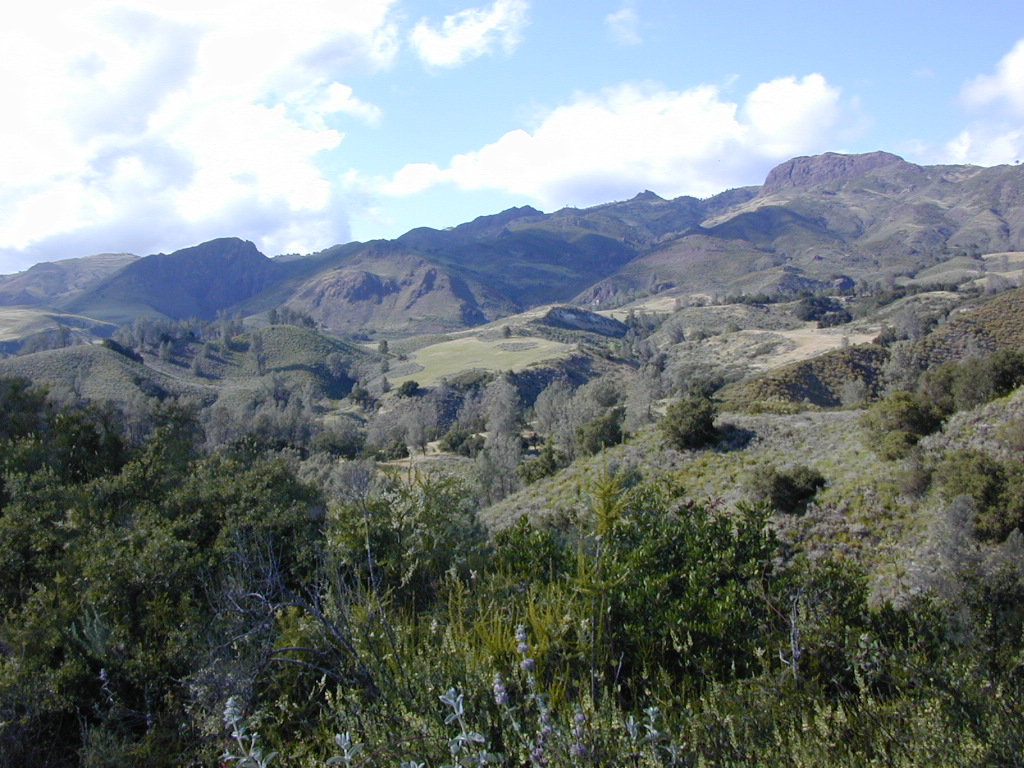
Figueroa Mountain of the Santa Barbara Backcountry

Find Los Padres National Forest Map

Find Sespe Wilderness Trail Map

Find Channel Island National Park Map

Books on the Santa Barbara Coast & the Santa Barbara Mountains

Santa Barbara Books


Santa Barbara Books

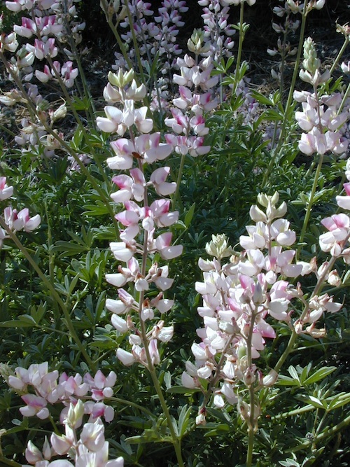
Peppermint Lupine @ Figueroa Mountain Road

Santa Barbara is a coastal city in Santa Barbara County, California, of which it is also the county seat. Situated on a south-facing section of coastline, the longest such section on the West Coast of the United States, the city lies between the steeply rising Santa Ynez Mountains and the Pacific Ocean.

In addition to being a popular tourist and resort destination, the city has a diverse economy that includes a large service sector, education, technology, health care, finance, agriculture, manufacturing, and local government.

The city is served by Santa Barbara Airport and train service is provided by Amtrak, which operates the Pacific Surfliner, which runs from San Diego to San Luis Obispo. The Santa Barbara area is connected via U.S. Highway 101 to Los Angeles (100 miles to the southeast) and San Francisco (325 miles to the northwest).

Behind the city, in and beyond the Santa Ynez Mountains, is the Los Padres National Forest, which contains several remote wilderness areas. Channel Islands National Park and Channel Islands National Marine Sanctuary are located approximately 20 miles offshore.

Santa Barbara Mountains:

Santa Barbara Books

Oregon Hiking Books

Oregon Hiking BooksPNW
The Pacific Northwest region covers both Washington and Oregon, which are directly north of California. Abundant mountains with forests, rivers and waterfalls.

Hiking Books for Oregon State

Oregon Hiking Books Oregon Hiking Books

Oregon is a state in the Pacific Northwest region of the United States. The Columbia River delineates much of Oregon’s northern boundary with Washington, while the Snake River delineates much of its eastern boundary with Idaho. The 42° north parallel delineates the southern boundary with California and Nevada.

Oregon is one of the most geographically diverse states in the U.S., marked by volcanoes, abundant bodies of water, dense evergreen and mixed forests, as well as high deserts and semi-arid shrublands. Mount Hood, a stratovolcano, at 11,249 feet elevation is the state’s highest point. Oregon’s only national park, Crater Lake National Park, comprises the caldera surrounding Crater Lake, the deepest lake in the United States. The state is also home to the single largest organism in the world, Armillaria ostoyae, a fungus that runs beneath 2,200 acres of the Malheur National Forest.

Because of its diverse landscapes and waterways, Oregon’s economy is largely powered by various forms of agriculture, fishing, and hydroelectric power. Oregon is also the top timber producer of the contiguous United States, and the timber industry dominated the state’s economy in the 20th century. Technology is another one of Oregon’s major economic forces.

Oregon is 295 miles north to south at longest distance, and 395 miles east to west. With an area of 98,381 square miles, Oregon is slightly larger than the United Kingdom. It is the ninth largest state in the United States. Crater Lake National Park, the state’s only national park, is the site of the deepest lake in the United States at 1,943 feet.


canoe Oregon Hiking Books

see also – 

Columbia River Map
Oregon Dunes Map
Rogue River Float Guide
Rogue River National Forest Map 

Baja Map Mexico

Detailed Map of Baja Mexico
Baja California MX

Camping Gonzaga Bay

Camping Gonzaga Bay

2021 – New MAP for Baja!!!

Benchmark Baja California
Road & Recreation Atlas

Baja Map Mexico

Release date MAY 2021 – announcing a brand new atlas for Baja California, created by none-other than Benchmark Maps. 

Baja Map Mexico

National Geographic has Adventure Maps for Baja California

full color, 2 sided, waterproof, tear resistant, topographic maps

NatGeo Baja Map NORTH
(Baja Norte)

This travel map covers from San Diego down to Bay of LA. Norte map covers the US/Mexico border from Tijuana to Mexicali, including border crossings, as well as Ensenada & Tecate. Inset maps give extensive detail to these areas: The southern side shows Valle de los Cirios, Bahia de los Angeles, Native Rock Paintings of the Sierra de San Francisco and Whale Sanctuary of El Vizcaino.

Baja Map Mexico

OLDER VERSION

hiking

NatGeo Baja Map SOUTH
(Baja Sur)

The sparsely populated southern half of the peninsula has some of the Gulf of California Islands. The southern side covers the state capital La Paz, Cabo San Lucas, San Jose del Cabo, and Todos Santos. Inset maps give extensive detail to some of these popular areas.

Baja Map Mexico

OLDER VERSION

hiking

Baja Map Mexico

Dining Out in Baja

National Geographic Adventure Map Pack
Baja California 2 Map Set

Baja Map Mexico

OLDER EDITION

Baja Map Mexico

La Paz Coast Baja – Sea of Cortez

see also – 

Baja Almanac
Baja California Books

Santa Monica Mountains Map

Santa Monica Mts National Recreation Area, NatGeo Map #253

Santa Monica Mountains Map

Santa Monica Mountains Map

Santa Monica Mountains NRA

  • Los Angeles Hiking
  • Backbone Trail
  • Malibu Hikes
  • Coastal Mountains

Trails Illustrated Map from National Geographic. Santa Monica Mountains NRA Map #253. Santa Monica Mountains National Recreation Area, California. Leo Carrillo, Malibu Creek, Point Mugu, Topanga State Parks. Zuma Canyon, Trancas Canyon. Horse trails too. Biking, Camping & Hiking Map. Very detailed & colorful. Waterproof Plastic Map; Tear Resistant. UTM grid printed on map to aid with GPS navigation. ISBN# 9781566954471

Map details the largest urban park in the US, with terrain spanning from Point Mugu State Park to Will Rogers State Beach. Key areas of interest including Runyon, Franklin, Mission, and Tuna Canyons; Las Virgenes Canyon Open Space; Zuma Trancas Canyons; Marvin Braude Mulholland Gateway, Rustic Canyon, and Temescal Canyon parks; Paramount Ranch; and State Parks of Topanga, Malibu Creek, Point Mugu, and Leo Carrillo.

Miles of trails including the popular Backbone Trail, this map can guide you off the beaten path and back again whether you’re traveling by foot, bike, or horse. The Mulholland Scenic Corridor is noted for those wishing to take in the scenery by car. Other features found on this map include: Agoura Hills, Beverly Hills, Calabasas, Camarillo, Culver City, Encino Reservoir, Franklin Canyon Reservoir, Malibu, Point Dume, San Fernando Valley, Santa Monica, Santa Monica Mountains, Santa Monica Mountains National Recreation Area, Sepulveda Dam, Stone Canyon Reservoir, Thousand Oaks.

  • backpack

    Santa Monica Mountains Map

    older version

  • camp
  • mountain bike
  • hike

Santa Monica Mountains Map

Santa Monica Mountains Map

see also –Santa Monica Mountains Map

LA Hiking Maps

Malibu State Park Map
Point Mugu State Park Map
Topanga Canyon Map
Zuma Canyon Map