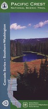
PCT Map #9 S Washington

PCT Map 9 Southern Washington State

Pacific Crest Trail
Pacific Crest National Scenic Trail
PCT – Hiking Map 9

USDA PCT Map 9

Columbia River to Snoqualmie Pass

Cascade Mountains in Washington state. Areas include – Norse Peak Wilderness, Chinook Pass, Green Pass, Tacoma Pass, Government Meadow, William O Douglas Wilderness, Old Snowy Mountain, White Pass, Carlton Pass, Tieton Pass, Panther Creek Campground, Crest Horse Camp, Goat Rocks Wilderness, Sawtooth Mountain, Surprise Lakes Campground, Wind River, Horse Camp, Indian Heaven Wilderness. USDA National Forest Map. Large fold out map, durable waterproof paper w/ sturdy cardboard cover. ISBN# 9781593515379

USDA PCT Map 9

see also –

Columbia River Map
PCT Map #10 N Washington
PCT Map #8 N Oregon

PCT Map #8 N Oregon

PCT Map 8 Northern Oregon

Pacific Crest TrailUSDA PCT Map 8
Pacific Crest National Scenic Trail
PCT – Hiking Map #8

Cascade Mountains of North Oregon

Pacific Crest Trail Map: Pacific Crest Trail National Scenic Trail PCT – Map #8 (Cascade Mountains – Northern Oregon). Odell Lake to Columbia River OR; Areas include – Three Sisters Wilderness, Yapoah Crater, Obsidian Cliffs, Barlow Pass, McKenzie Pass, Santiam Pass, Timberline Trail, Three Finger Jack, Mount Jefferson, Minto Pass, North Cinder Peak, Opie Dilldock Pass, Shale Lake, Mount Washington, Jack Lake, Duffy Butte, Maxwell Butte, Cathedral Rocks, Grizzly Peak, Big Lake, Marion Lake, Dee Wright Observatory, Lava Camp, Timothy Lake, Warm Springs Indian Reservation, Pinhead Butte, Olallie Meadow, Olallie Lake, Campbell Butte, Odell Lake, Waldo Lake Wilderness, Gold Lake, Elk Lake, Wickiup Plain, Hosmer Lake, ,Mink Lake, LeConte Crater, Irish Taylor Campground, Taylor Butte, Packsaddle Mountain, Jude Lake, Breitenbush Lake, Koosah Mountain, Stormy Lake, Bobby Lake, Charlton Lake, Williamette Pass, Separation Creek, Basin Point, Mark O Hatfield Wilderness, Mount Hood Wilderness, & Columbia River. Large fold out map, durable waterproof paper w/ sturdy cardboard cover. ISBN# 9781593515454

USDA PCT Map 8

USDA PCT Map 8

National Geographic Trails Illustrated PCT Maps

The Pacific Crest Trail Map Pack Bundle of Oregon includes 2 Topographic Map Guides that cover the entire PCT as it traverses the incredible terrain of the Beaver State. The maps start at the lowest point of the PCT, Cascade Locks, where it passes over the Columbia River, and continue past the many volcanic cones of the Cascade Range. The Oregon South booklet ends at the border of California in the Siskiyou Mountains.

The PCT spans 2,650 miles from the Canadian border, through Washington, Oregon, and California to the southern terminus at the Mexican border. The famous trail crosses some of the most wild and scenic landscapes of the western U.S., including six national parks, 25 national forests, 48 wilderness areas, the volcanic Cascade Range of the Pacific Northwest, the snowcapped Sierra Nevada, and the Mojave and Sonoran deserts.

Each PCT Topographic Map Guide includes detailed topographic maps at a scale of almost 1 inch = 1 mile. Each page is centered on the PCT and overlaps with the adjacent pages so there is little chance of getting lost. Along the bottom of each page is a trail profile that shows the distance between camping areas, trailheads, and other points of interest. The map and trail profile provide a step by step visual guide to hiking the trail, mile by rugged mile.

National Geographic Reference Map for PCT


see also –

Columbia River Map
Oregon Books
Oregon Dunes Map
Rogue River Guide Book

Red Buttes Wilderness Map

Red Buttes Wilderness Map

Red Buttes Map USDA

This map is outta print!
Check Ranger Stations for availability. (see below)

hikers mapRed Buttes Wilderness Map Oregon
Siskiyou National Forest Applegate Ranger District, Rogue River National Forest

OR Topo Maps, Oregon Maps backpacking, hiking, camping, fishing; Illinois Valley Cave Junction, Klamath River California, RedButtes Wilderness Hiking Map, Topo Red Buttes Oregon, Applegate River Topographical Hiking Maps Northern California, Siskiyou NFS, Siskiyou Forest, Whiskey Ridge, at the California Oregon border.

Sierra map

Red Buttes Wilderness is situated in both Oregon and California and includes the crest of the Siskiyou Mountains between the Rogue River and Klamath River drainages. The wilderness is 13 miles long and 6 miles wide, with elevations ranging from 2,800′ in Butte Fork Canyon to 6,740′ at the east summit of the Red Buttes.

The main waterways that flow through Red Buttes Wilderness are all part of the Rogue River watershed, including the Butte Fork and the Middle Fork of the Applegate River, as well as Sucker Creek, a tributary of the Illinois River. The Wilderness contains the headwaters of the Illinois River.

Red Buttes Wilderness takes its name from the dominant peak along the Siskiyou Crest; because of its high iron and magnesium content, the butte’s rock is a reddish-orange color.

The Siskiyou Mountains are part of the larger Klamath Mountains Province of southwestern Oregon and northwestern California, and they include some of the oldest rocks in the region.

The former ocean-bottom sediments that make up most of the Wilderness are several hundred million years old. Over time they were slowly changed by pressure and heat into the complex variety of metamorphic rocks present today: schist, quartzite, gneiss, and several outcrops of white marble. During the last ice age small glaciers sculpted the Siskiyou basins that now contain lakes and meadows.

Red Buttes Wilderness Map

Closest USFS stations:

Happy Camp Ranger Station
Oak Knoll Ranger District
63822 Highway 96,
Happy Camp, CA 96039
530-493-2243

US Forest Service: Star Ranger Station
6941 Upper Applegate Rd,
Jacksonville, OR 97530
541-899-3800

fishing map

see also –

Oregon Dunes Map
Rogue River Float Guide
Rogue River National Forest Map
Columbia River Map
PCT Map #7 Southern Oregon
PCT Map #8 Northern Oregon


Baja California Maps

Baja Road Trip Map
Baja California Mexico

Baja Road Trip Map

Benchmark Baja California
Road & Recreation Atlas

Baja Map Mexico

New atlas for Baja California MX, created by Benchmark Maps.
Released MAY 2021

Baja Map Mexico

old baja almanacDecent printed Baja Maps are always hard to come by. If you are seeking a hard copy Baja Road Trip Map, then the links below may help you find one.
Historic Baja Almanac >

Landon’s legacy will always live on with the amazing map that he created; published between 1997-2009. The Baja California Almanac is regarded as the best topographical map of the Baja California peninsula. This map book has been out of print since 2010 and finding one on eBay or Amazon is often difficult.

baja trail mapLandon S. Crumpton (RIP) * dirt biker turned map maker

baja foldout map

OLD fold-out MAP

This smaller Baja fold out map was a once-off map publication that was printed in the mid-2000s, but it is impossible to find now. Originally selling for a mere $5.95, they were quickly outta stock and never to be seen again.

Furthermore, if you are seeking to travel Baja California in depth, may we suggest a GPS unit; and downloading the more relevant, digital maps over at Baja GPS Guide. They have newer digital maps for this region. Claiming to be the most detailed map of Baja, Copper Canyon, and mainland Mexico. NOTE: must own a compatible GPS for this map. BAJA & MEXICO E32 TOPO MAP

baja maps

Gonzaga Bay, Baja California Mexico

Explore Baja: Petroglyphs, Back Roads, Surf Spots, Fishing Maps, Off Road Routes, Mountains, Deserts, Camping, Beaches, Sea of Cortez; in particular, these popular favorite south-of-the-border destinations Guadalupe Canyon Hot Springs and Mikes Sky Ranch

Several notable Baja California towns:camp maps

baja California atlas

OUT OF PRINT

4x4 maps

Surf Baja Road Trip Map

Surf Baja California


National Geographic makes Baja Maps!

maps of Baja California

Baja Road Trip Maps (2 pack) by NatGeo