PCT Map #10 N Washington

PCT Map 10
North Washington State

PCT WA

Pacific Crest Trail
Pacific Crest National Scenic Trail
PCT – Hiking Map 10
hiker

Northern Washington State

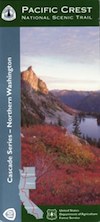
Farthest north portion of the Cascade Mountains, inside Washington state. Spans from central Washington to the PCT’s top end point at the Canadian border. USDA National Forest Map. Large fold out map, durable waterproof paper w/ sturdy cardboard cover. ISBN# 9781593515348

top of PCT map

see also –

PCT Map 9 – South Washington

Washington Hiking Books

Washington Hiking BooksPNW
The Pacific Northwest region covers both Washington and Oregon, which are directly north of California. Abundant coastlines, waterways, islands, with mountains with forests, rivers and waterfalls. Summer is the best time to camp in this state, as it rains most often in other months.

Books for Washington State: Hike, Bike, Fish, Kayak, Explore

Washington Hiking Books


Washington Hiking Books


Washington Hiking Books

see also – 

Columbia River Map
PCT Map 9 – Southern Washington
PCT Map 10 – Northern Washington