Sequoia Books

Sequoia Groves in California

Find Maps for Kern River Canyon
(Sequoia National Forest)
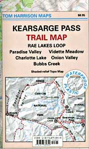
Find Kings Canyon High Country Map
Find Maps for Kings Cyn & Sequoia National Parks

Books on the Southern Sierra Mountains, Calaveras Big Trees, Sequoia National Forest & Sequoia National Park

Sequoia Books

Sequoia Books

Sequoia Books

Sequoia Books

Sequoia Books

Sequoia Books

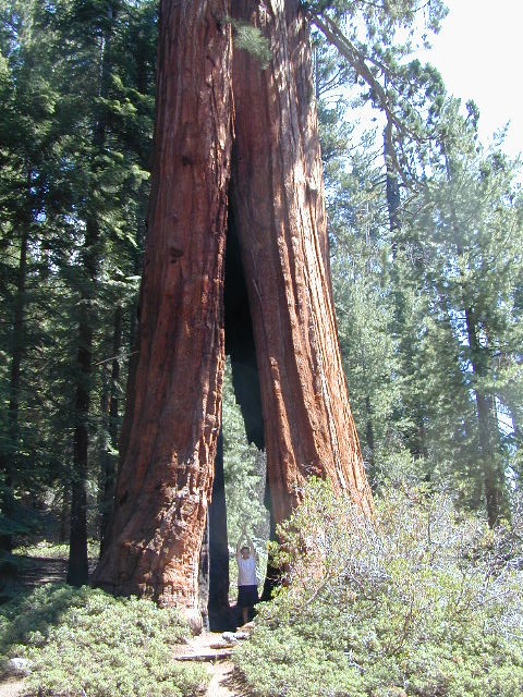
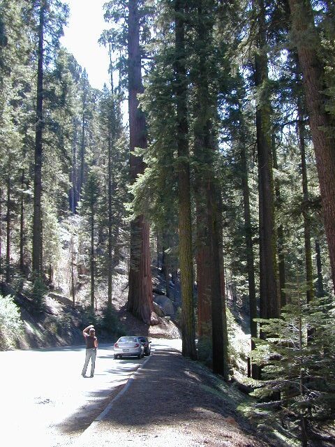
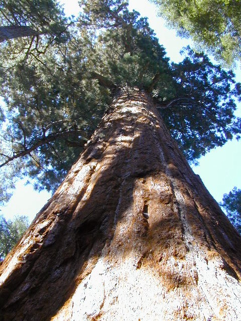
Giant Sequoia are the most massive individual trees in the world. They grow to an average height of 164–279 feet with trunk diameters ranging from 20–26 feet. Record trees have been measured at 311 feet tall. The specimen known to have the greatest diameter at breast height is the General Grant tree at 28.9 feet.

The oldest known giant sequoia is approximately 3,200 years old based on dendrochronology. Giant sequoias are among the oldest living organisms on Earth. Giant sequoia bark is fibrous, furrowed, and may be 3 feet thick at the base of the columnar trunk. The sap contains tannic acid, which provides significant protection from fire damage. The leaves are evergreen, awl-shaped and arranged spirally on the shoots.

The giant sequoia regenerates by seed. The seed cones are 1–3 inches long and mature in 18–20 months, though they typically remain green and closed for as long as 20 years. Each cone has 30–50 spirally arranged scales, with several seeds on each scale, giving an average of 230 seeds per cone. Seeds are dark brown, yellow-brown wing along each side. Some seeds shed when the cone scales shrink during hot weather in late summer, but most are liberated by insect damage or when the cone dries from the heat of fire. Young trees start to bear cones after 12 years.

Sequoia Books

Giant Sequoia Trees on Western Divide Highway


Sequoia Kings Canyon Maps

Sequoia Maps
Kings Cyn Map

Roaring River Falls
One of the most visited areas of the Sierra Nevada Mountains – Kings Canyon & Sequoia NP sit next door to each other, just south of Yosemite National Park.

Kings Canyon National Park has a deep granite gorge with lower elevations, along the Kings River (the longest river in the Sierra). Plus Kings also has an expansive back-country – accessible only by foot, to High Sierra peaks and many alpine lakes.

On the south side, Sequoia National Park has a higher terrain with a highway skirting the ancient groves, on the west side of the Sierra range.

Several Maps for this Sierra National Parks region:NPS

Sequoia Kings Canyon Maps

Sequoia Kings Map

Sequoia Kings Canyon
NatGeo Map #205


Trails Illustrated Map from National Geographic. NatGeo map #205. Sequoia National Park Map w/ Kings Canyon National Park. Mount Whitney, Giant Sequoia National Monument, John Muir Wilderness, Pacific Crest Trail. Topographic Hiking Maps, Sequoia Backpacking, Sequoia Camping, Sierra Lakes. Back Roads, Kings River Camping & Hiking Map.

Very detailed & colorful. Waterproof Plastic Map; Tear Resistant. GPS data. Scale 1:80,000 Contour Interval = 100 feet. Updated 2013. ISBN# 9781566952989

Sequoia Kings Canyon Maps

Kings Canyon Highway 180

  • backpack
  • camp
  • canyons
  • climb
  • creeks
  • fish
  • hike
  • horseback
  • lakes
  • mountain peaks
  • picnic
  • rivers
  • waterfalls

hiker

pinetree

Sequoia National Park &
Kings Canyon NP

Generals Highway Map

Sequoia Kings Canyon Maps

Sequoia Kings Canyon Maps

CALIFORNIA HWY 198: The Generals Highway is the main paved road that runs the ridge, north to south inside Sequoia National Park.  Since they have named the giant redwood trees after famous military generals, the road name mirrors that theme.

Now-a-days, our ancient and massive trees are fighting for their lives in a new type of war. Wildfires, drought and bark beetle infestations are taking their toll and killing these beauties. They have stood the test of time for thousands of years and withstood fires in the past, but recent blazes are hotter and more destructive than previous.

Kings Canyon Highway 180: A long, scenic, dead end road which descends dramatically into the river canyon. Elevation spans from 6600′ at Grant Grove to 4000′ at Cedar Grove at the end of the paved route.

biggest115

Kearsarge Pass Trail Map

Kearsarge Pass to Rae Lakes Loop
High Sierra, Eastern Sierra

Kearsarge Pass Map
Rae Lakes Loop Hike
Tom Harrison Maps

Kearsarge Pass Trail Map, Rae Lakes Loop, Onion Valley Hikes, Hiking John Muir Backpacking Maps Rae Lakes Loop. Onion Valley Campground; Eastern Sierra Trails, Kings Canyon High Country; Eastern Sierra, High Sierra Maps; Areas include: Rae Lakes Loop, Paradise Valley, Vidette Meadow, Charlotte Lake, Onion Valley, Bubbs Creek.

Durable, waterproof plastic map; Folded. Map Scale: 42K; ISBN# 9781877689840

avenza mapsdownload digital version of this map –
Kearsarge Pass Map

hikers map

National Forest Maps
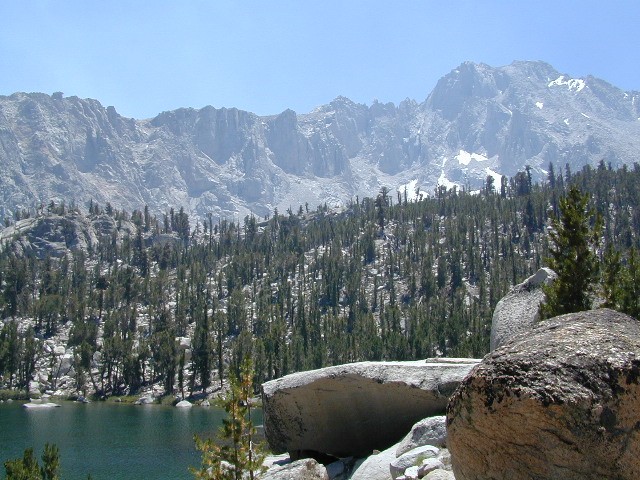
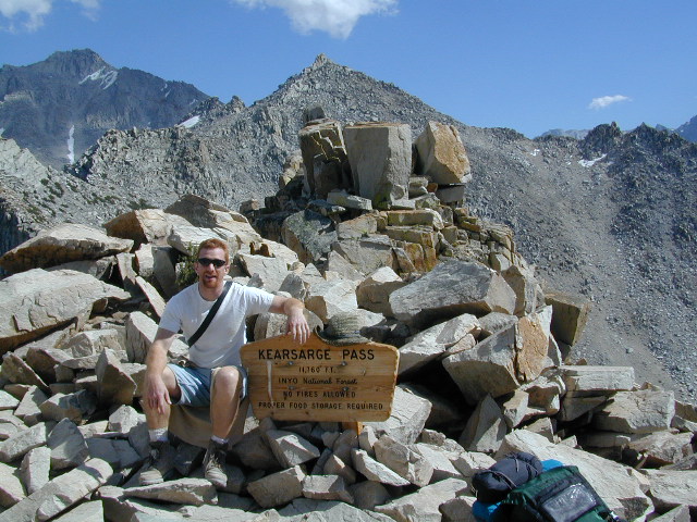
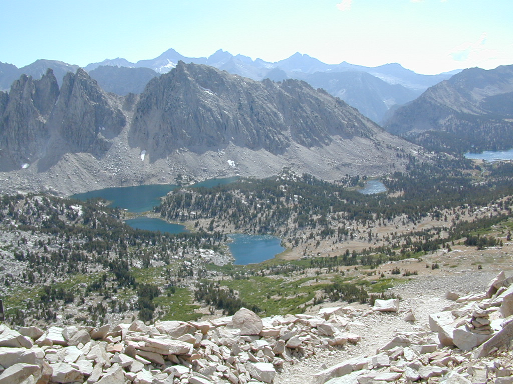
Onion Valley Campground NFS
@ 9200′ elevation

Kearsarge Pass @ 11,835′ elevation

  • alpine lakes
  • backpacking
  • camping
  • climbing
  • fishing lakes
  • hiking
  • horse packing
  • granite peaks & pinnacles
  • waterfalls
  • wilderness
  • wildflowers

horse trail maps

see also –

Kings Canyon Highcountry Map
Sequoia Kings NP Map by NatGeo
Sequoia Kings NP Map by Tom Harrison
Inyo National Forest Map
Inyo Topo Atlas
John Muir Wilderness Maps

wow scenery

High Sierra Lakes Loop Hikes

nearby towns:
Big Pine, CA
Independence, CA
Lone Pine, CA

Kearsarge Pass Map

OLD EDITION

Kearsarge Pass Map

Hike Kearsarge Pass

Kearsarge Pass Map

RAE LAKES LOOP – OLD MAP

Kearsarge Pass Map

Kings Canyon High Country