Columbia River Map

Columbia River Gorge

On the border between Oregon and Washington state, this huge river gorge is a recreation paradise. Fishing, camping, kayaking, wind surfing, hiking and much more.

Columbia River Gorge National Scenic Area

USDA Columbia River
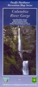
Columbia River Map NFS

Columbia River Camping, Oregon Hikes, Columbia River Gorge Campgrounds

Recreation Map Oregon Washington. Topographic Map. Pacific Northwest Recreation, Outside in Oregon, Columbia River National Scenic Area, Maps, Mount Hood National Forest, Gifford Pinchot National Forest

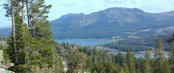
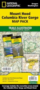
On the borders of southern Washington state and the north boundary of Oregon lies the Columbia River Gorge, which cuts through the Cascade Mountain Range, and is the deepest, spectacular river canyon on the entire west coast. 80 miles long and 4,000′ deep. Bird watching, boating, camping, fishing, hiking, mountain biking, picnicking, rock climbing, windsurfing, wildflowers. Waterfalls in Oregon. Multnomah Falls is the second highest in the United States.

Map Scale: 1 inch = 1 mile; BLM & USDA. Printed in 2007 on waterproof plastic. This map can also be found at USFS Ranger Stations.

Columbia River Map

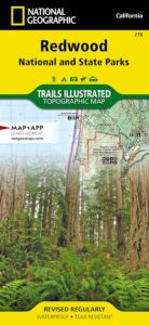
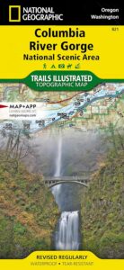
National Geographic has a full color map for this region

Columbia River Gorge NSA
Map #821

Columbia River Map

Mt Hood OR

Mount Hood Map, Columbia River Gorge
MAP PACK (2 map set)
National Geographic – Trails Illustrated Map

Coconino National Forest Map

Coconino Forest Map

coconino map

Camping Prescott / Arizona Map Prescott / AZ National Forest Maps

hikers map
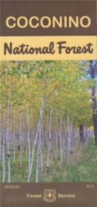
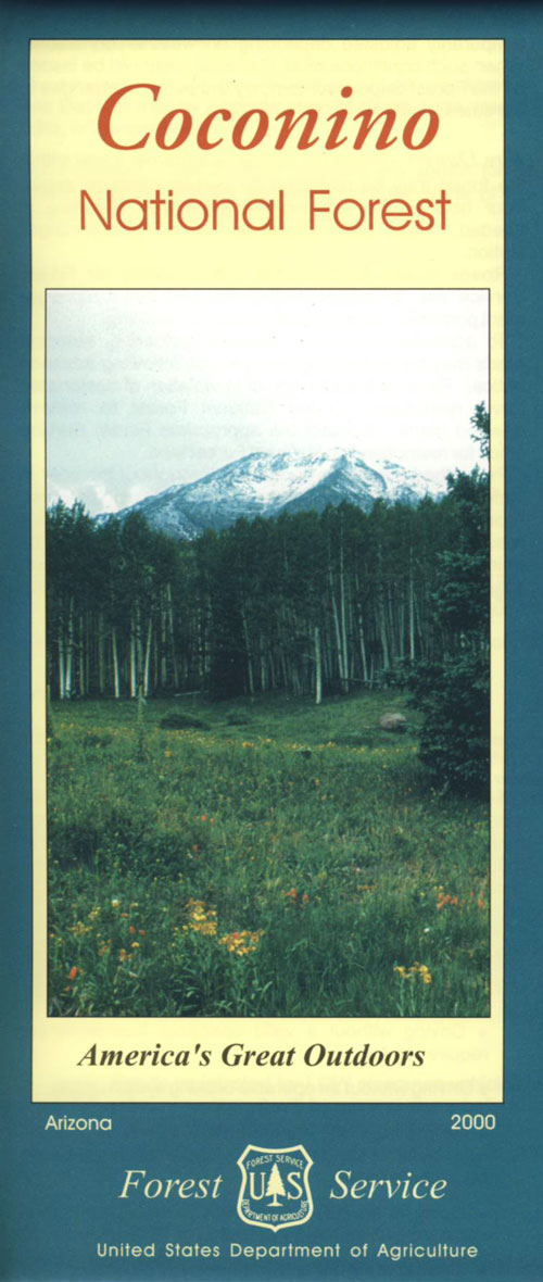
USDA Coconino National Forest Map, Prescott National Forest Map, Prescott Arizona Hiking Map, Williams AZ, Prescott Backpacking Maps, Topo Map AZ, Chino Valley, Camp Verde, Fort Verde, Hiking Sycamore Canyon Wilderness, Red Rock Secret Mountain Wilderness Pine Mountain, Cedar Bench AZ, Mingus Mountain Campground, Powell Springs, Apache Creek Wilderness, Juniper Mesa Wilderness, Granite Mountain Wilderness, Granite Mtn. AZ, Castle Creek Wilderness Map. Waterproof plastic map paper. Printed in 2013. ISBN# 9781593512439

Coconino Map

OLDER VERSION

Explore the super scenic deserts of the Southwest US. These current Arizona Maps will help with road trip planning, sightseeing, driving routes, overnight camping and lodging options, not to mention trailheads, forest boundaries and flowing creeks. Discover more wilderness and less people, with a detailed, official USDA map.

Scenic views of red rock canyons, stands of old-growth pine, streams, lakes, golden aspen groves in autumn, and snow covered slopes in the winter.  Backpacking, hiking, horseback riding, mountain biking, snow ski.

Coconino National Forest covers 1.8 million acres – varying from enchanting semi-arid desert, magnificent ponderosa pine forests, to incredible views from alpine tundra. Elevations range from 2,600′ in canyon bottoms to 12,643′ at the peak of San Francisco Mountain.


camping maps

see also – 

Flagstaff Sedona Map by NatGeo
Anza Borrego Desert Map

Crystal Basin Silver Fork Map

Crystal Basin Map
Crystal Basin & Silver Fork
of Eldorado NF
NatGeo Map # 806

Loon Lake, Central Sierra Nevada Maps

hikers mapTrails Illustrated Map from National Geographic. Crystal Basin / Silver Fork Map inside El Dorado National Forest map #806. 4×4 routes for the Rubicon Trail – all the way to Tahoe. Loon Lake, Union Valley Reservoir, Ice House Reservoir. Auburn State Recreation Area (Auburn SRA) and Carson – Emigrant Historic National Recreation Trail. Pony Express National Historic Recreation Trail.

Mountain bike trails, backpacking routes, equestrian and hiking trail mileage. High country map. Many rivers, roads and trails to explore. 2-sided map. Very detailed & colorful. Waterproof Plastic Map; Tear Resistant. GPS data. Scale = 1:63,360 ISBN#9781566952644

Silver Lake @ Carson Pass

Crystal Basin Silver Fork

The Crystal Basin spreads over 85,000 acres north of Highway 50 and west of Desolation Wilderness. Wonderful views of the Crystal Range extends north along the ridge from prominent Pyramid Peak (9963′ elev), Mount Price, Red Peak, and Silver Peak.

The Crystal Basin Recreation Area is a joint development between the Sacramento Municipal Utility District and the National Forest Service. SMUD operates a series of reservoirs and hydroelectric powerhouses which furnish energy to the Sacramento area.

Plasses

see also –

Carson Iceberg Wilderness Map
Desolation Wilderness Trail Map
Eldorado National Forest Map
Gold Country Maps

Redwoods Map

Redwoods Map

Redwoods Map
NatGeo Map #218

  • Redwood National Park
  • All Redwood State Parks nearby

Redwood MapTrails Illustrated Map from National Geographic. Redwood National Park & State Parks Map #218. Northern California Redwood Park Map. Features all the redwood parks in NorCal from the Redwood National Park to the many State Parks. Smith River National Recreation Area. Siskiyou Wilderness. Hiking & Horse trails. Primitive Campsites, Camping & Hiking Map. Very detailed & colorful. Waterproof Plastic Map; Tear Resistant. GPS data. ISBN# 9781566953191

redwoodpalace

hikers mapnearby towns:


Redwood Maps


california


see also –

Big Sur Coast Maps
Lost Coast Map
Sequoia Topo Atlas
Sequoia National Forest Map
Sequoia National Park Map