Mount Diablo Map

Mt Diablo Map
San Francisco East Bay

Connecting regional parks and state park lands; includes the 30 mile long Diablo Trail and the Los Vaqueros Reservoir at Livermore, CA

Mount Diablo is the tallest mountain peak in the East Bay San Francisco area. Hiking trails, horseback riding, a developed campground and picnic spots.

Mount Diablo Map

Mount Diablo Map

Emigrant Wilderness Maps

Several map makers have waterproof topo maps covering the Emigrant Wilderness Area. Some have more than one wilderness per map, so know the MAP SCALE before you buy one, especially if you need it for an overnight backpacking adventure with super details.

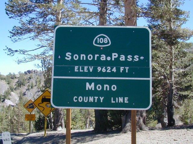
Day hikes into EMIGRANT WILDERNESS AREA from – Sonora Pass (Hwy 108) or Yosemite @ Cherry Lake (Hwy 120).

Emigrant Wilderness – Central Sierra Nevada California

Emigrant Wilderness Maps

Emigrant Wilderness Map USDA

Emigrant Wilderness, South of CA 108 – Sonora Pass
part of Stanislaus NF and north of Yosemite National Park

Emigrant Wilderness Maps

OLD VERSION

High Sierra with deep snows close this region annually. Check local rangers for all road conditions, fire info, trail access points before departing on a backcountry trip. Wilderness permits and campfire permits are always required!

Waterproof Plastic Paper. 1″ to mile; Usually only found at Ranger Stations – Hard to find maps. Perfect for a day hike reference or extended backpacking adventures. Printed on plastic in 2016. ISBN# 9781628114133

Emigrant Wilderness Maps

Emigrant Wilderness Trail Map
Tom Harrison

Tom Harrison Trail Map: Emigrant Wilderness Map Trail Map, Sonora Pass Map, Sierra Nevada; Kennedy Meadows, CA. Pinecrest Lake, Dodge Ridge, Relief Reservoir, Leavitt Lake, Leavitt Meadows, The Dardanelles, Eagle Meadows; Sonora River fishing, Dardanelle CA. Durable, waterproof plastic map; Folded. Map Scale: 63.4K; ISBN# 9780989457910

Emigrant Wilderness Maps

previous version

NatGeo Wilderness Areas: Carson Iceberg, Emigrant & Mokelumne

Emigrant Wilderness Maps

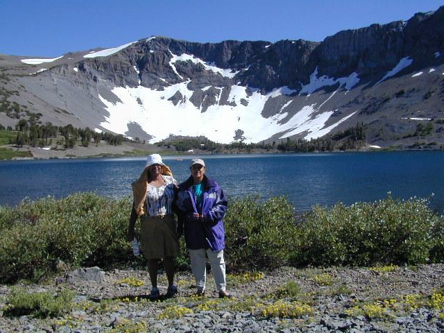
Sonora Pass exploring, in search of wildflowers (mid-JULY)

Wilderness Press Topo Map: Yosemite & Vicinity

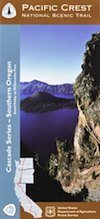
PCT Map #7 S Oregon

Pacific Crest Trail
Pacific Crest National Scenic Trail
PCT – Hiking Map #7

USDA PCT Map 7

Cascade Mountains in Southern Oregon

USDA PCT Map 7PNW, Pacific Northwest
MAP number 7
Pacific Crest Trail, Southern Oregon, PCT, OR, day hikes, overnight hikes, backpacking trails, outdoor vacations, Oregon recreation, rivers, kayaking, camping, canoeing, swimming, river rafting, hiking, mountain biking, traveling.

USDA PCT Map 7

USDA PCT Map 7

PCT Map Siskiyou Mountains. by NatGeo

The Pacific Crest Trail Map Pack Bundle of Oregon includes 2 Topographic Map Guides that cover the entire PCT as it traverses the incredible terrain of the Beaver State. The maps start at the lowest point of the PCT, Cascade Locks, where it passes over the Columbia River, and continue past the many volcanic cones of the Cascade Range. The Oregon South booklet ends at the border of California in the Siskiyou Mountains.


Oregon is a state in the Pacific Northwest region of the United States. The Columbia River delineates much of Oregon’s northern boundary with Washington, while the Snake River delineates much of its eastern boundary with Idaho. The 42° north parallel delineates the southern boundary with California and Nevada.

Oregon is one of the most geographically diverse states in the U.S., marked by volcanoes, abundant bodies of water, dense evergreen and mixed forests, as well as high deserts and semi-arid shrublands. Mount Hood, a stratovolcano, at 11,249 feet elevation is the state’s highest point. Oregon’s only national park, Crater Lake National Park, comprises the caldera surrounding Crater Lake, the deepest lake in the United States. The state is also home to the single largest organism in the world, Armillaria ostoyae, a fungus that runs beneath 2,200 acres of the Malheur National Forest.

Oregon is 295 miles north to south at longest distance, and 395 miles east to west. With an area of 98,381 square miles, Oregon is slightly larger than the United Kingdom. It is the ninth largest state in the United States. Crater Lake National Park, the state’s only national park, is the site of the deepest lake in the United States at 1,943 feet.

National Geographic Reference Map for PCT


see also –

Columbia River Map
Oregon Hiking Books
Oregon Dunes Map
Rogue River Guide Book
Marin Hiking Maps

Marin Hikes: Bay Area Trail Maps

Marin Hiking Maps

Tom Harrison Maps for Marin County

Marin Hiking Maps

Tom Harrison makes the most topographic trail maps for the San Francisco Bay Area, which include hiking, mountain biking routes as well as trail camps and campgrounds. Printed on waterproof plastic, the durable outdoor maps are known to last decades and are indeed, tear-resistant.

North Marin, Novato Map

Marin Hiking Maps

Tom Harrison Trail Map: Marin Hiking Trails, North Marin County, Novato California Hikes. Rush Creek, Marin Deer Island, Indian Tree, Little Mountain, Verissimo Hills, Stafford Lake County Park, Olompali State Park, Petaluma Marsh, Mount Burdell. Petaluma Hikes Marin. Durable, waterproof plastic map; Folded. Map Scale: 24K; ISBN# 9781877689963

Marin Hiking Maps

Marin Hiking Maps

Central Marin, San Rafael Map

2022 currently unavailable on Amazon

Marin Hiking Maps

Tom Harrison Trail Map: Marin Hiking Trails, Central Marin, San Rafael California Hikes. China Camp State Park, Terra Linda, San Pedro Mountain, Sleepy Hollow, Corte Madera Marsh, Sun Valley Hikes, Fairfax, California, Ross Valley, Greenbrae, Baltimore Canyon Preserve, Blithedale Summit, King Mountain, San Pedro Mountain. Durable, waterproof plastic map; Folded. Map Scale: 24K; ISBN# 9781877689949

Marin Hiking Maps

Southern Marin Hiking Map

Southern Marin County Hiking Map, Marin Redwood Forests, Marin Topo Map. Mill Valley Trails, Fort Baker, Ring Mountain Trails, Horsehill Preserve Marin Headlands, Tiburon Peninsula, Rodeo Valley, Oakwood Valley, Tennessee Valley mountain bike trails, equestrian, paragliding spots, parasail, biking trailheads Marin beaches, backpacking topos, beach waterfalls. Mountain Biking Maps. Tom Harrison; Mill Valley Hiking Maps. Durable, waterproof plastic map; Folded. ISBN# 9781877689901

Marin Hiking Maps

hiking

Marin Hiking Maps