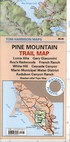
Pine Mountain Trail Map
Tom Harrison Maps

Pine Mountain Trail Map by Tom Harrison; Marin County Pine Mountain; Loma Alta, Gary Giacomini, Roy’s Redwoods, French Ranch, White Hill, Cascade Canyon, Marin Municipal Water District. Marin County Hikes, Marin Hiking Trails, Topo, Topographic Maps California, SoCal Hiking Trails, SF Hikes Bay Area Trails. Durable, waterproof plastic map; Folded. Map Scale: 24K; ISBN# 9781877689826
Scale is 1:24,000 (1 inch represents 2000 feet) the contour interval is 40 feet.
This is a little-known area in Marin County, north of Mount Tamalpias. It is very isolated and used by mountain bikers and horse riders.
Pine Mountain of Marin County, California, just West of San Rafael and NW of Marin City. This map includes most of the trails in the Marin Water District, along with portions of the Coastal Trail above Stinson Beach and Bollinas Lagoon. The upper section of the map covers a variety of hiking, biking and horseback riding opportunities off upper Sir Francis Drake Boulevard, in the San Geronimo Valley and along Big Carson Ridge.
 backpack
- camp
- hike
- horseback ride
- mountain bike
- picnic
- trail runs
Marin County Hikes: Pine Mountain
OLDER VERSION

see all Marin Hiking Maps
