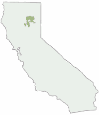
San Bernardino Topo Atlas

San Bernardino
National Forest Atlas USDA San Bernardino Forest Atlas

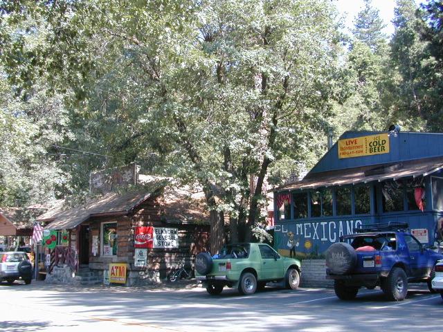
Big Bear / Lake Arrowhead / Idyllwild
San Bernardino Mountains
Big Bear Atlas Topo

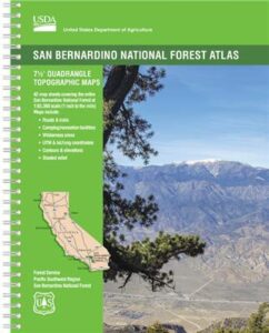
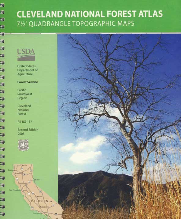
SAN BERNARDINO atlas, is a spiral bound book – a collection of all the quads. (7½ minute topographical maps, of all of San Berdu National Forest) This book map has detailed topo lines, mountain peaks, streams, lakes, hiking trails & back roads. Perfect for all kinds of recreational needs. Southern California, mountain recreation. Printed in 2018 USDA. ISBN# 9781628114300

Forest Falls, CA

Forest Falls LA

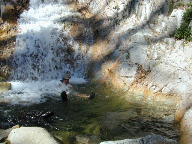
Forest Falls – waterfall near L.A.

San Bernardino National Forest QUADS:
from south to north

San Bernardino, Mountains, Trails, Map, Big Bear, Idyllwild, Big Bear Map, Topographical Maps, Topo Atlas, San Gorgonio, Backpacking Big Bear, Hiking, Hike Gorgonio, Mount San Gorgonio; Old Gray Back, Grayback, Greyback, Big Bear 4×4 Trail

San Bernardino Forest Atlas

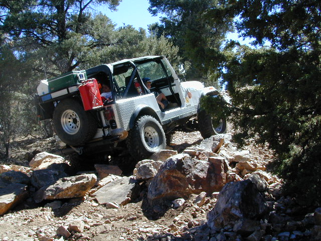
Rock Garden on Gold Mountain Trail, Big Bear, CA


San Bernardino Forest Atlas

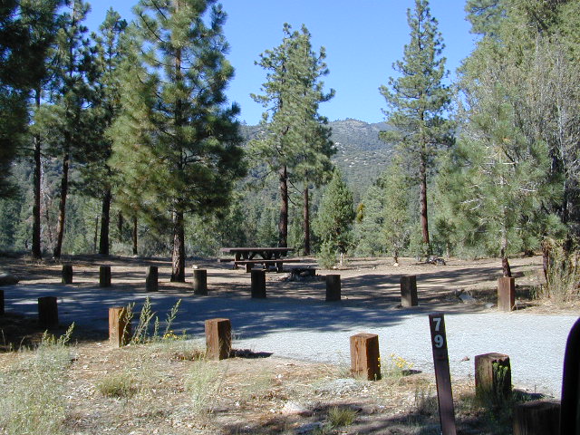
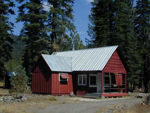
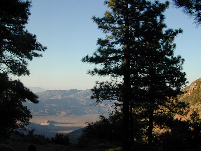
HeartBar Campground, near Mount San Gorgonio

see also –

San Bernardino NF Map
San Jacinto Map
San Gorgonio Map
Big Bear Maps
PCT Map Angeles
Angeles Maps

San Bernardino Forest Atlas

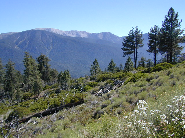
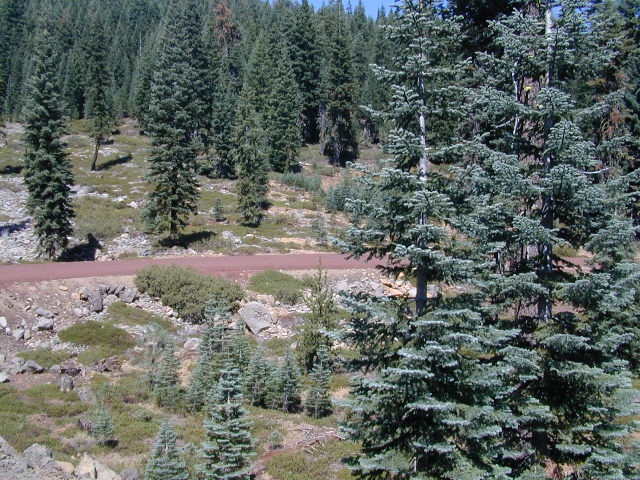
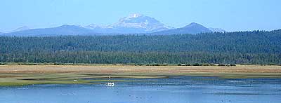
San Gorgonio views, from Forest Road #2N93

Cleveland Forest Topo Atlas

Cleveland Forest Atlas

Cleveland National Forest Atlas Topo

camp mapSouthern California Forest Map / San Diego Mountains Topo

Cleveland National Forest

San Diego Mountains / Cleveland National Forest Map / Cleveland Forest Map

Cleveland Forest AtlasCleveland Forest Atlas is a spiral bound book – a collection of all the quads. (7.5 minute topographical maps, of all of Cleveland National Forest; aka. San Diego backcountry) This book map has detailed topo lines, mountain peaks, streams, lakes, hiking trails & back roads. Perfect for all kinds of recreational needs. USDA

Cleveland Forest Atlas

Views over Anza Borrego Desert


Cleveland Forest Atlas

Snow at Palomar Mountain

Cleveland Forest Atlas

Cleveland National Forest QUADS:
from south to north –
Cleveland Forest Atlas

see also –

Cleveland National Forest Map
San Diego Backcountry Map
Anza Borrego Desert Map
Rancho Cuyamaca Map
Pine Creek Wilderness Map

Cleveland Forest Atlas

first edition

Cleveland Forest Atlas

a previous atlas

nearby towns –

Cleveland Forest Atlas

Morris Ranch Road, San Diego County Mountains

Plumas Forest Topo Atlas

Plumas Atlas USDA
Plumas National Forest Atlas

Plumas Atlas Book

The PLUMAS atlas, is a spiral bound book – a collection of all the quads. (7½ minute topographical maps, of all of Plumas National Forest) This book map has detailed topo lines, mountain peaks, streams, lakes, hiking trails & back roads. Perfect for all kinds of recreational needs. These particular maps are on a per order basis, meaning most have to be special ordered from the ranger – which takes about a week to get them. Printed in 2019

check mapsWILDFIRE NOTE: Two thirds of the Plumas National Forest has burnt in 2020-2021 with huge and destructive wildland fires. Some areas are closed, due to fire damage. Expect debris in roadways, detours, bleak scenery and dead trees falling.

The 2020 #BearFire #NorthComplex and the 2021 #DixieFire destroyed historic buildings, fire lookouts, old cabins, residential houses, small towns and rural communities; plus old growth forests and unimaginable numbers of wildlife. Many roads, trails and campgrounds are closed to the public; while reforestation may take many decades, if not a century.

Caribou Road (in 2018) off Hwy 70. North Feather River

hikers map

trail map

camp map

Plumas National Forest QUADS:
from south to north –

  • French Corral
  • Challenge
  • Rackerby
  • Oroville Dam
  • Forbestown
  • Clipper Mills
  • Strawberry Valley
  • Goodyears Bar
  • Cherokee
  • Berry Creek
  • Brush Creek
  • Cascade
  • American House
  • La Porte
  • Mount Fillmore
  • Gold Lake
  • Clio
  • Calpine
  • Paradise East
  • Pulga
  • Soapstone Hill
  • Haskins Valley
  • Dogwood Peak
  • Onion Valley
  • Blue Nose Mountain
  • Johnsville
  • Blairsden
  • Portola
  • Reconnaissance Peak
  • Chilcoot
  • Beckwourth Pass
  • Kimshew Point
  • Storrie
  • Bucks Lake
  • Meadow Valley
  • Quincy
  • Spring Garden
  • Mount Ingalls
  • Grizzly Valley
  • Crocker Mountain
  • Dixie Mountain
  • Frenchman Lake
  • Constantia
  • Belden
  • Caribou
  • Twain
  • Crescent Mills
  • Taylorsville
  • Gensee Valley
  • Babcock Creek
  • Squaw Valley Peak
  • Ferris Creek
  • McKesick Peak
  • Almanor
  • Canyondam
  • Greenville
  • Moonlight Peak
  • Kettle Rock
  • Antelope Lake
  • Stony Ridge
  • Milford
  • Fredonyer Pass
  • Diamond Mountain
  • Janesville
  • Standish

Plumas Forest, USFS Map, Topo Atlas, Fishing, Camping, Feather River, Lake Almanor, Indian Valley

see also –

Plumas National Forest Map USDA
Bucks Lake Wilderness Map
Sierra Buttes Maps

North Feather River

North Feather River @ Caribou Rd

Lassen National Forest Map

Lassen NF Map USDA

USDA Lassen Map

lassen maps
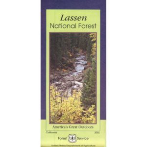
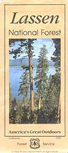
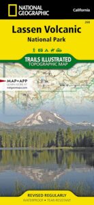
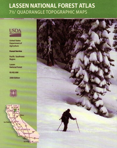
Lassen National Forest Map includes all of Lassen Volcanic National Park too.

NFS – USDA – U.S. Forest Service – USGS

Lassen National Forest
Lassen National Park
Lassen Camping

Lassen National Forest Map: Lassen National Forest surrounds Lassen Volcanic National Park. Quality USDA maps, National Forest Service. Lassen National Park, Lake Almanor, Susanville, Fall River Mills, Burney Falls, Juniper Lake, Drakesbad Ranch, Bucks Lake Wilderness Ranger Map – NFS issued map. GPS: Longitude & Latitude; Rivers, Creeks, Peaks, Elevations, 4WD and every dirt BackRoad, Hot Springs, Equestrian Areas, all Campgrounds, Hiking Trails and BackPacking Trailheads.

Areas include: Northern California, Butte County, Tehama County, Shasta County, Plumas County, Lassen County, Burney, Ahjumawi Lava Springs State Park, Thousand Lakes Wilderness, Manzanita Lake, Mineral, Shingletown, Ponderosa Sky Ranch, Hwy. 89, Hwy. 36, Lassen Volcanic Peak, Stover Mountain, as well as the Feather River.

Lassen National Forest

PREVIOUS VERSION

Lassen National Forest Maps

Lassen Map USDA

OLDER VERSION

Lassen National Forest Map

REALLY OLD EDITION

Lassen National Forest Map

Many graded dirt roads lead out to trailheads, secluded lakes, hidden campsites.

As of 2019, National Geographic also makes a waterproof map for the Lassen Peak region. Over 150 miles of trails including 17 miles of the Pacific Crest Trail and a portion of the California National Historic Trail are clearly marked and include approximate mileage between intersections and trail use designations. A chart of campgrounds, their elevations, the number of sites, and the facilities available at each will help you choose the one that’s right for you.

NatGeo Lassen MapNATGEO MAP: Interpretive information regarding the area’s unique geology and descriptions of the important hydrothermal areas are also included. The map base shows contour lines and elevations for summits, passes and many lakes. A variety of recreation features are noted as well, including campgrounds, trailheads, picnic areas, boat launches, cabins, and scenic viewpoints.

Lassen National Forest Maps

Lassen Peak from Lake Almanor

Mount Lassen Area Digital Maps

digital maps

apps/maps:
download digital topos & maps

California Deer Hunting Zone C4 Map
California Deer Hunting Zone X4 Map
California Deer Hunting Zone X5b Map
Chester California Topo Map USGS (free)
Childs Meadows Topo Map USGS (free)
Fredonyer Pass Topo Map USGS (free)
Hat Creek Headwaters Trail Map (free)
Lassen National Forest Visitor Map USFS
Lassen Volcanic National Park NPS Map (free)
Lassen MVUM – OHV Map 1b (free)
Lassen MVUM – OHV Map 2b (free)
Lassen MVUM – OHV Map 3a (free)
Lassen MVUM – OHV Map 3b (free)
Lassen Peak Topo Map USGS (free)
Lassen Peak Trail Topo Map (free)
Nat Geo 268 – Lassen Volcanic National Park Map
Susanville Ranch Park Trail Map (free)
Susanville Topographic Map USGS (free)
Westwood East, USGS Topo Map (free)
Westwood West, USGS Topo Map (free)

Remote Roads

Graded Dirt Roads

Lassen National Forest

bikepath susanville

Bizz Johnson Trail, Susanville

loghomehistoric

Historic Log Home: Downtown Susanville, CA

hiker

Sulfur Steam Lassen Park

Seeking a detailed topographic maps of every square mile of Lassen territory? Then the Lassen Forest Topo Atlas is a book to discover.

lassen atlas

Lassen Topographic Atlas


Lassen National Forest Map

Eagle Lake, N of Susanville