Rogue River Map Booklet
Rogue River Guide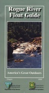
Tubing Oregon – Rogue River. Raft, float, paddle, camp, fish or hike.
Float tube, kayak, river rafting details for southern Oregon’s Rogue River. Every rapid, every camp site, every creek, swimming holes, fishing spots, mile by mile; Well laid out visual maps & information in this handy booklet. Printed on paper in 2004. BLM & USFS printing.
2022 currently unavailable on Amazon; might still be found at local ranger stations
Rogue River Map Book, Oregon Float Guide, Tubing
Kayak, Raft, Creek, BLM, USFS, USDA

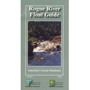
Rogue River Float Guide Booklet (USFS & BLM)

Rogue River National Wild and Scenic River

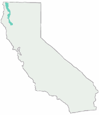
Rogue River in located within the state of Oregon, just above the state line of California. Flowing westward, the river joins the Pacific Ocean at Gold Beach, Oregon.
The Rogue River in southwestern Oregon flows about 215 miles in a generally westward direction from the Cascade Range to the Pacific Ocean. Known for its salmon runs, whitewater rafting, and rugged scenery, it was one of the original eight rivers named in the Wild and Scenic Rivers Act of 1968.
Beginning near Crater Lake, which occupies the caldera left by the explosive volcanic eruption and collapse of Mount Mazama, the river flows through the geologically young High Cascades and the older Western Cascades, another volcanic province.
Further west, the river passes through multiple exotic terranes of the more ancient Klamath Mountains. In the Kalmiopsis Wilderness section of the Rogue basin are some of the world’s best examples of rocks that form the Earth’s mantle. Near the mouth of the river, the only dinosaur fragments ever discovered in Oregon were found in the Otter Point Formation, along the coast of Curry County.

see also –
Rogue River National Forest Map
Red Buttes Wilderness Map
Columbia River Map
Oregon Dunes Map
PCT Map #7 Southern Oregon
PCT Map #8 Northern Oregon
 NFS – USDA – U.S. Forest Service
 USDA MAP Ranger Map – NFS issued map. GPS: Longitude & Latitude; Rivers, Creeks, Peaks, Elevations, 4WD & every dirt BackRoad, Equestrian Areas, all Campgrounds, Hiking Trails & BackPacking Trailheads.