
San Jacinto Wilderness Trail Map
Mount San Jacinto Maps


- Palm Springs Tramway hikes
- Mount San Jacinto hiking
- San Bernardino National Forest

USDA Map San Jacinto Wilderness


Printed on plastic in 2010. Map Scale – 1:42,240 w/ contour lines- 100 feet. This map may still be available at Ranger Stations USFS San Bernardino, Big Bear Lake and Idyllwild, CA
![]()

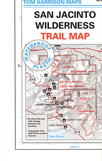
Mt San Jacinto Map
by Tom Harrison Maps


Southern California Mountains
Mt San Jacinto Map. Tahquitz Peak Climb, Tom Harrison Trail Map: San Jacinto Wilderness CA; Mount San Jacinto State Park Idyllwild Camping Backpacking; San Jacinto Peak, Palm Springs Hiking. Durable, waterproof plastic map; Folded. Map Scale: 42K; ISBN# 9781877689437

OLDER VERSION

towns nearby –
Hemet, CA
Idyllwild, CA
Indio, CA
Palm Desert, CA
Palm Springs, CA
Pine Cove, CA
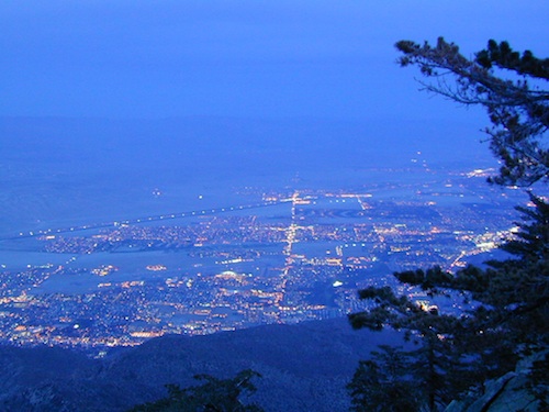
Palm Springs @ dusk, as viewed from top of tram
see also –
Big Bear Maps
Mount San Gorgonio Maps
Orange County Maps
San Bernardino National Forest Map
San Bernardino Forest Atlas