Yolla Bolly Map USDA
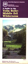
both Yolla Bolly Wilderness & Middle Eel Wilderness on one map
UNAVAILABLE, see below for topo maps
 Yolla Bolly Map / Middle Eel Wilderness
part of Mendocino NF & Shasta Trinity NF
This mountainous area is located in between the Mendocino coastline and the North Sacramento Valley. Waterproof plastic map paper. 1″ to mile; Perfect for a day hike reference or extended backpacking adventures. Map found only at Mendocino Ranger Stations. No longer available online.
REAL OLD VERSION

Atop the California Coastal Range in Northern California, lying in between US Hwy 101 (redwoods) and Interstate 5 (valley), are two prominent peaks: North Yolla Bolly (7863′ elev) and South Yolla Bolly (8092′ elev) which are part of a wilderness area, that has no roads crossing the range and does get some snow. To the north side is Shasta Trinity National Forest and on the south is Mendocino National Forest.
Numerous headwaters begin up here – South fork of Cottonwood Creek (flowing northeast); South fork of the Trinity River (flowing north); Thomes Creek (flowing east), Middle fork of the Eel River (flowing south).
North Yolla Bolly Topo

South Yolla Bolly Topo

towns nearby:

