Monarch Wilderness Map

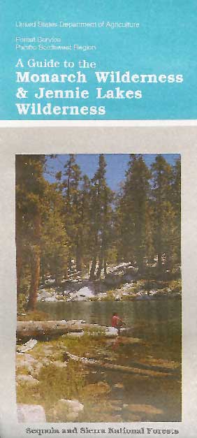
Monarch Wilderness w/
Jennie Lakes Wilderness Area

Monarch Wilderness Map

Jennie Lakes Map
Monarch Wilderness Map USDA

Jennie Lakes / Monarch Map / Monarch Wilderness

( Part of Sierra NF & Sequoia NF )

Near Kings Canyon and Sequoia NP. Perfect for a day hike reference or extended backpacking adventures. Scale = 2″ to mile; Printed on paper.

USDA Map may no longer be available. Find out at any USFS Sequoia National Forest Ranger Station.

Jennie Lakes

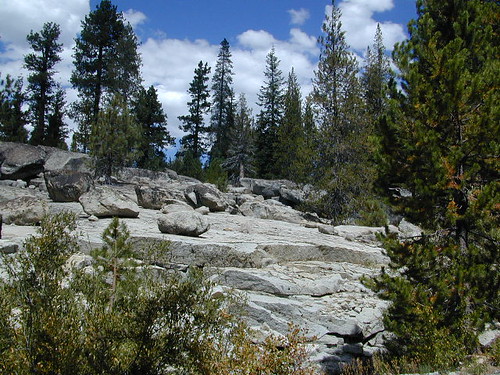
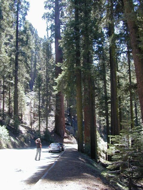
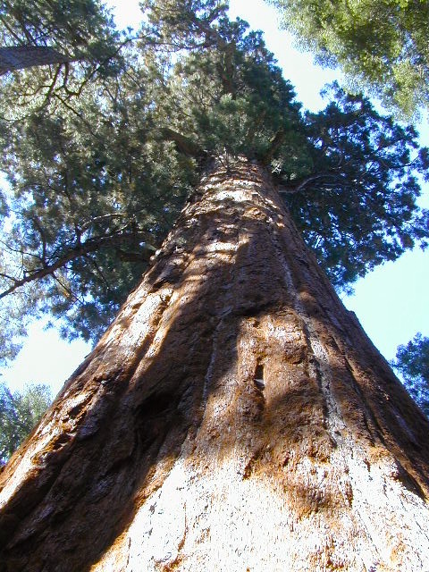
Jennie Lakes Wilderness is about nine square miles within the Sequoia National Forest. The wilderness is classic high Sierra landscape. Wilderness size is 10,500 acres with a mixture of lakes, mountain peaks, forests, meadows and streams, most of which is above 7,000 feet in elevation. The wilderness contains variations of alpine and sub-alpine forest. Lodgepole Pines, Red and White Firs and White Mountain Pine dominate the area, while Jeffrey Pines and a few juniper are also present. In the summer, wildflowers are common. Jennie Lake sits about 9,000 feet above sea level and Weaver Lake is slightly lower. The summit of Mitchell Peak is the highest point in the wilderness at 10,365 feet and features views of the surrounding area and of Kings Canyon National Park.

Monarch Wilderness Map

Monarch

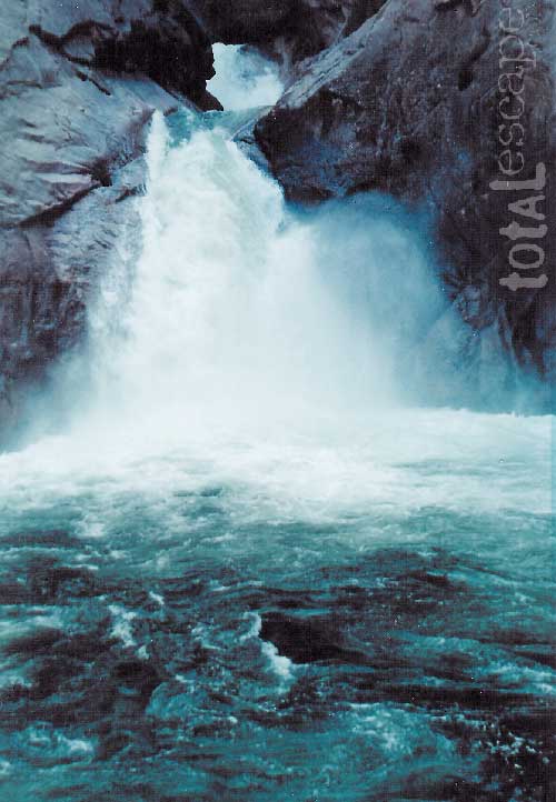
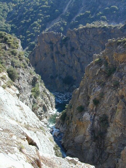
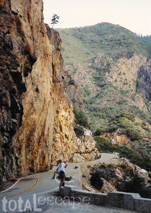
The Monarch Wilderness offers over 30 miles of trails with sweeping views of Kings Canyon and some classic high Sierra backcountry, as well as descents into the canyon itself. With dramatic elevation changes the vegetation ranges from chaparral and sub-alpine to alpine – covering about every species of tree known in this part of the Sierra, and then transforming into pure granite above the treeline. The remote Monarch Wilderness offers the chance to walk alone among Giant Sequoias and hike up to the isolated and wild Grizzly Lakes area. Above Upper Grizzly Lake you can scramble up the granite and access the spectacular Monarch Divide.

hikers map

see also –

Kings Canyon High Country Map
Sequoia National Forest Map USDA
Sequoia Forest Atlas

Sequoia Kings Canyon Maps

Sequoia Maps
Kings Cyn Map

Roaring River Falls
One of the most visited areas of the Sierra Nevada Mountains – Kings Canyon & Sequoia NP sit next door to each other, just south of Yosemite National Park.

Kings Canyon National Park has a deep granite gorge with lower elevations, along the Kings River (the longest river in the Sierra). Plus Kings also has an expansive back-country – accessible only by foot, to High Sierra peaks and many alpine lakes.

On the south side, Sequoia National Park has a higher terrain with a highway skirting the ancient groves, on the west side of the Sierra range.

Several Maps for this Sierra National Parks region:NPS

Sequoia Kings Canyon Maps

Sequoia Kings Map

Sequoia Kings Canyon
NatGeo Map #205


Trails Illustrated Map from National Geographic. NatGeo map #205. Sequoia National Park Map w/ Kings Canyon National Park. Mount Whitney, Giant Sequoia National Monument, John Muir Wilderness, Pacific Crest Trail. Topographic Hiking Maps, Sequoia Backpacking, Sequoia Camping, Sierra Lakes. Back Roads, Kings River Camping & Hiking Map.

Very detailed & colorful. Waterproof Plastic Map; Tear Resistant. GPS data. Scale 1:80,000 Contour Interval = 100 feet. Updated 2013. ISBN# 9781566952989

Sequoia Kings Canyon Maps

Kings Canyon Highway 180

  • backpack
  • camp
  • canyons
  • climb
  • creeks
  • fish
  • hike
  • horseback
  • lakes
  • mountain peaks
  • picnic
  • rivers
  • waterfalls

hiker

pinetree

Sequoia National Park &
Kings Canyon NP

Generals Highway Map

Sequoia Kings Canyon Maps

Sequoia Kings Canyon Maps

CALIFORNIA HWY 198: The Generals Highway is the main paved road that runs the ridge, north to south inside Sequoia National Park.  Since they have named the giant redwood trees after famous military generals, the road name mirrors that theme.

Now-a-days, our ancient and massive trees are fighting for their lives in a new type of war. Wildfires, drought and bark beetle infestations are taking their toll and killing these beauties. They have stood the test of time for thousands of years and withstood fires in the past, but recent blazes are hotter and more destructive than previous.

Kings Canyon Highway 180: A long, scenic, dead end road which descends dramatically into the river canyon. Elevation spans from 6600′ at Grant Grove to 4000′ at Cedar Grove at the end of the paved route.

biggest115

Golden Trout Maps

National Forest Maps
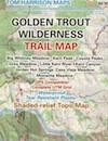
National Forest USDA makes a paper map for the Golden Trout Wilderness which includes the South Sierra Wilderness. Good luck trying to find it; maybe @ ranger stations.

Tom Harrison also offers a hiking trail map for the Golden Trout Wilderness. Extremeline now makes a pretty decent Kern River Recreation Map.

backpacking, camping, climbing, hiking, horseback riding, fishing

  • Jerky Meadow
  • Kern Hot Springs (in the backcountry)
  • Kern River Gorge
  • Upper Kern River

golden trout

Golden Trout Wilderness Map USDA

Official Trail Map for the U.S. National Forest Service. Map scale 1:63,360. Contour lines at 80 foot intervals show elevation. Detailed road network shown. Encompassing 475 square miles in the Sequoia and Inyo National Forests. Map Scale = 1″ to mile; Usually only found at Ranger Stations – Hard to find maps. Perfect for a day hike reference or extended backpacking adventures. Printed on paper in 1995.

driftwood

Golden Trout Trail Map
Tom Harrison Maps

THgoldentrout

OLD VERSION

Golden Trout Wilderness Trail Map, Sequoia National Forest, South Sierra Backpacking Maps, Forks of the Kern River Map, Jerky Meadow Trailhead, Big Whitney Meadow, Kern Peak, Coyote Peaks, Grey Meadow, Little Kern River, Kern Canyon, Jordan Hot Springs, Casa Vieja Meadow, Monache Meadows. Topo Sequoia Camping Kern River; Durable, waterproof plastic map; Folded. Map Scale: 63.4K; ISBN# 9781877689765

driftwood

hikers mapGolden Trout Kern River, Golden Wilderness Trail Map, Sequoia, South Sierra Backpacking Maps, Forks of the Kern River Map, Jerky Meadow Trailhead, Big Whitney Meadow, Kern Peak, Coyote Peaks, Grey Meadow, Little Kern River, Kern Canyon, Jordan Hot Springs, Casa Vieja Meadow, Monache Meadows. Topo Sequoia Camping Kern River

Golden Trout Maps

Jerky Meadows Rd is Route #22S82

Extremeline Productions

horse trail maps
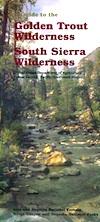
Extremeline also makes a Kern River Recreation Map which covers the Golden Trout trailheads, plus the whole Kern River Canyon area.

see also – fishing map

South Sierra Wilderness Map 
Sequoia National Forest Map
Sequoia Forest Topo Atlas
Sequoia Kings National Park Maps
Inyo National Forest Map 
Inyo Forest Topo Atlas