Desolation Wilderness Trail Map

Desolation Wilderness Trail Map
Tom Harrison

Desolation Wilderness Trail Map

Desolation Wilderness Map, Tahoe Lake Camping. Lake Tahoe, CA; Tahoe Westside, Loon Lake camping, Lake Aloha, Emerald Bay, Fallen Leaf Lake, DL Bliss State Park, Echo Lake, Velma Lake, Wrights Lake, Rubicon River, Rubicon 4×4 Trail, Rockbound Valley, Tahoe Rim Trail hiking PCT Pacific Crest Trail; Sierra Nevada High Country Tahoe hiking; Durable, waterproof plastic map; Folded. Map Scale: 42.24K; ISBN# 9781877689611

avenza mapsdownload digital version of this map –
Desolation Wilderness Trail Map
Desolation Wilderness Trail Map

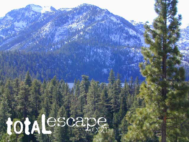
Desolation Wilderness on the Westside of Lake Tahoe

Desolation Wilderness Trail Map

Desolation Wilderness Trail Map

NEWER VERSION

Desolation Wilderness is a popular backpacking destination next to Lake Tahoe, with much barren rocky terrain at the edge of the tree line. It has extensive areas of bare granite rock formations. The Tahoe Rim Trail and Pacific Crest Trail pass through the wilderness.

Permits are required for both day use and overnight camping. In the summer, a quota system is used for overnight trips to limit the number of visitors on any given day in the wilderness. Desolation Wilderness is one of the most heavily used protected areas in the United States. This Wilderness area is split up into 45 different zones, with each having a specific permitting quota.

The Crystal Range is within the wilderness area, with Pyramid Peak as the highest point in the range and the wilderness at 9,985 feet in elevation. Among the many waterfalls within the wilderness is Horsetail Falls.

Its largest body of water is Lake Aloha, a reservoir with shallow, clear waters sitting in a wide granite basin carved by glaciers of the last ice age. Many other alpine and wooded lakes of various sizes are scattered throughout the area.


see also –

Crystal Basin Silver Fork Map
Eldorado National Forest Map
Lake Tahoe Books
Lake Tahoe Maps
PCT Map #4 Mid Sierra
PCT Map #5 N Sierra

Mount San Gorgonio Maps

Big Bear Maps:
San Gorgonio Wilderness

San Gorgonio Trail Map
Mount San Gorgonio MapsTom Harrison Maps

Mount San Gorgonio Maps

Mount San Gorgonio Maps, San Gorgonio Trail Map. Tom Harrison Trail Map: Big Bear Hiking, San Gorgonio Wilderness CA; Mount San Gorgonio; Old Gray Back, Grayback, Greyback, Big Bear Area: Durable, waterproof plastic map; Folded. Map Scale: 48K; ISBN# 9781877689529

San Gorgonio Wilderness Map, Backpacking Big Bear, Hiking, Hike Gorgonio, Topo Gorgonio, Mount San Gorgonio; Old Gray Back, Grayback, Greyback, Big Bear Area

Mount San Gorgonio Maps

Mount San Gorgonio Maps


San Gorgonio Map USDA
Big Bear Wilderness Hikes

San Gorgonio Wilderness

USDA, waterproof topographic map of San Gorgonio Wilderness in the San Bernardino National Forest. Big Bear hikes, camping, backpacking. Heartbar Campground, Forest Falls, Gorgonio trailheads, Southern California hiking. Waterproof plastic. Updated 2010. ISBN# 9781593514945

Old Grayback

San Bernardino Maps

Mount San Gorgonio Maps

Mount San Gorgonio Maps

see also –

San Bernardino National Forest Map
San Bernardino Forest Atlas
San Bernardino Mountains 

Mount San Jacinto Maps

Angeles Maps
San Gabriel Mountains Map


PCT Trail Maps Mount San Gorgonio Maps

NatGeo Yosemite Maps

Yosemite Map California 

Yosemite National Park Maps byYosemite Map California
National Geographic: Trails Illustrated Maps

Overview Yosemite National Park Map #206


Central Sierra Nevada Mountains

2-sided, full color, waterproof maps

Yosemite is the most visited National Park in all of California, which is why NatGeo makes 5 maps for this region – so we can all spread out a little. Map bundles and a day hike guide is also available.

Yosemite Map CaliforniaThe main hub, Yosemite Valley, is the busy region – so try to avoid it during summer (if at all possible). Tuolumne Meadows and Tioga Pass on Hwy 120 is considered the high country and has numerous trailheads leading to peaks, domes, viewpoints, waterfalls, alpine lakes, and the famous wilderness w/ High Sierra Camps (HSC). The paved route (SR 120) closes annually for winter snow (more than half the year), so reservations are required if planning an overnight stay.

Yosemite Map California

TOPOGRAPHIC HIKING MAPS
for Yosemite backcountry listed below:

NatGeo Map #307 Yosemite NW – Hetch Hetchy Reservoir

Yosemite Map California

NatGeo Map #306 Yosemite SW – Wawona & Yosemite Valley

Yosemite Map California

NatGeo Map #308 Yosemite NE – Toulumne Mdws & Hoover Wilderness

Yosemite Map California

NatGeo Map #309 Yosemite SE – Ansel Adams Wilderness

Yosemite Map California

Yosemite Map California

NatGeo Yosemite Park Map Bundle – Yosemite Map Pack

Yosemite Map California

NatGeo Yosemite Park Hiking Map – Yosemite Day Hikes

Yosemite Map California

Yosemite Map California

see also –

All Yosemite Trail Maps by Tom Harrison