Angeles Crest Hwy 2
Los Angeles Hiking Books


PCT: Pacific Crest Trail Map Angeles
San Gorgonio Trail Map
Tom Harrison Maps
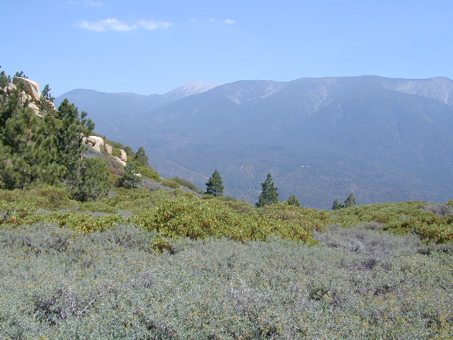
Mount San Gorgonio Maps, San Gorgonio Trail Map. Tom Harrison Trail Map: Big Bear Hiking, San Gorgonio Wilderness CA; Mount San Gorgonio; Old Gray Back, Grayback, Greyback, Big Bear Area: Durable, waterproof plastic map; Folded. Map Scale: 48K; ISBN# 9781877689529
San Gorgonio Wilderness Map, Backpacking Big Bear, Hiking, Hike Gorgonio, Topo Gorgonio, Mount San Gorgonio; Old Gray Back, Grayback, Greyback, Big Bear Area
![]()
USDA, waterproof topographic map of San Gorgonio Wilderness in the San Bernardino National Forest. Big Bear hikes, camping, backpacking. Heartbar Campground, Forest Falls, Gorgonio trailheads, Southern California hiking. Waterproof plastic. Updated 2010. ISBN# 9781593514945
see also –
San Bernardino National Forest Map
San Bernardino Forest Atlas
San Bernardino Mountains
Angeles Maps
San Gabriel Mountains Map
Verdugo Mountain
by Tom Harrison Topo Maps
Verdugo Hills Map / Angeles Hiking Map / L.A. Hikes
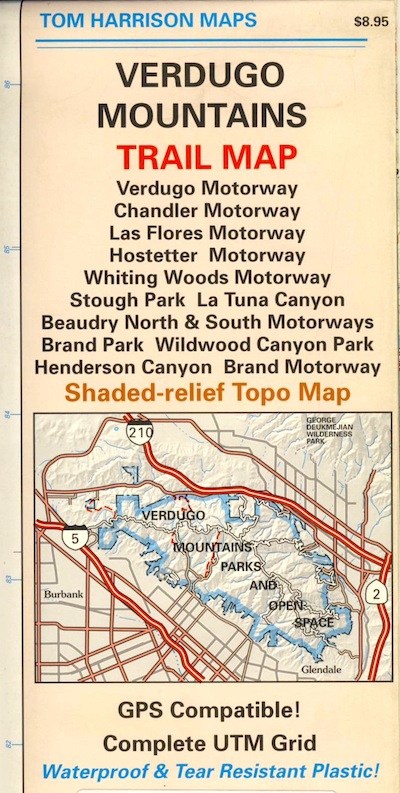
Amazon is displaying a Mount Baldy map image for this Verdugo Mountains Map. Not sure why! There is a newer version of this map.
Tom Harrison Trail Map: Los Angeles County Hiking Trails, LA Hikes Chandler, Los Flores, Hostetter, Whiting Woods, Stough Park, La Tuna Canyon, Beaudry Brand Park, Wildwood Canyon, Henderson Canyon, L.A. Hiking. Durable, waterproof plastic map; Folded. Map Scale: 24K; ISBN# 9781877689925
see also –
Cheeseboro Canyon Map
Malibu Creek Map
Santa Monica Mountains Map
Topanga Canyon Map
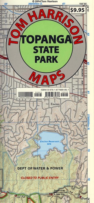
Topanga State Park Map
Tom Harrison
Topanga Canyon Map, Topanga State Park Map, Topanga Hiking Maps, Backpacking Topanga, Malibu Maps; Will Rogers Park, Tuna Canyon, Biking Trail, Red Rock Canyon Malibu, Temescal Canyon, Temescal Gateway Hike. Durable, waterproof plastic map; Folded. Map Scale: 31.7K; ISBN# 9781877689857
Topanga Canyon Road is California State Route 27 (Hwy 27) a paved highway connecting the San Fernando Valley to the Malibu coast. Hiking and mountain biking trails, waterfalls, hidden restaurants and a large residential population in these hills.

nearby towns:
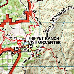
Topanga State Park
Covering 11,000 acres, with 36 miles of trails and unimproved roads, the boundaries stretch from Topanga Canyon to Pacific Palisades and Mullholland Drive. There are more than 60 trail entrances. Topanga State Park is the largest park in the Santa Monica Mountains.
Topanga State Park was opened to the public in 1974. Land includes more than 7,500 acres from the original Rancho San Vicente y Santa Monica land grant. Additional acreage has been added in the form of 1,500 acres from the Palisades Highlands and another 1,600 acres added in 2002, near the mouth of the Topanga Creek
The word Topanga is an old Shoshonean language word meaning ‘above’ and referring to the canyon settlement being above the flood waters of Topanga Creek. The Tongva and Chumash peoples inhabited the area for thousands of years

see also –
Santa Monica Mountains Map
Malibu Creek Map
Zuma Canyon Map
Point Mugu Map
Channel Islands Map
L A Hiking Maps